HOW TO
Extract LAS ground points from a LAS dataset to a TIN-based surface in ArcMap
Summary
In ArcMap, by default, all the data points in a LAS dataset are displayed as point clouds if no filter is applied. It is possible to display, classify, and extract data points to only ground points to produce a high-quality elevation model like triangular irregular networks (TIN).
In this example, the data points are classified to only ground points and extracted as a TIN-based surface to represent the ground points as a continuous ground surface consisting of triangular facets.
Procedure
Follow the steps below to extract LAS ground points from a LAS dataset to a TIN-based surface in ArcMap.
Note:
The following steps require the 3D Analyst license. To enable the ArcGIS 3D Analyst extension, in the main menu, click Customize > Extensions. In the Extensions dialog box, check the 3D Analyst check box, and click Close.
- Add the LAS dataset to the map.
Note:
Refer to ArcMap: Create LAS Dataset for more information on constructing a LAS dataset.
- Classify the ground points in the LAS dataset.
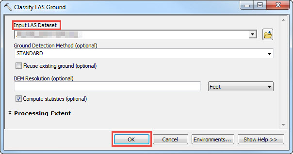
- In ArcToolbox, navigate to 3D Analyst Tools > Data Management > LAS Dataset > Classify LAS Ground.
- Under Input LAS Dataset, choose the LAS dataset layer.
- Optionally, set the Ground Detection Method and the DEM Resolution parameter. Click OK.
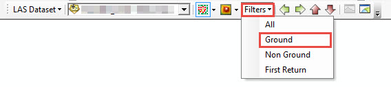
- On the LAS Dataset toolbar, for Filters, select Ground from the drop-down list.
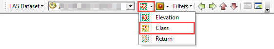
- In Point Symbology Renderers
 , select Class from the drop-down list to display ground points.
- Display ground points classification in the data frame.
- In the Table of Contents, right-click the LAS dataset, and select Properties.
- On the Filter tab, under Classification Codes, check the 2 Ground check box, and click OK.
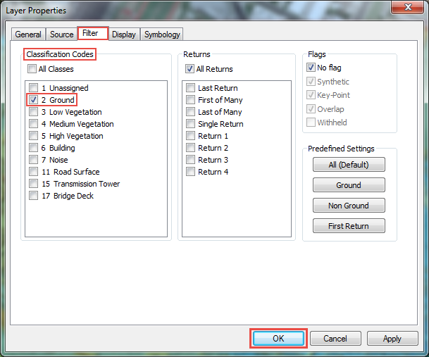
Note:
Ensure only one classification code is selected. If other codes are selected, the TIN layer includes points other than the ground and takes a longer time to process.
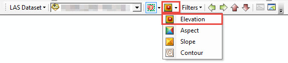
- Click Surface Symbology Renderers
 and select Elevation. A TIN surface of only points representing ground is displayed.
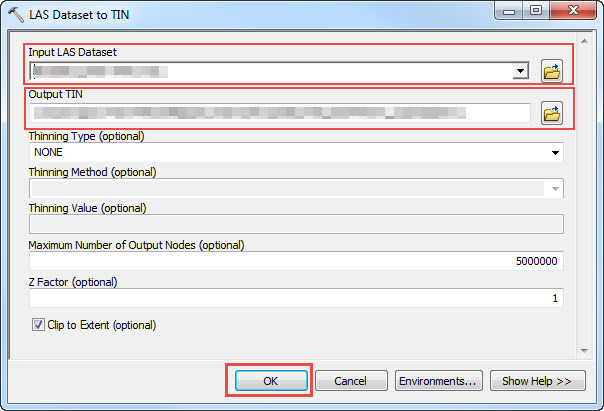
- Use the LAS Dataset to TIN tool to export the LAS dataset as a TIN layer.
- In ArcToolbox, navigate to 3D Analyst Tools > Conversion > From LAS Dataset > LAS Dataset to TIN.
- Under Input LAS Dataset, select the LAS dataset layer.
- Set a name for the Output TIN.
- Optionally, set the Thinning Type, Thinning Method, Thinning Value and Maximum Number of Output Nodes. Click OK.
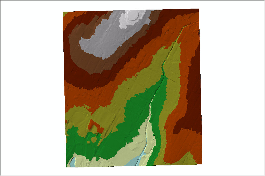
The image below shows an example of a classified LAS dataset for ground surface exported as a TIN layer.
Article ID: 000021888
- ArcMap
Get support with AI
Resolve your issue quickly with the Esri Support AI Chatbot.


Related Information
Discover more on this topic
Search for related information
Find training related to this topic
Explore ideas and give feedback
Get help from ArcGIS experts
Start chatting now