HOW TO
Extract LAS ground points from a LAS dataset to a TIN layer in ArcGIS Pro
Summary
A LAS dataset includes comprehensive statistics and area coverage of the lidar data contained in LAS files. In ArcGIS Pro, all data points returned in a LAS dataset are displayed as point clouds for all classification codes by default. Displaying, classifying, and extracting data points from only ground points makes it possible to generate a high-quality elevation model, such as a triangular irregular network (TIN). This method is useful for visualizing a topographical surface based on the elevation data collected by the airborne lidar.
The workflow provided in this article involves classifying data points as ground points using the Classify LAS Ground tool. The point clouds are then exported to a TIN layer, representing ground points as a continuous ground surface.
Procedure
Note:
The following steps require a 3D Analyst license. Refer to ArcGIS Pro: Use extensions for more information.
- Open the project with the LAS dataset layer in ArcGIS Pro.
- Classify the ground points for the LAS dataset layer using the Classify LAS Ground tool.
- In the Geoprocessing pane, search for and click Classify LAS Ground (3D Analyst Tools).
- In the Classify LAS Ground pane, for Input LAS Dataset, select the LAS dataset from the drop-down list.
- For Ground Detection Method, select the preferred method to detect ground points. Refer to ArcGIS Pro: Parameters for more information.
- Click Run.

- In the Contents pane, right-click the LAS dataset layer, hover over LAS Filters, and click Ground.
- Export the LAS dataset as a TIN layer using the LAS Dataset To TIN tool.
- In the Geoprocessing pane, search for and click LAS Dataset To TIN (3D Analyst Tools).
- In the LAS Dataset To TIN pane, for Input LAS Dataset, select the LAS dataset layer from the drop-down list.
- For Output TIN, specify a name and location to export the TIN layer.
- For Thinning Type, select the preferred type of thinning to reduce the LAS data points saved as the nodes in the output TIN layer. Refer to ArcGIS Pro: Parameters for more information.
- Click Run.
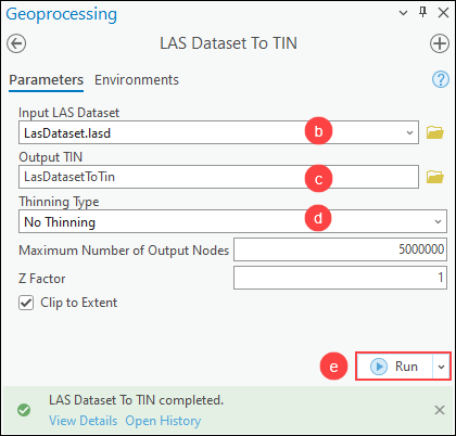
The image below shows a classified LAS dataset for a ground surface exported as a TIN layer.

Article ID: 000031012
- ArcGIS Pro 3 1
- ArcGIS Pro 3 0
- ArcGIS Pro 2 9x
Get support with AI
Resolve your issue quickly with the Esri Support AI Chatbot.


Related Information
Discover more on this topic
Search for related information
Find training related to this topic
Explore ideas and give feedback
Get help from ArcGIS experts
Start chatting now