HOW TO
Create Thiessen polygons from line features in ArcGIS Pro
Summary
Thiessen polygons are used to define and delineate proximal regions around point features by using polygonal boundaries. In ArcGIS Pro, Thiessen polygons can be created for city planning to effectively allocate resources, plan emergency response routes, or identify densely populated areas.
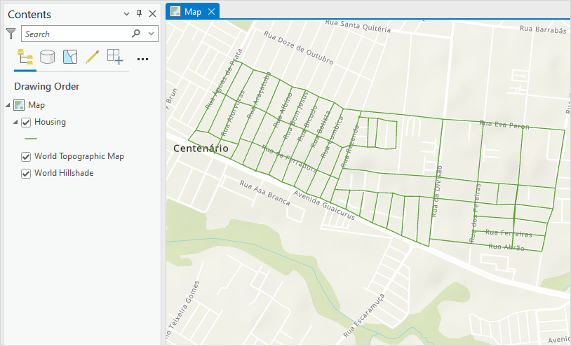
In this example, a line feature layer named Housing is converted to Thiessen polygons using the Create Thiessen Polygons tool to determine the population center within the residential area.
Procedure
Note:
The Feature Vertices To Points and Create Thiessen Polygons tools require an ArcGIS Desktop Advanced license.
- Open the ArcGIS Pro project.
- On the ribbon, click the Analysis tab, and click Tools in the Geoprocessing group.
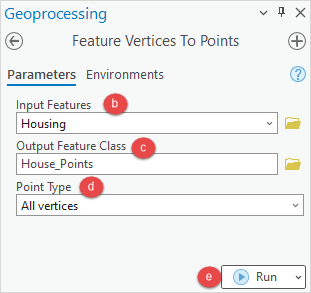
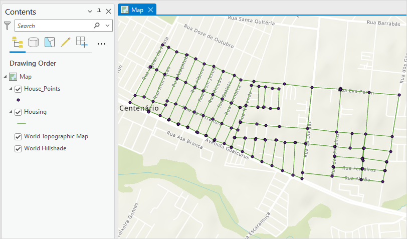
- Use the Feature Vertices To Points tool to convert the line feature layer to point features.
- In the Geoprocessing pane, search for and click the Feature Vertices To Points tool.
- In the Feature Vertices To Points pane, for Input Features, select the line feature layer from the drop-down list.
- For Output Feature Class, click Browse
 and specify the location and name for the point feature layer.
 - For Point Type, select All vertices from the drop-down list.
- Click Run.
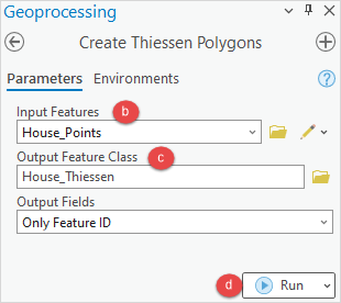
- Use the Create Thiessen Polygons tool to create Thiessen polygons from the point features.
- In the Geoprocessing pane, search for and click the Create Thiessen Polygons tool.
- In the Create Thiessen Polygons pane, for Input Features, select the point feature layer from the drop-down list.
- For Output Feature Class, click Browse
 and specify the location and name for the Thiessen polygons.
 - Click Run.
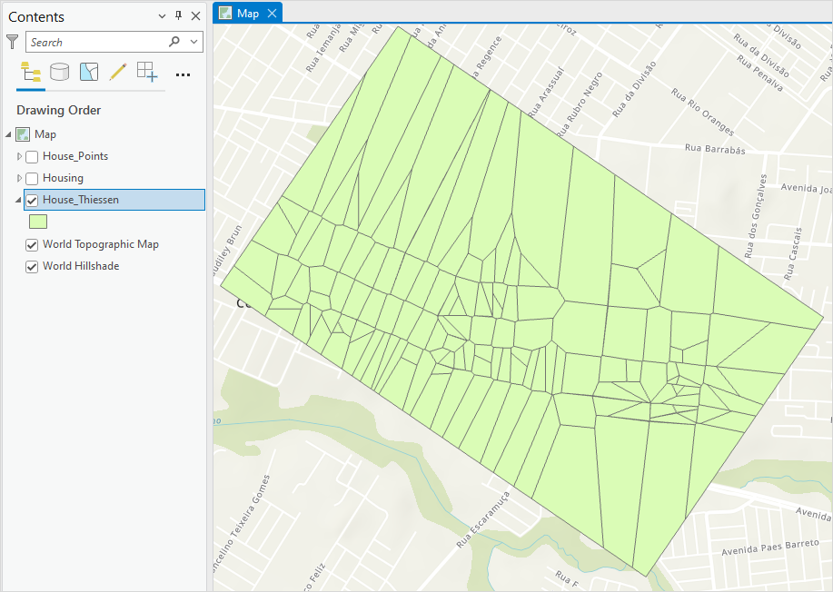
The image below shows the Thiessen polygons created in ArcGIS Pro. Based on the distribution and size of the polygons, the densely populated area can be determined as the population center.
Article ID: 000030840
- ArcGIS Pro 3 1
- ArcGIS Pro 3 0
- ArcGIS Pro 2 9x
Get support with AI
Resolve your issue quickly with the Esri Support AI Chatbot.


Related Information
Discover more on this topic
Search for related information
Find training related to this topic
Explore ideas and give feedback
Get help from ArcGIS experts
Start chatting now