HOW TO
Create point features based on the corner vertices of polygon features in ArcGIS Pro
Summary
In ArcGIS Pro, it is sometimes necessary to create point features based on the corner vertices of polygon features for mapping and analytical purposes. This article provides two methods to generate point features based on the corner vertices of polygon features using the Feature Vertices To Points tool or the Coordinate Conversion function.
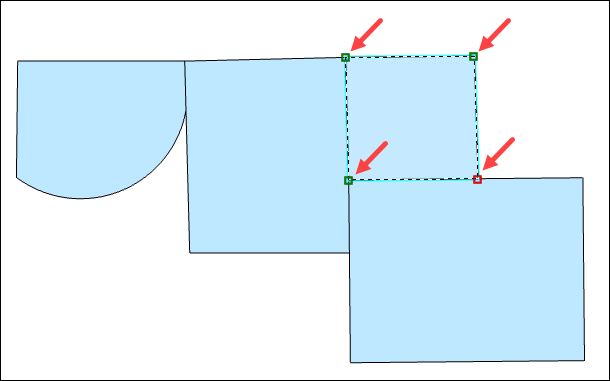
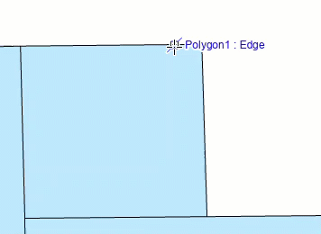
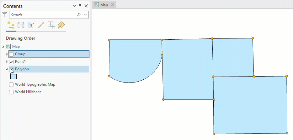
In this example, there are four polygon features and the corner vertices of one of the polygon features are displayed in the image below.
Procedure
Use the Feature Vertices To Points tool
Note:
An ArcGIS Desktop Advanced license is required to use this tool.
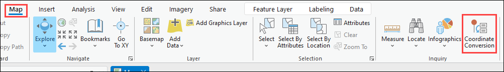
- In ArcGIS Pro, on the Analysis tab, click Tools.
- In the Geoprocessing pane, search for and open the Feature Vertices To Points tool.
- Configure the parameters in the Feature Vertices To Points pane.
- For Input Features, select the feature layer containing the polygon features. In this example, the polygon feature layer is Polygon1.
- For Output Feature Class, type a name for the output. In this example, the name of the output is ToPoints.
- For Point Type, ensure All vertices is selected.
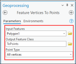
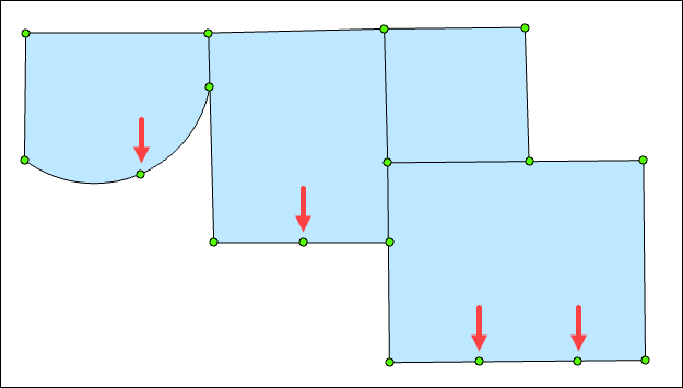
- Click Run. Point features created from all the vertices in the polygon features are populated in a new point feature layer.
- If necessary, delete the new point features that are not created based on the corner vertices of the polygon features. In this example, there are four point features to be deleted.
- In the Contents pane, right-click the new point feature layer, navigate to Selection, and click Make this the only selectable layer.
- Delete the unwanted point features. Refer to ArcGIS Pro: Delete a selected feature for instructions. Press the Shift key on the keyboard to select multiple point features.
- On the Edit tab, in the Manage Edits group, click Save.
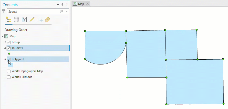
The point features created using the Feature Vertices To Points tool are displayed on the map.
Use the Coordinate Conversion function
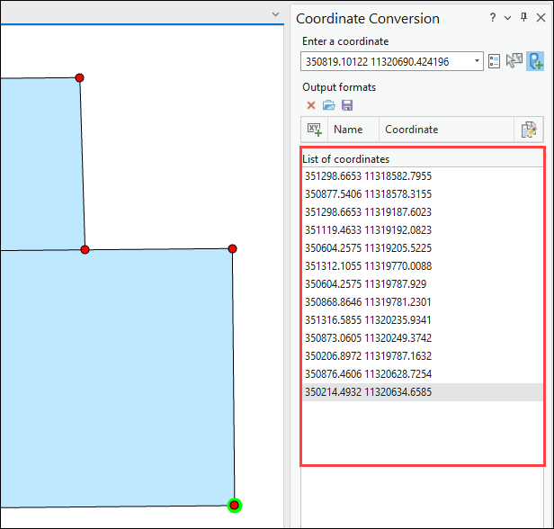
- In ArcGIS Pro, turn on snapping on the map. Refer to ArcGIS Pro: Turn snapping on for more information.
- On the Map tab, in the Inquiry group, click Coordinate Conversion.
- In the Coordinate Conversion pane, ensure the Map Point Tool
 option is selected.
 - Select the polygon features’ corner vertices on the map. Corner vertices are indicated as '<Layer name>: Vertex' when the cursor is snapped to the polygon feature.
The coordinates of the selected vertices are listed in the List of coordinates section.
- In the Coordinate Conversion pane, click Export.
- In the Select Output window, click Feature class to create a new point feature class, and click OK.
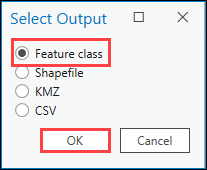
- In the file window, browse to the output location and type a name for the point feature class, and click Save.
- In the Coordinate Conversion pane, click Clear All to clear the selections.
Point features created using the Coordinate Conversion function are populated in the new point feature layer, Point1.
Article ID: 000028380
- ArcGIS Pro 3 0
- ArcGIS Pro 2 8 x
- ArcGIS Pro 2 x
Get support with AI
Resolve your issue quickly with the Esri Support AI Chatbot.


Related Information
Discover more on this topic
Search for related information
Find training related to this topic
Explore ideas and give feedback
Get help from ArcGIS experts
Start chatting now