HOW TO
Create rectangular grids within a polygon layer with sampling points away from the polygon boundaries in ArcGIS Pro
Summary
The Create Fishnet tool creates a fishnet of rectangular cells within a polyline or polygonal output feature. The Create Fishnet tool is useful for mapping areas, for instance when deciding on proper drilling locations. The tool creates rectangular grids representing possible borehole locations. In this scenario, the grids are created within the sandstone polygon and away from the polygon boundary in a specified distance using the Buffer tool.
Procedure
Follow the instructions below to create rectangular grids within a polygon layer with sampling points away from the polygon boundaries in ArcGIS Pro.
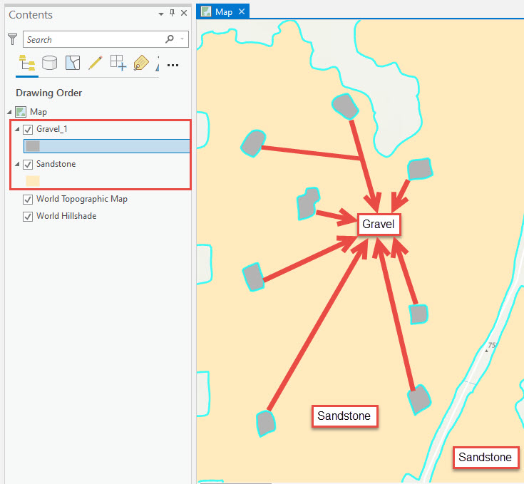
- In ArcGIS Pro, add the desired polygon layers to the map. In this example, the sandstone and gravel polygon layers are added. The blue lines represent the boundaries of the polygons.
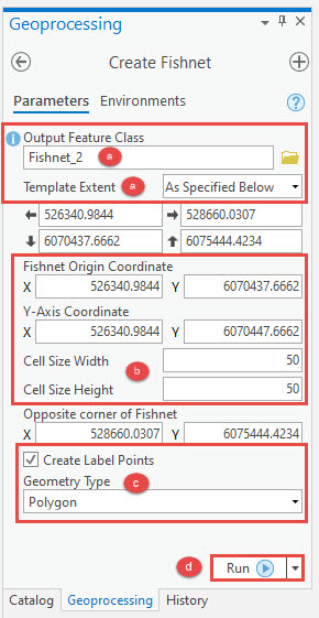
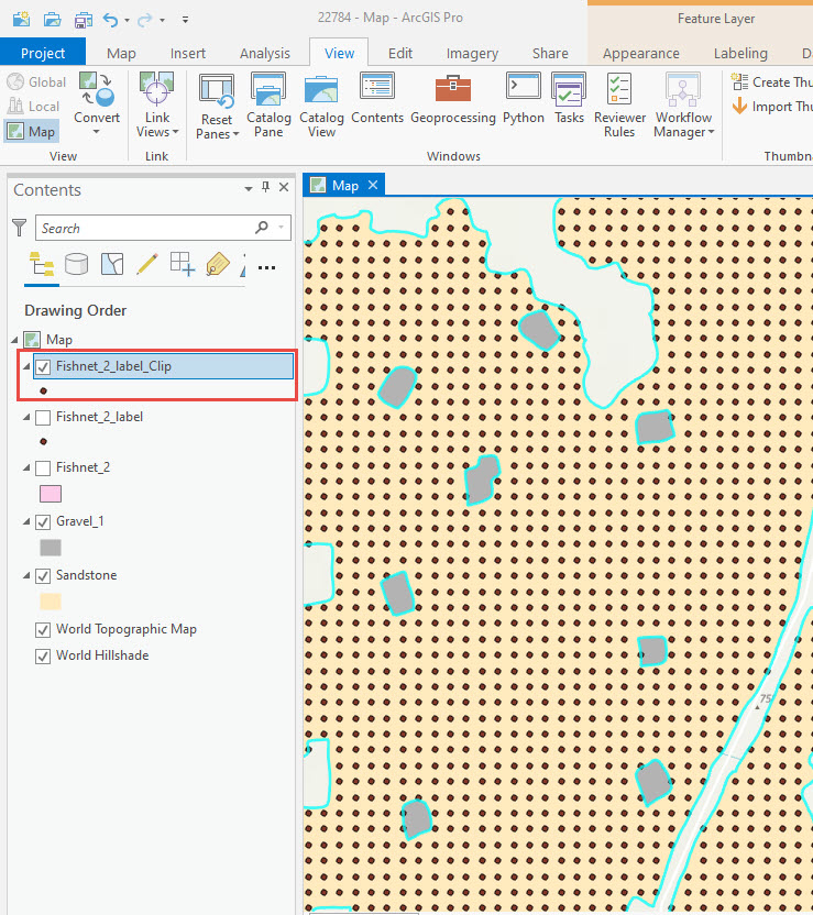
- Use the Create Fishnet tool from Data Management > Samplings to create rectangular grids within the desired polygon. In this example, the sandstone polygon is used.
- In the Create Fishnet pane, specify a name for Output Feature Class, and set the polygon feature for Template Extent.
Note:
Template Extent automatically changes to As Specified Below when the polygon feature is selected.
- Enter the desired values for Cell Size Width and Cell Size Height, and set values for Number of Rows and Number of Columns for the rectangular grids.
Note:
Optionally, set zero as the values for Cell Size Width, Cell Size Height, Number of Rows and Number of Columns to automatically calculate numbers of rows and columns. However, when values are entered for Cell Size Width and Cell Size Height, the Number of Rows and Number of Columns text boxes automatically close.
- Check the Create Label Points check box and set Geometry Type to POLYGON.
- Click Run to execute the tool.
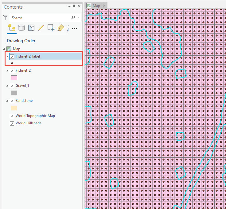
The image below shows the output of the Create Fishnet tool with the rectangular grids.
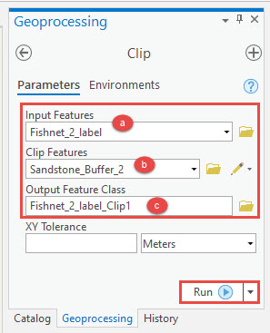
- Use the Clip tool from Analysis > Extract to clip the sandstone polygon layer with the rectangular grids.
- In the Clip pane, set the label layer created using the Create Fishnet tool from Step 2 for Input Features.
- Set the polygon layer used in Step 2a as Clip Features.
- Specify a name for Output Feature Class, and click Run.
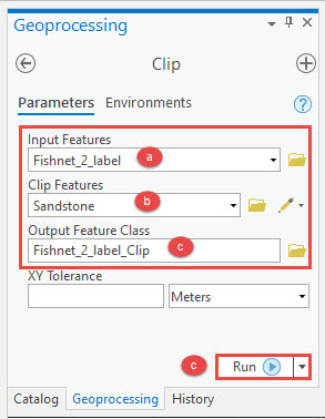
The image below shows the output of the Clip tool.
- Use the Buffer tool from Analysis > Proximity to set a buffer distance away from the polygon boundary.
- In the Buffer pane, set the polygon layer used in Step 2a for Input Features, and specify a name for Output Feature Class.
- For Distance [value or field], select Linear Unit and set a negative buffer value to create buffers inside the polygon.
- Set the conversion unit.
- Click the Side Type drop-down list and select FULL.
- Click Run to execute the tool.
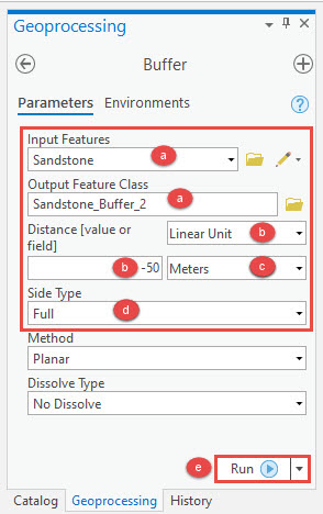
The image below shows the output of the Buffer tool.
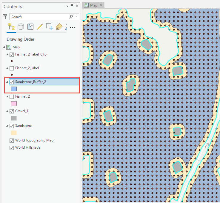
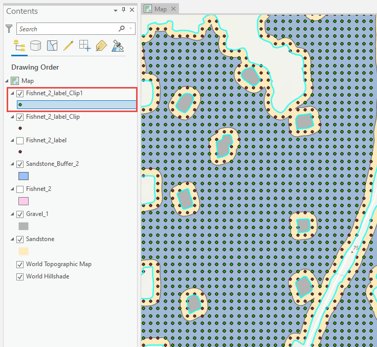
- Use the Clip tool from Analysis > Extract to remove the sampling points away from the buffer area.
- In the Clip pane, set the label layer created using the Create Fishnet tool from Step 2 for Input Features.
- Set the buffer layer created in Step 4 for Clip Features.
- Specify a name for Output Feature Class, and click Run.
The image below shows the output of the Clip tool.
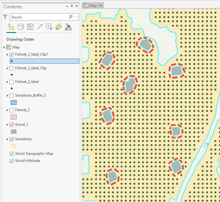
The image below shows the sandstone polygon layer with sampling points 50 meters away from the surrounding sandstone polygon boundaries.
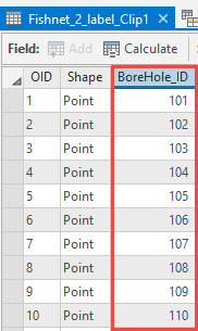
Note:
Optionally, open the attribute table, add a new field and use the Calculate Field (Data Management) tool to label the points as shown in the image below. Refer to ArcGIS Pro: Add Field (Data Management) and ArcGIS Pro: Fundamentals of field calculations for more information.
Article ID: 000022784
- ArcGIS Pro 2 x
Get support with AI
Resolve your issue quickly with the Esri Support AI Chatbot.


Related Information
Discover more on this topic
Search for related information
Find training related to this topic
Explore ideas and give feedback
Get help from ArcGIS experts
Start chatting now