HOW TO
Create rectangular grids within a polygon layer with sampling points away from the polygon boundaries in ArcMap
Summary
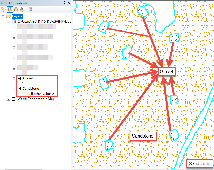
Polygons represent shapes and locations of different types of data such as rock units of the Earth surface. Rock units are drilled for environmental site assessment, however, the site must be mapped to determine accurate drilling locations.
In this scenario, the Create Fishnet tool is used to determine accurate drilling locations within the polygon layer representing the rock units. The tool creates rectangular grids representing possible borehole locations. The boreholes are drilled within the sandstone polygon and away from the polygon boundary in a specified distance using the Buffer tool.
Procedure
Follow the instructions below to create rectangular grids within a polygon layer with sampling points away from the polygon boundary in ArcMap.
- In ArcMap, add the desired polygon layers to the data frame. In this example, the sandstone and gravel polygon layers are added. The blue lines represent the boundaries of the polygons.
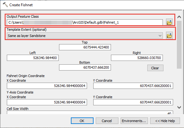
- Use the Create Fishnet tool from Data Management > Samplings to create rectangular grids within the desired polygon. In this example, the sandstone polygon is used.
- In the Create Fishnet dialog box, specify a name for Output Feature Class, and set the polygon feature for Template Extent (optional).
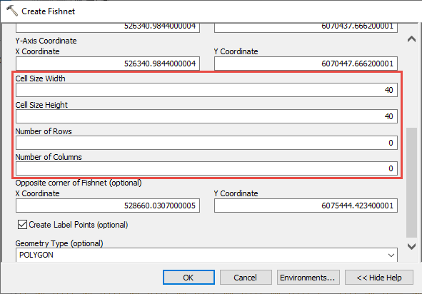
- Enter the desired values for Cell Size Width and Cell Size Height, and set values for Number of Rows and Number of Columns for the rectangular grids.
Note:
Optionally, set zero as the values for Number of Rows and Number of Columns to automatically calculate the numbers of rows and columns.
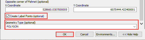
- Check the Create Label Points (optional) check box, and set Geometry Type (optional) to POLYGON. Click OK.
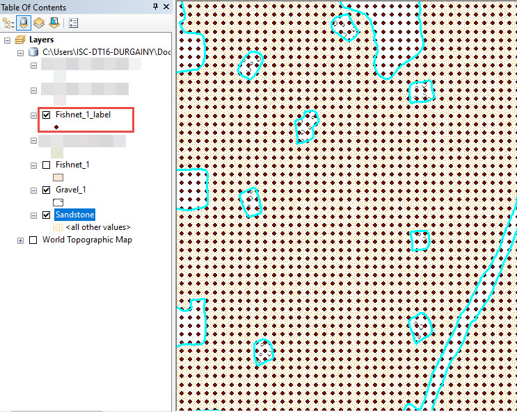
The image below shows the output of the Create Fishnet tool with the rectangular grids.
- Use the Clip tool from Analysis > Extract to clip the sandstone polygon layer with the rectangular grids.
- In the Clip dialog box, set the label layer created using the Create Fishnet tool from Step 2 for Input Features.
- Set the polygon layer used in Step 2a as Clip Features.
- Specify a name for Output Feature Class, and click OK.
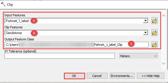
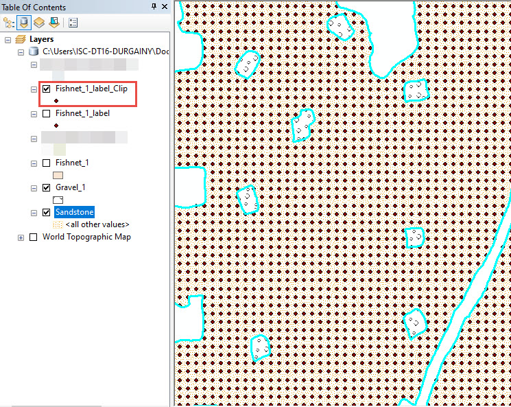
The image below shows the output of the Clip tool.
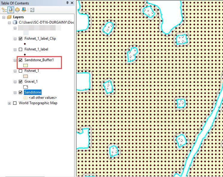
- Use the Buffer tool from Analysis > Proximity to set a buffer distance away from the polygon boundary.
- In the Buffer dialog box, set the rectangular grid layer created in Step 2 for Input Features and specify a name for Output Feature Class.
- Set a desired negative buffer value for Linear unit to create buffers inside the polygon, and set the desired unit conversion.
- Click the Side Type (optional) drop-down menu and select FULL.
- Click OK to view the results.
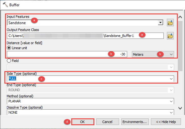
The image below shows the output of the Buffer tool.
- Use the Clip tool from the Analysis toolbox > Extract to remove the sampling points away from the buffer area.
- In the Clip dialog box, set the label layer created using the Create Fishnet tool from Step 2 for Input Features.
- Set the buffer layer created in Step 4 for Clip Features.
- Specify a name for Output Feature Class, and click OK.
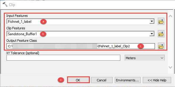
The image below shows the output of the Clip tool.
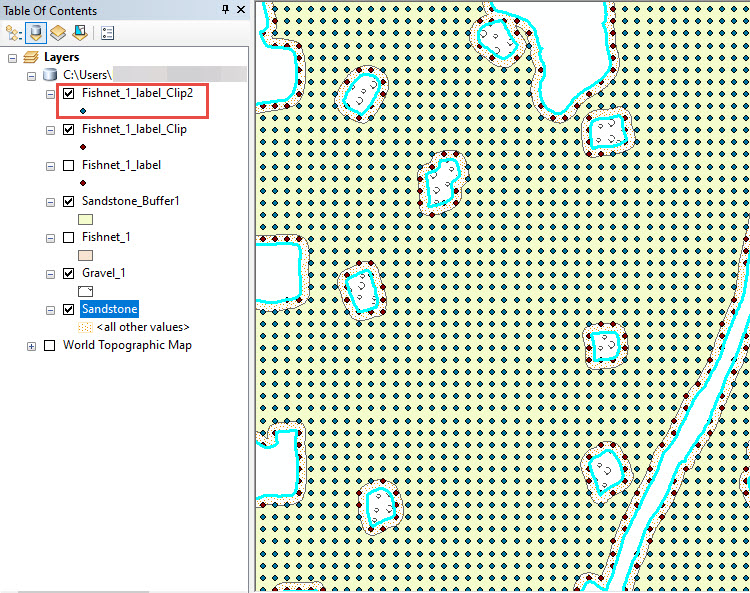
The image below shows the sandstone polygon layer with sampling points 30 meters away from the surrounding sandstone polygon boundaries.
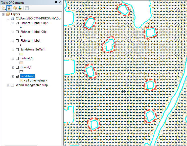
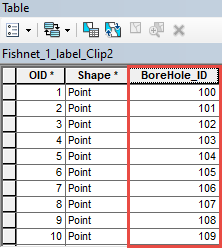
Note:
Optionally, open the attribute table, add a new field and use the Field Calculator tool to name each point as shown in the image below. Refer to ArcMap: Adding fields and ArcMap: Making field calculations for more information.
Article ID: 000022517
- ArcMap
Get support with AI
Resolve your issue quickly with the Esri Support AI Chatbot.


Related Information
Discover more on this topic
Search for related information
Find training related to this topic
Explore ideas and give feedback
Get help from ArcGIS experts
Start chatting now