HOW TO
Create an address locator to geocode parcels by ParcelID
Summary
It is common to create an address locator to geocode polygon parcels by parcel centroids (the center point of parcel polygons) using the US Address - Single House locator style. Another alternative is to create an address locator to geocode parcels by the parcel identification number (ParcelID).
Procedure
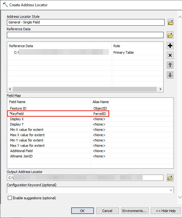
Follow the steps below to create an address locator by ParcelID:
- When creating the address locator, select the General - Single Field style.
- After selecting the parcel as the Reference Data, under the Field Map section, select the ParcelID field as the Alias Name for the *KeyField field.
Note:
Alternatively, if the locator must be published as a geocode service, use the General - Gazetteer style and select the ParcelID field as the Alias Name for the *Place Name field.
- Click OK.
Article ID: 000021697
Software:
- ArcMap
Get support with AI
Resolve your issue quickly with the Esri Support AI Chatbot.


Related Information
Discover more on this topic
Search for related information
Find training related to this topic
Explore ideas and give feedback
Get help from ArcGIS experts
Start chatting now