HOW TO
Convert each pixel of a raster layer to polygon features in ArcGIS Pro
Summary
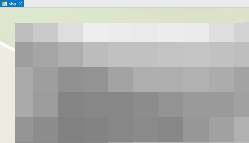
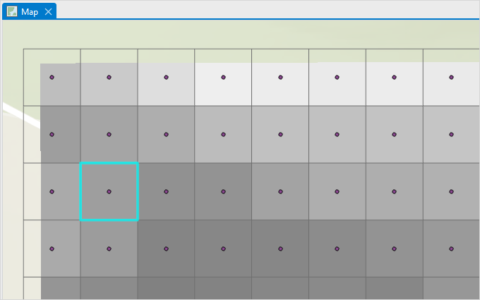
A raster comprises a matrix of pixels where each pixel contains a value representing information, such as image reflectance, temperature, or height. In ArcGIS Pro, it is useful to convert each pixel of a raster layer to a feature as each feature represents different attributes and spatial information.
In this example, each pixel of the raster layer is converted to a polygon feature for spatial analysis using the Feature To Polygon tool or the Raster to Polygon tool in ArcGIS Pro.
Procedure
Use the Feature To Polygon tool
In ArcGIS Pro, the outputs from the Raster to Point and the Create Fishnet tools are used as inputs by the Feature To Polygon tool to create the polygon features.
- Open the ArcGIS Pro project.
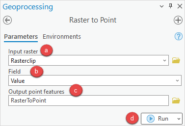
- Create point features based on the pixels of the raster layer using the Raster to Point tool.
- In the Raster to Point pane, on the Parameters tab, select the raster layer from the Input raster drop-down list.
- For Field, select Value from the drop-down list.
- Specify a name for Output point features, and click Browse
 to specify a location for the output.
 - Click Run. A new point layer is added to the Contents pane.
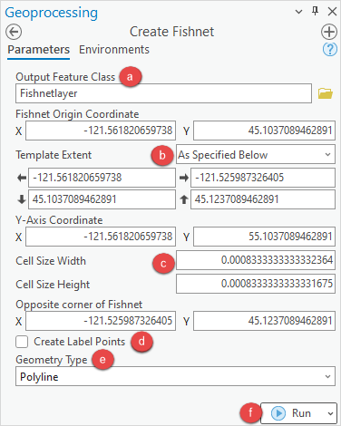
- Create a line layer based on the pixels of the raster layer using the Create Fishnet tool.
- In the Create Fishnet pane, on the Parameters tab, specify a name for Output Feature Class, and click Browse
 to specify a location for the output feature class.
 - For Template Extent, select the raster layer from the drop-down list. It automatically changes to As Specified Below when the raster layer is selected.
- Specify values for the Cell Size Width and Cell Size Height parameters.
- In the Create Fishnet pane, on the Parameters tab, specify a name for Output Feature Class, and click Browse
Note:
Open the raster layer properties to obtain the Cell Size Width and Cell Size Height values. In the Contents pane, right-click the raster layer, and click Properties. In the Layer Properties window, click the Source tab, and expand the Raster Information group. Specify the Cell Size X value in Cell Size Width, and the Cell Size Y value in Cell Size Height.
- Uncheck the Create Label Points check box.
- For Geometry Type, select Polyline from the drop-down list.
- Click Run.
Note:
The Fishnet Origin Coordinate, Y-Axis Coordinate, and Opposite corner of Fishnet values are automatically specified when the raster layer is selected.
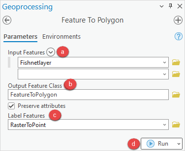
- Convert the line layer created in Step 3 to polygon features using the Feature To Polygon tool.
- In the Feature To Polygon pane, on the Parameters tab, select the line layer created in Step 3 from the Input Features drop-down list.
- Specify a name for Output Feature Class, and click Browse
 to specify a location for the output feature layer.
 - Select the point layer created in Step 2 from the Label Features drop-down list.
- Click Run.
The image below shows each of the pixels converted to polygon features in ArcGIS Pro.
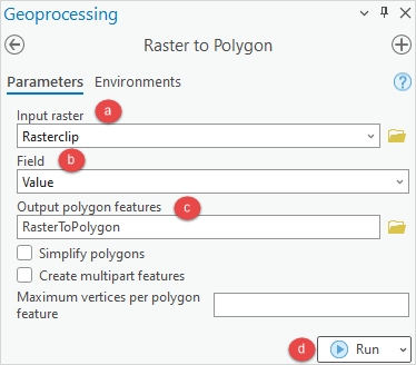
Use the Raster to Polygon tool
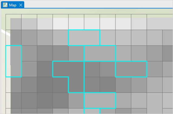
Note:
Adjacent pixels with the same pixel value are merged into one polygon feature in the output of the Raster to Polygon tool.
- Open the ArcGIS Pro project.
- In the Raster to Polygon pane, configure the Parameters tab.
- Select the raster layer from the Input raster drop-down list.
- For Field, select Value from the drop-down list.
- Specify a name for Output polygon features, and click Browse
 to specify a location for the output.
 - Click Run.
The pixels are converted to polygon features and the pixels of the same value are merged into one polygon feature in ArcGIS Pro.
Article ID: 000028721
- ArcGIS Pro 3 0
- ArcGIS Pro 2 8 x
- ArcGIS Pro 2 x
Get support with AI
Resolve your issue quickly with the Esri Support AI Chatbot.


Related Information
Discover more on this topic
Search for related information
Find training related to this topic
Explore ideas and give feedback
Get help from ArcGIS experts
Start chatting now