HOW TO
Calculate the longest side of a polygon feature in ArcGIS Pro
Summary
In some instances, it may be necessary to calculate the longest side of a polygon feature, for example, to measure distance for navigation and to construct buildings for architecture.
In this article, the longest side of each polygon feature in a polygon layer is calculated in ArcGIS Pro.
Procedure
Note:
The Polygon To Line and Split Line At Vertices tools requires an ArcGIS Desktop Advanced license.
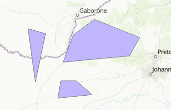
- Open the polygon feature layer in ArcGIS Pro.
- Convert the polygon features to line features using the Polygon To Line tool.
- On the Analysis tab, click Tools to open the Geoprocessing pane.
- In the Geoprocessing pane, search for and click the Polygon To Line tool.
- In the Polygon To Line pane, on the Parameters tab, select the polygon feature layer from the Input Features drop-down list. In this example, 'Polygon1' is selected.
- Specify a name for Output Feature Class.
- Uncheck the Identify and store polygon neighboring information check box.
- Click Run.

- Split the polygon lines using the Split Line At Vertices tool.
- On the Analysis tab, click Tools to open the Geoprocessing pane.
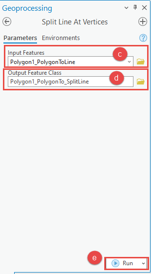
- In the Geoprocessing pane, search for and click the Split Line At Vertices tool.
- In the Split Line At Vertices pane, on the Parameters tab, select the line feature layer created in Step 2 from the Input Features drop-down list. In this example, 'Polygon1_PolygonToLine' is selected.
- Specify a name for Output Feature Class.
- Click Run.
- Determine the longest side of the polygon features using the Summary Statistics tool.
- On the Analysis tab, click Tools to open the Geoprocessing pane.
- In the Geoprocessing pane, search for and click the Summary Statistics tool.
- In the Summary Statistics pane, on the Parameters tab, select the line feature layer created in Step 3 from the Input Table drop-down list. In this example, 'Polygon1_PolygonTo_SplitLine' is selected.
- Specify a name for Output Table.
- For Statistics Fields, check or select Shape_Length for Field and select Maximum for Statistic Type.
- For Case Field, check or select ORIG_FID.
- Click Run.

A standalone table is generated displaying the longest side of the polygon features in meters as shown in the image below.

Article ID: 000026673
- ArcGIS Pro 3 1
- ArcGIS Pro 3 0
- ArcGIS Pro 2 9x
Get support with AI
Resolve your issue quickly with the Esri Support AI Chatbot.


Related Information
Discover more on this topic
Search for related information
Find training related to this topic
Explore ideas and give feedback
Get help from ArcGIS experts
Start chatting now