Frequently asked question
What are some best practices for using CityEngine street data as 2D data in ArcGIS Pro?
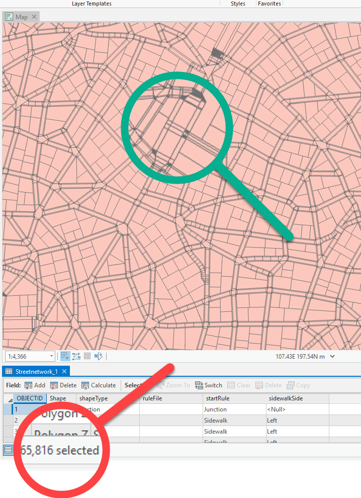
Exporting CityEngine polygons sometimes results in data with complex geometry and x,y,z values that may cause errors when running geoprocessing tools in ArcGIS Pro. CityEngine is designed to create realistic 3D scenes with complex street networks, buildings, and various other features. This complexity is not easily translated to 2D data, and might not be well represented on a 2D map. For example, when zooming in and opening the attribute table of an exported street feature class in ArcGIS Pro, thousands of records are displayed, as shown in the image below.
This article describes some of the best practices for using CityEngine street data in ArcGIS Pro as 2D data to avoid issues such as invalid geometry, and reduce the number of vertices so rendering is simplified.
Disable the z- and m-values
Street data exported from ArcGIS CityEngine are assigned with z- and m-values. Since the exported street data are used as 2D data in ArcGIS Pro, disable the z-values and m-values properties to avoid issues related to them. Refer to How To: Remove Z- and/or M-values from a feature class for steps to do this.
Eliminate slivers
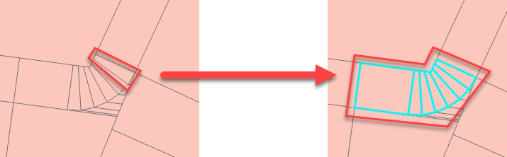
2D data exported from CityEngine street data may contain slivers. Selecting a sliver highlights other surrounding polygons, indicating the selected sliver is a multipart polygon. For example, as displayed in the image below, the selected slivers are classified in the attribute table as Sidewalk, and can be dissolved based on the shared attribute to create a larger polygon.
To eliminate the slivers, follow the instructions below.
- Select all the features in the feature class. Refer to Select features for editing for methods in selecting features.
- Click the Edit tab.
- Expand the tools in the Tools group, and select Explode.
- In the Modify Features pane, click Explode to explode the multipart features to individual features.
Dissolve polygons with the same street type
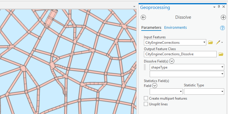
To get one continuous polygon for all polygons sharing an edge and eliminate unwanted polygons, dissolve them. CityEngine street data may sometimes contain other features such as parcel lots, utilities, and lakes. If necessary, query the street polygons, leaving out the other polygons and dissolving only the streets. Refer to Query builder for more information on querying and selecting a subset of records. To dissolve street polygons, use the Dissolve tool, and uncheck the Create multipart features option. In the example below, the shapeType field is used as the dissolve field to dissolve streets based on the street type.
Article ID: 000021933
- ArcGIS CityEngine Prev
- ArcGIS Pro 2 x
Get support with AI
Resolve your issue quickly with the Esri Support AI Chatbot.


Related Information
Discover more on this topic
Search for related information
Find training related to this topic
Explore ideas and give feedback
Get help from ArcGIS experts
Start chatting now