A to Z GIS | Explore this related guide, featuring updated terms and graphics and developed in coordination with Esri’s GIS Dictionary team.
Learn more about A to Z GIS
GIS Dictionary
Browse dictionary
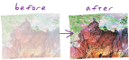
stretch
URL copiedShare URL
[visualization techniques]
A display technique applied to the histogram of raster datasets, most often used to increase the visual contrast between cells.