A to Z GIS | Explore this related guide, featuring updated terms and graphics and developed in coordination with Esri’s GIS Dictionary team.
Learn more about A to Z GIS
GIS Dictionary
Browse dictionary
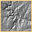
relief
URL copiedShare URL
[visualization techniques, geography]
Elevations and depressions of the earth's surface, including those of the ocean floor. Relief can be represented on maps by contours, shading, hypsometric tints, digital terrain modeling, or spot elevations.