Schwebende Dialogleiste | Support | GIS-Wörterbuch
GIS (A bis Z) | Erkunden Sie dieses zugehörige Dokument mit aktualisierten Begriffen und Abbildungen, das in Zusammenarbeit mit dem GIS-Wörterbuchteam von Esri entwickelt wurde.
Weitere Informationen zu GIS (A bis Z)
GIS-Wörterbuch
Wörterbuch durchsuchen
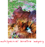
Fernerkundungsbilddaten
URL kopiertURL freigeben
[Fernerkundung]
Bilddaten, die von Satelliten, Flugzeugen und Drohnen aufgenommen werden, wie zum Beispiel panchromatische, Radar-, Mikrowellen-, Farb- und multispektrale Bilddaten.