操作方法
操作方法:将浮点型栅格转换为面要素类,并保留十进制值
摘要
The Raster to Polygon tool can only process integer input rasters. Therefore, a floating type raster must be converted to an integer type raster before using the tool.
过程
Note:
The following workflow requires a Spatial Analyst license. The Int tool mentioned in this article exists in both the Spatial Analyst and 3D Analyst toolsets.
The instructions provided describe how to convert a floating type raster to a polygon feature class and retain the decimal values.
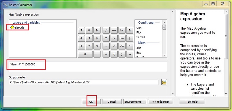
- Using the Raster Calculator tool, multiply the raster by 10 to remove the decimal values. For example, multiply a raster by 1000 if the raster values contain three decimal places, and by 100 if the values contain two decimal places.
- Navigate to ArcToolbox > Spatial Analyst Tools > Map Algebra > Raster Calculator.
- In the Layers and variables section, double-click the raster.
- Click the multiplication sign (*).
- Input the required multiple of 10. In this example, 1000000 is used because the raster contains floating values with six decimal places.
- Click OK.
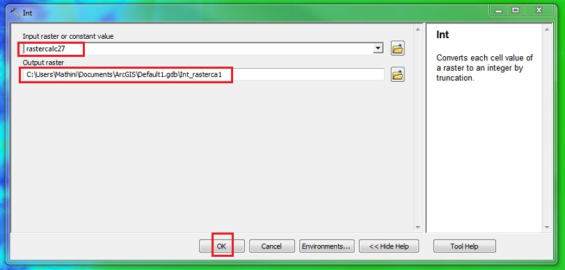
- Using the Int tool, convert the floating type raster to an integer type raster.
- Navigate to ArcToolbox > Spatial Analyst Tools > Math > Int.
- In the Int window, specify the raster created in Step 1 in the Input raster or constant value field.
- Specify the name and location for the output raster.
- Click OK.
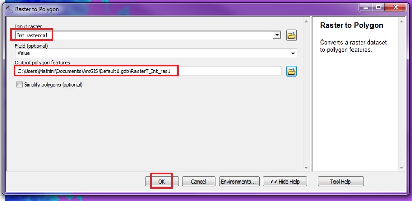
- Convert the integer type raster to a polygon feature class using the Raster to Polygon tool.
- Navigate to ArcToolbox > Conversion Tools > From Raster > Raster to Polygon.
- In the Raster to Polygon window, specify the raster created in Step 2 in the Input raster field.
- Specify the name and location for the output polygon feature class.
- Fill in any optional parameters.
- Click OK.
- Divide the polygon feature class by 10, as used in Step 1, to get the original decimal values.
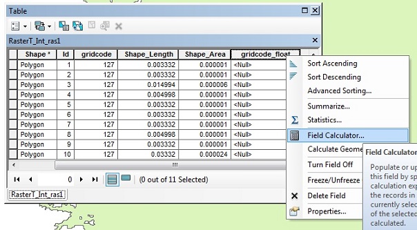
- Right-click the output feature layer from Step 3 and click Open Attribute Table.
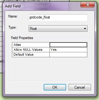
- Click the Table Options drop-down arrow and click Add Field.
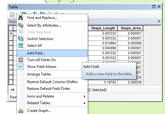
- Fill in the parameters in the Add Field window and click OK.
- Right-click the heading of the new field and click Field Calculator.
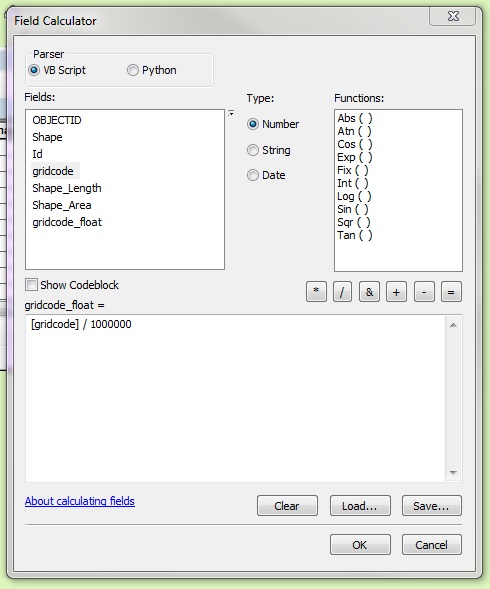
- In the Fields section, double-click the gridcode field with the multiple of 10 used in Step 1 and click OK.
文章 ID:000012554
从 ArcGIS 专家处获得帮助
下载 Esri 支持应用程序
相关信息
发现关于本主题的更多内容
Search for related information
Find training related to this topic
Explore ideas and give feedback