操作方法
问题:无法在 Field Maps Designer 和 ArcGIS Online 中的“项目详细信息”页面中打包切片图层的离线区域
描述
当尝试为切片图层生成离线区域时,离线区域打包失败,Field Maps Designer 和 ArcGIS Online 的“项目详细信息”页面中均显示通用“失败”消息。 如果在 Field Maps 移动设备中创建离线区域,则同一离线区域将在切片图层上成功打包。
当检查来自 REST 的打包请求时,虽然会显示错误消息并且无法创建离线区域,但 REST 仍将指示打包作业成功。
原因
切片图层的发布范围小于离线区域所定义的范围。 在发布到 ArcGIS Online 过程中,如果未将创建的切片图层设置为用于离线模式下图层的范围,则离线区域打包将失败。
解决方案或解决方法
将切片图层从 ArcGIS Pro 发布到 ArcGIS Online 时,用户需要发布其服务,并指定与创建离线区域时将使用的细节层次相同。 示例工作流如下:
- 在 ArcGIS Pro 中,打开工程。
- 从顶部的选项卡中选择共享 > 发布为 Web 图层。
- 在共享为 Web 图层窗格中,导航至配置选项卡。
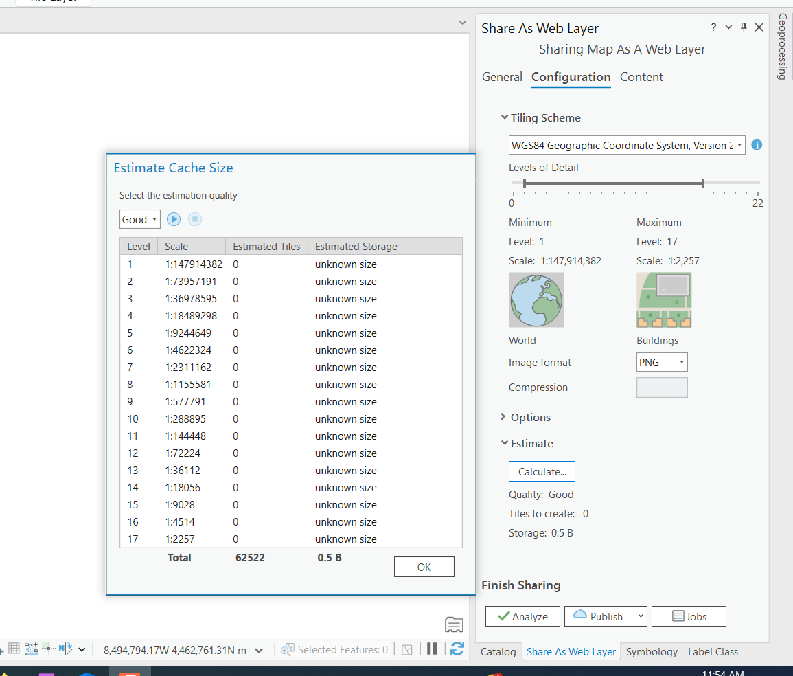
- 将最小和最大细节层次更改为所需的范围,如下图所示。
Note:
The min/max number depends on the size of the data. The larger the dataset, the more credits it uses for increased min and max. Tile Generation costs one credit per 1,000 Tiles Generated. You can estimate the credits used prior to publishing from ArcGIS Pro to ArcGIS Online using the Estimate > Calculate options in the same configuration window, as shown in the next image.
- 将此图层重新发布到 ArcGIS Online。
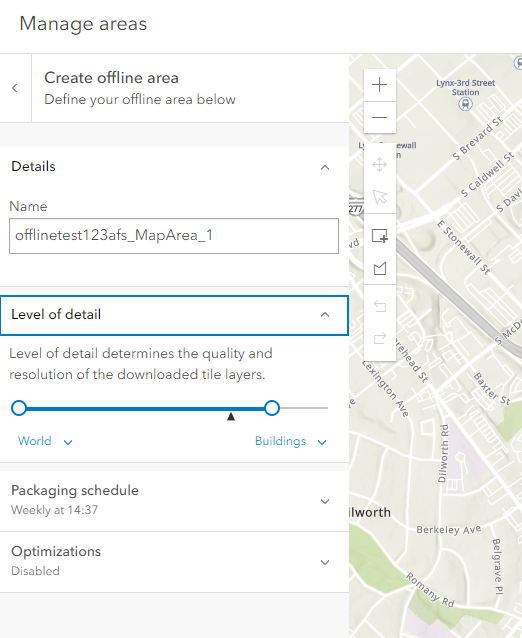
- 使用从 ArcGIS Pro 发布时配置的相同细节层次创建离线区域,如下图所示。
文章 ID: 000031661
获得人工智能支持
使用 Esri Support AI Chatbot 快速解决您的问题。


相关信息
发现关于本主题的更多内容
Search for related information
Find training related to this topic
Explore ideas and give feedback
获取来自 ArcGIS 专家的帮助
立即开始聊天