操作方法
问题:在 ArcGIS Pro 中创建正射映射工作空间时返回错误消息
描述
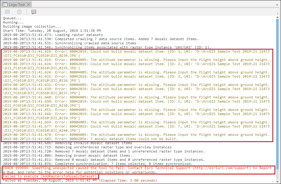
在某些情况下,在 ArcGIS Pro 中为无人机影像创建正射映射工作空间时,系统返回以下错误消息:
Error:
80042019: Could not build mosaic dataset item. [ID: 5, URI: 'D:\ArcGIS Sample Test 2019\21 21473\DJI_FC6510\DJI_0238.JPG']
Error:
Error: 80004005: The altitude parameter is missing. Please input the flight height above ground height.
Error:
ERROR 999999: Something unexpected caused the tool to fail. Contact Esri Technical Support (http://esriurl.com/support) to Report a Bug, and refer to the error help for potential solutions or workarounds.
Error:
Failed to execute (AddRastersToMosaicDataset).
原因
如果在将导入的无人机影像添加至“影像集合”窗格时,其高程值为负,则会触发此类错误。 此问题特定于 DJI6000 系列 FC 相机型号的无人机影像。 这是一个已知的问题,已被 Esri 记录为缺陷。 请参阅 BUG-000119757。
解决方案或解决方法
要解决此问题,请使用以下任一解决方法:
创建并导入地理位置 GPS 文本文件
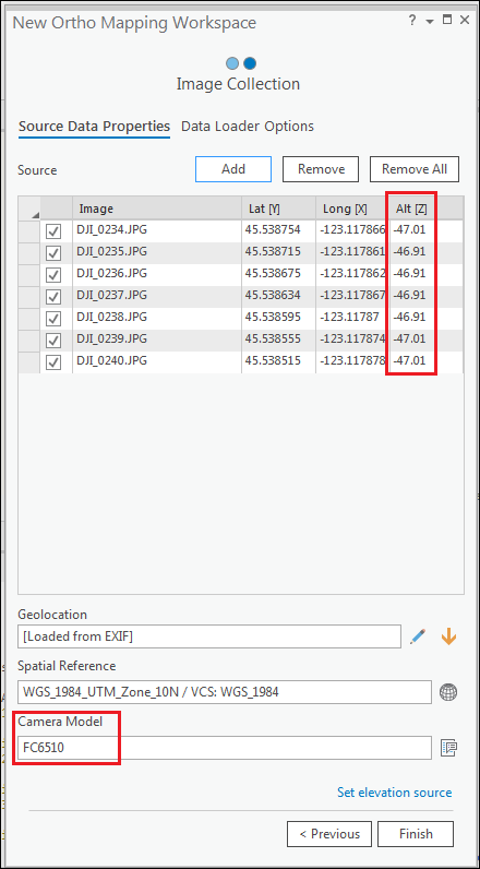
- 在影像选项卡中,单击新建工作空间,打开新建正射映射工作空间对话框。
- 在工作空间配置窗格中,键入工作空间名称,然后单击下一步。
- 在影像集合窗格中,单击添加按钮,然后浏览至包含无人机影像的文件夹。 单击确定。
- 根据影像集合窗格中看到的表,在 Microsoft Excel 中创建地理位置 GPS 文本文件。
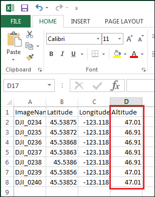
- 打开新的 Microsoft Excel 工作簿并添加字段,例如图像名称、纬度、经度和高度。
- 相应地填写字段。
- 对于高度,将负值更改为正值。
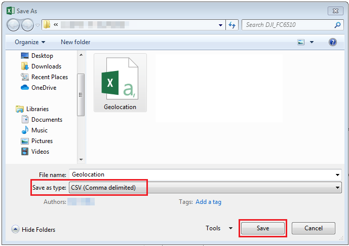
- 单击文件 > 另存为,然后将工作簿另存为 CSV(逗号分隔)文件类型。 单击保存。
- 在影像集合窗格中,单击导入 GPS 文件
 ,导入创建的 CSV 文件。
- 在 GPS/方向文件下,导航到创建的 CSV 文件的位置。
- 在字段映射下,确保字段和字段索引正确匹配。 单击确定。
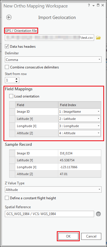
- 在图像集合窗格中,确保 Alt [Z] 字段中的所有值均为正值。 单击完成执行该工具。
![Alt [Z] 中的所有值都是正值](https://webapps-cdn.esri.com/CDN/support-site/technical-articles-images/000021473/00N39000003LL2C-0EMf2000000rp5L.png)
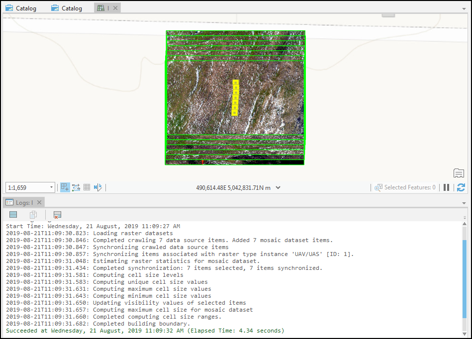
下图显示正射映射工作空间已成功创建且无任何错误。
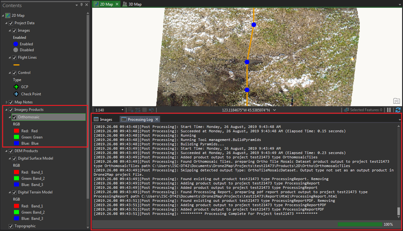
使用 Drone2Map for ArcGIS 创建正射镶嵌
在 Drone2Map for ArcGIS 应用程序中创建新工程后,根据工程图像生成正射镶嵌。 有关详细信息,请参阅 Drone2Map for ArcGIS:处理单个工程。
Note:
The Drone2Map for ArcGIS application can be downloaded from ArcGIS Marketplace: Drone2Map for ArcGIS.
Note:
Assign the Drone2Map for ArcGIS license to the ArcGIS Online account. Refer to ArcGIS Online: Manage licenses for more information.
下图显示在 Drone2Map for ArcGIS 应用程序中成功创建的正射镶嵌影像。
文章 ID: 000021473
获得人工智能支持
使用 Esri Support AI Chatbot 快速解决您的问题。


相关信息
发现关于本主题的更多内容
Search for related information
Find training related to this topic
Explore ideas and give feedback
获取来自 ArcGIS 专家的帮助
立即开始聊天