操作方法
操作方法:将 Site Scan Flight for ArcGIS 与 ArcGIS QuickCapture 集成
摘要
Site Scan Flight for ArcGIS can share a drone’s location with ArcGIS QuickCapture. This allows capturing point, line, and polygon features directly within QuickCapture by using the drone’s location mid-flight, rather than the location of the mobile device running QuickCapture.
过程
Note:
To complete the connection, both the device running Site Scan Flight for ArcGIS and the device running QuickCapture must be on the same Wi-Fi network. This can be achieved by connecting both devices to a mobile hotspot in the field.
In the Site Scan Flight app:
- Update Site Scan Flight for ArcGIS to the newest version.
- Open the app on the iPad.
- Open an existing Project or create a new Project.
- Connect to the drone.
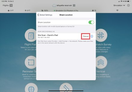
- Tap on the gear icon to open the Settings menu.
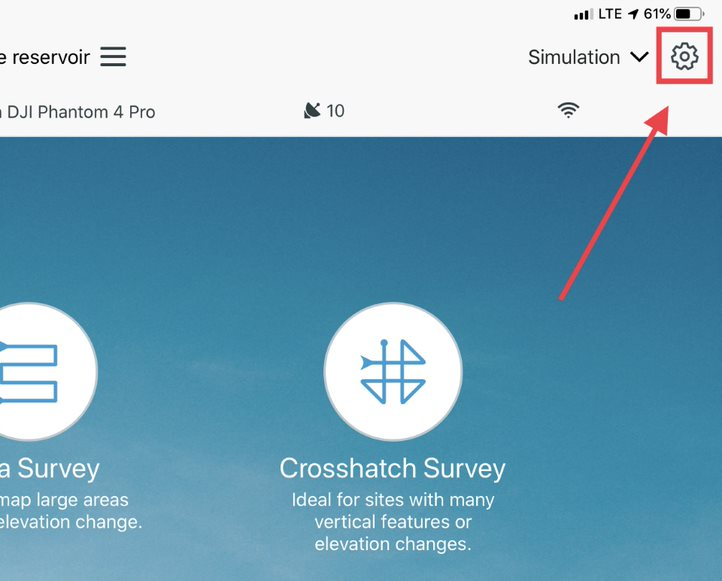
- Tap Share Location.
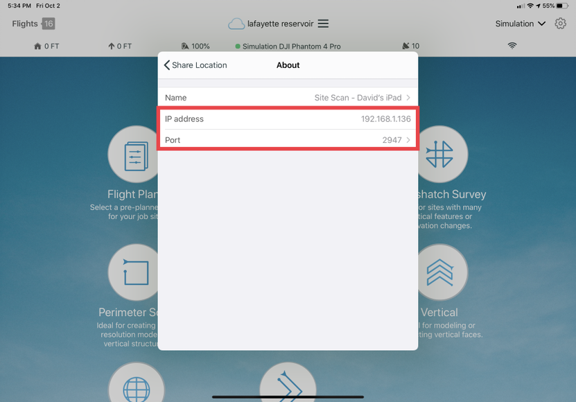
- Enable Share Location, and tap on the device name. Make a note of the IP address and Port, as this information is used to complete the configuration in QuickCapture.
- After completing the QuickCapture steps below, plan and fly the drone flight using an autonomous flight mode or the manual Inspect mode. The QuickCapture user can collect features during the flight.
In the QuickCapture mobile app:
- Open QuickCapture for ArcGIS on a mobile device.
- Sign in using ArcGIS Online or ArcGIS Enterprise credentials, or create a free ArcGIS Online trial account.
- Tap your user icon and open the Settings menu.

- Under Location, tap Provider.
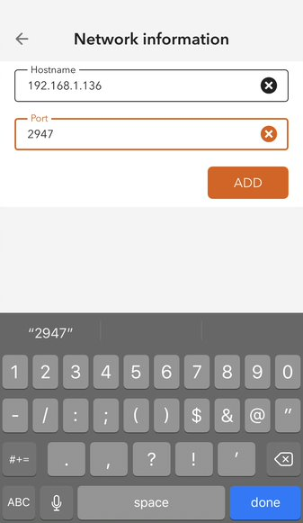
- Under Add Provider, tap Via Network.
- Enter the following
- Under Hostname, enter the IP Address from Step 7 of the previous procedure.
- Under Port, enter the port number from Step 7 of the previous procedure.
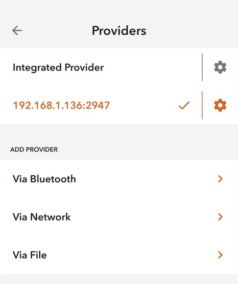
- After adding the provider, return to the Providers page to validate the new provider is connected.
- Refer to the QuickCapture documentation for instructions on creating projects and collecting data.
Note:
It is recommended to fly with the gimbal pointed straight down (nadir) so that the X,Y coordinates of the drone are as close as possible to those of the feature being identified.
Safety Considerations
- The Site Scan/QuickCapture integration is a two-person responsibility. Esri does not recommend that the drone pilot capture locations in QuickCapture during the flight.
- The Site Scan/QuickCapture integration works best on two mobile devices. The pilot should use the Site Scan Flight iOS app on one device, and another person should use QuickCapture on a separate device. This is to ensure the pilot is fully dedicated to flying the drone.
文章 ID: 000024336
获得人工智能支持
使用 Esri Support AI Chatbot 快速解决您的问题。


相关信息
发现关于本主题的更多内容
Search for related information
Find training related to this topic
Explore ideas and give feedback
获取来自 ArcGIS 专家的帮助
立即开始聊天