操作方法
操作方法:使用 Site Scan Flight for ArcGIS 执行多电池飞行
摘要
Depending on the hardware of your drone, survey of expansive areas may be not be possible with only a single battery. However, ArcGIS Flight allows pilots to split a mission between multiple batteries. Without any input from the user, ArcGIS Flight automatically pauses data collection during the mission, returns to home for safe landing, and resumes data collection once the battery has been replaced.
过程
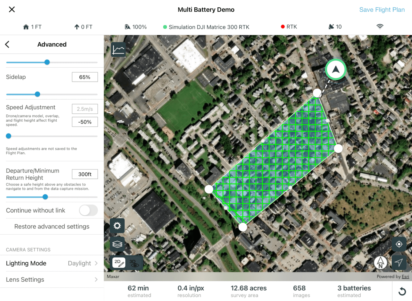
When planning a mission, ArcGIS Flight calculates the number of fully charged batteries the drone will consume to complete the mission. Below is an image of a crosshatch survey that will consume three batteries.
Before takeoff, Flight checks the battery level of the drone. If the battery is not fully charged, a message appears requesting a battery change before taking off.
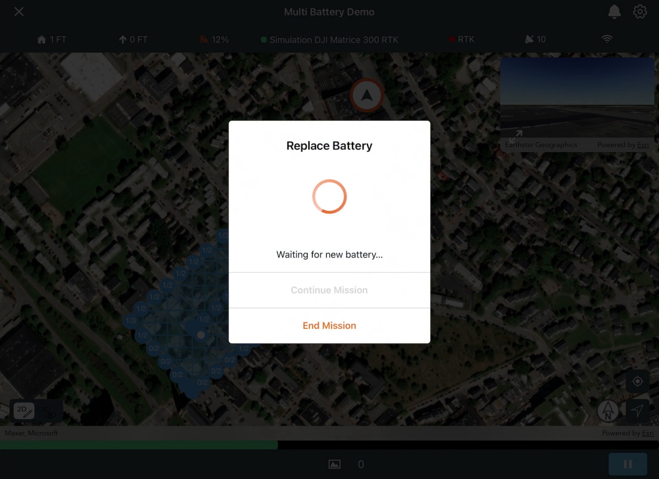
After takeoff, the drone travels to the mission area and begins collecting imagery. When battery level reaches 20%, ArcGIS Flight will pause data collection, automatically trigger a return to home, and land the drone. Upon landing, the drone prompts for a battery change, as shown in the image below. Replace the battery and select Continue Mission, or select End Mission if it is no longer necessary to capture the remainder of the photos.
After replacing the battery, make sure your drone is powered on. Flight will automatically reconnect to the drone.
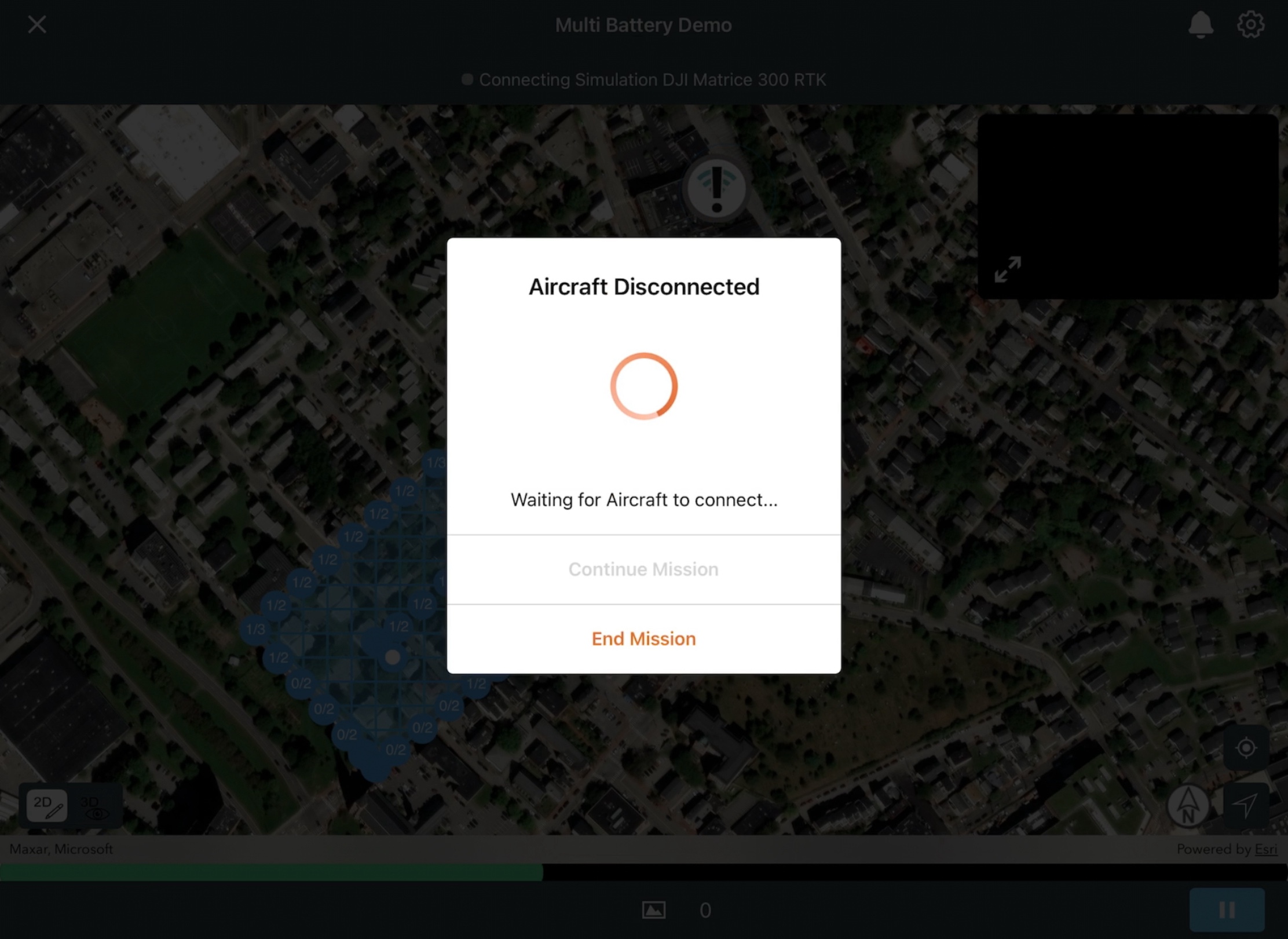
After successful reconnection, Flight prompts you to continue the mission. Select Continue Mission.

Note:
This behavior occurs whether the survey was ended prematurely by the user, or automatically for battery replacement.
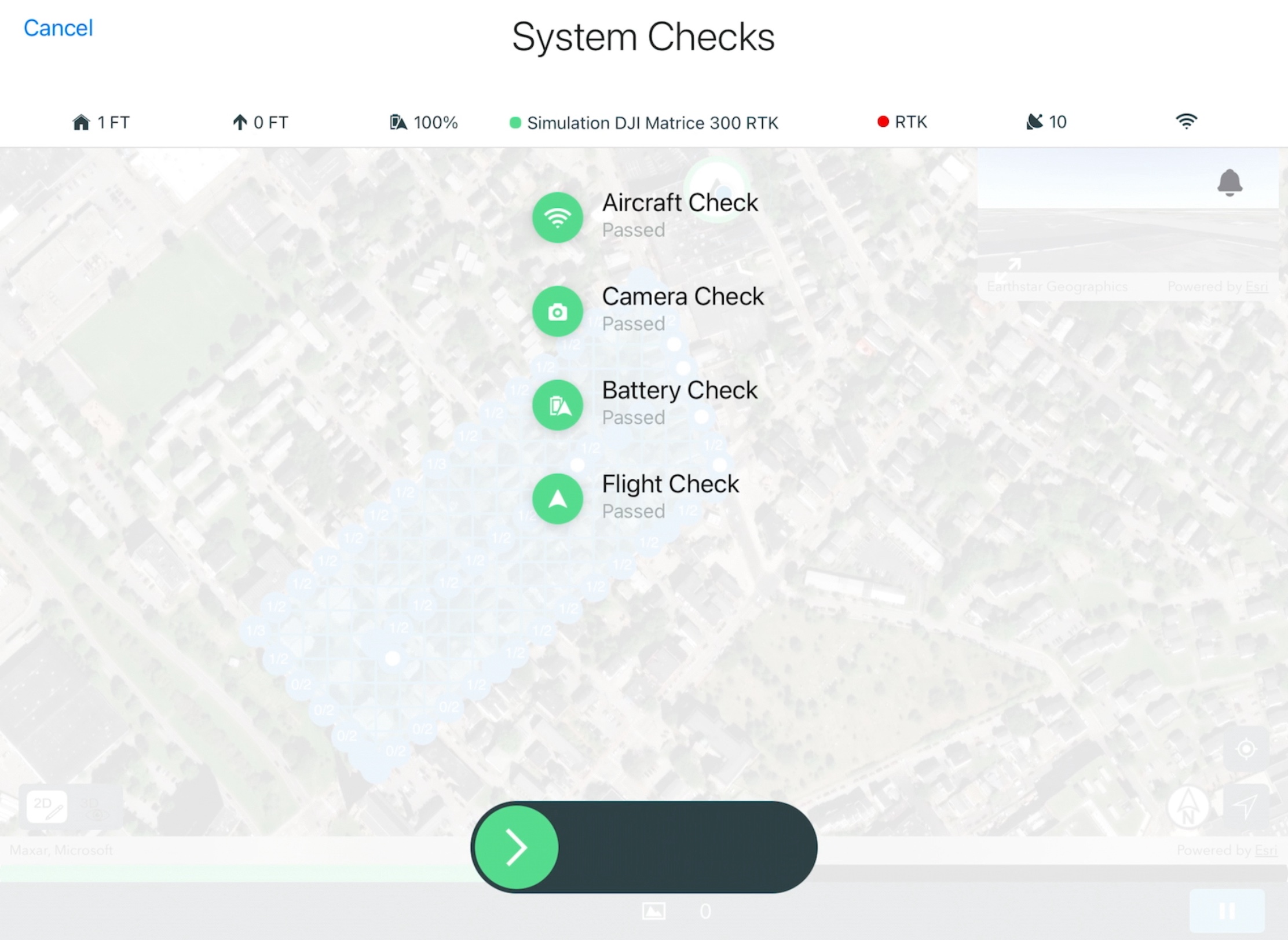
Similar to the initial takeoff, Flight displays the System Checks screen and conducts automatic assessments of the drone's sensor hardware, SD card storage, battery levels, and mission settings. If all system checks have been passed, swipe the green arrow slider to the right.
The drone will initiate takeoff and fly to the mission area. It returns to the location where data collection was paused before battery replacement and resumes capturing imagery.
Note:
The process of pausing data collection and returning to home for battery replacement repeats until all mission data is captured, or the user elects to End Mission.
Use the in-flight view to monitor the progress of your mission, and maintain visual line-of-sight with the drone. Mission progress will be indicated by the green bar at the bottom of the screen. The Mission Complete screen will display when all imagery has been captured and the drone has landed. From the Mission Complete screen select Done to return to the project home screen.For information on methods to import the captured imagery from your drone into ArcGIS Flight, refer to How To: Import images to ArcGIS Flight and upload to Site Scan.
文章 ID: 000023057
获得人工智能支持
使用 Esri Support AI Chatbot 快速解决您的问题。


发现关于本主题的更多内容
Search for related information
Find training related to this topic
Explore ideas and give feedback
获取来自 ArcGIS 专家的帮助
立即开始聊天