操作方法
操作方法:从高程点计算区域的体积
描述
高程点表示地表的高度,每个点都包含地球表面的 x,y,z 测量值。 可以使用高程点作为输入来计算区域的体积,结果将提供从特定深度的土地挖掘一定区域收集的土壤量等信息。可以通过以下步骤从高程点计算区域的体积:首先从高程点插值生成栅格表面,然后运行“表面体积”工具来计算该区域高于或低于特定高程(参考平面)的体积。
Note:
The 3D Analyst extension must be licensed to perform the workflows described in this article.
所提供的说明描述了如何从高程点计算区域的体积。
解决方案或解决方法
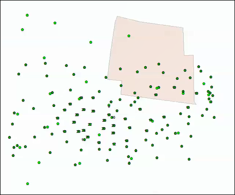
- 在 ArcMap 中,添加高程点和边界要素类。
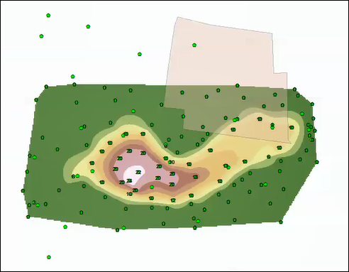
- 使用自然邻域法工具从高程点插入栅格表面。
Note:
There are several interpolation methods available in ArcGIS Desktop depending on the purpose of the raster interpolation. For more information on other raster interpolation methods, refer to An introduction to interpolation methods.
- 导航至 3D Analyst 工具 > 栅格插值法 > 自然邻域法。
- 选择高程点要素类作为输入点要素。
- 选择包含每个点的高度值的字段作为 Z 值字段。
- 设置输出栅格的名称和位置。
- 单击确定。 插值栅格将显示在地图中。
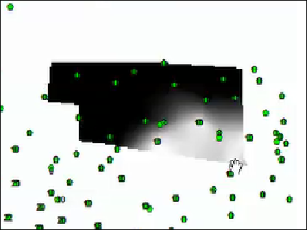
- 使用裁剪工具剪切在步骤 2 中创建的栅格,并将边界作为输出范围。
Note:
In this scenario, the boundary feature class represents the area of interest, not the entirety of the interpolated area.
- 导航至数据管理工具 > 栅格 > 栅格处理 > 裁剪。
- 选择在步骤 2 中创建的栅格作为输入栅格。
- 选择边界图层作为输出范围。
- 选中使用输入要素裁剪几何复选框。
- 设置输出栅格数据集的名称和位置。
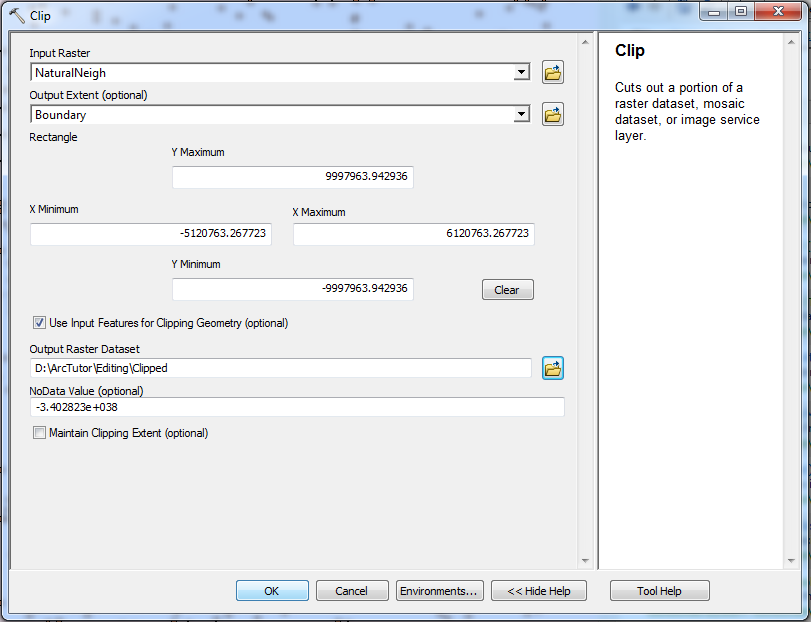
- 单击确定。 随即在地图中显示裁剪的栅格。
- 使用表面体积工具计算区域的表面体积。
- 导航到 3D Analyst 工具 > 功能表面 > 表面体积。
- 选择步骤 3 中裁剪的栅格作为输入表面。
- 设置输出文本文件的名称。
- 为参考平面选择 ABOVE 或 BELOW,计算指定平面高度与高于或低于参考平面的表面部分之间的体积。
- 在平面高度参数中插入要用作计算体积基准面的 Z 值。
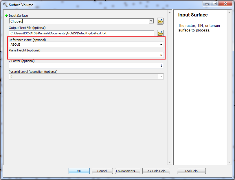
- 单击确定。 输出文本文件将存储表面的完整路径、用于生成结果的参数以及计算得出的面积和体积测量值。

文章 ID: 000015815
获得人工智能支持
使用 Esri Support AI Chatbot 快速解决您的问题。


相关信息
发现关于本主题的更多内容
Search for related information
Find training related to this topic
Explore ideas and give feedback
获取来自 ArcGIS 专家的帮助
立即开始聊天