固定对话栏 | 支持 | GIS 词典
A 到 Z 的 GIS |
探索这份相关指南,其中包含更新的术语和图形,并由 Esri 的 GIS 词典团队协作开发。
了解更多关于 A 到 Z 的 GIS 知识
GIS 字典
浏览字典
平面图
URL 已复制
共享 URL
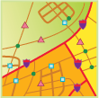
[专题制图]
一种仅显示要素的 x,y 位置的地图,表示水平位置,而非垂直(高度或深度)尺寸。
另请参阅
地形图