固定对话栏 | 支持 | GIS 词典
A 到 Z 的 GIS |
探索这份相关指南,其中包含更新的术语和图形,并由 Esri 的 GIS 词典团队协作开发。
了解更多关于 A 到 Z 的 GIS 知识
GIS 字典
浏览字典
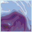
坡度图
URL 已复制
共享 URL
[专题制图]
使用颜色或阴影来表示坡度的地图。
另请参阅
坡度