Instrução
Medir volumes no Site Scan Site Scan Manager for ArcGIS
Resumo
Instructions provided describe how to measure volumes using the Volume tool in Site Scan Manager.
Causa
Site Scan Manager's Volume tool is designed to estimate the volume of stockpiles, trenches, and other voids or volumes. There are three base planes available that account for the underlying terrain: lowest point, highest point, and best fit.
- The lowest point base plane finds the lowest elevation within the selected area, and creates the base plane from that point. This is best suited for stockpiles on a flat surface—or with walls or other stockpiles nearby—that is to be cut.
- The highest point base plane works from the highest point in the selected area, and is great in cases where the area is to be filled, such as a trench or hole.
- The best fit base plane is the default plane in Site Scan, and is the most robust of the three; it automatically determines the most appropriate fit for the selected area.
Procedimento
- Select the Volume tool from the Measure menu at the top of the screen. The Volume tool also measures the area of the drawing.
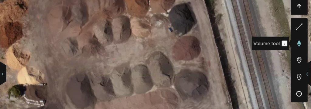
- After selecting the polygon tool, click the map to set the first point. Continue selecting points around the desired area to measure. To close the shape, press the Enter or Return key, or double-click the last point created. Once the area is delimited, click the polygon created and the measurements are returned. By default, the measurement displayed is the best fit base plane.
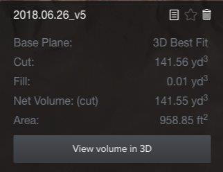
- When the net volume displays cut, it means the tool is detecting an excess of volume over the base, for example, a stockpile.
- When the net volume displays fill, it means the tool is detecting a negative volume (or the absence of material), which indicates it is a trench.
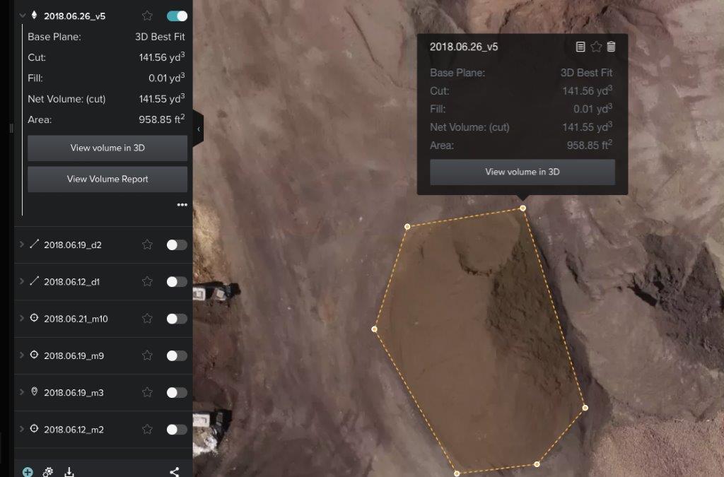
- Click View Volume in 3D to access Mesh Viewer for a better understanding of the measurements.
Edit the area selected and observe the changes displayed in Mesh Viewer on the right.
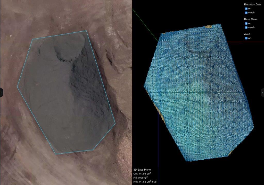
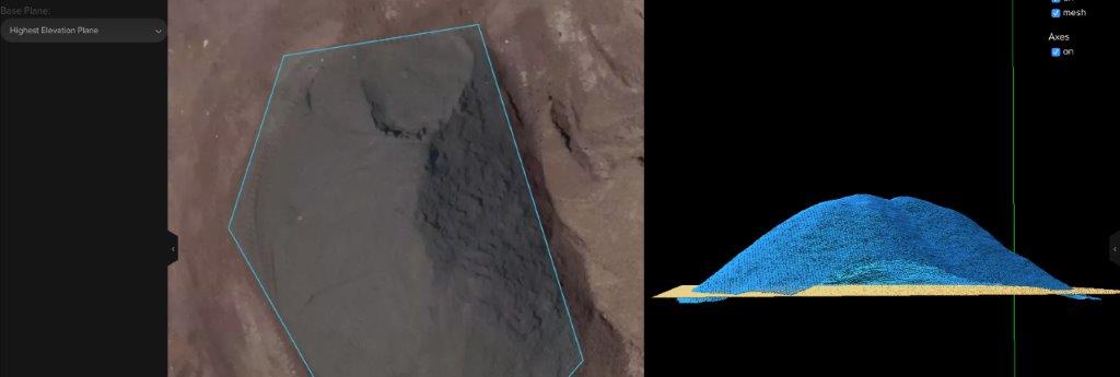
Change the underlying terrain using the drop-down menu at the top-right of the screen, and get different measurements according to variations on the base.
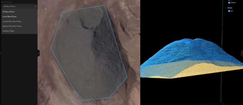
- Lowest Elevation Plane: Creates a flat base based on the lowest of the points used to draw the polygon.
- Highest Elevation Plane: Creates a flat base based on the highest of the points used to draw the polygon.
- Level Base Plane: Enables the user to define a custom flat base at a specific altitude above mean sea level. By default, it always goes to the lowest points selected, but can be modified by changing the Elevation value.
ID do Artigo: 000023029
Obtenha suporte com IA
Resolva seu problema rapidamente com o chatbot de IA de suporte da Esri.


Descubra mais sobre este tema
Search for related information
Find training related to this topic
Explore ideas and give feedback
Obtenha ajuda de especialistas do ArcGIS
Comece a conversar agora