方法
ArcGIS Pro で Arcade を使用してテキストを連結したマルチライン ラベルを作成する
サマリー
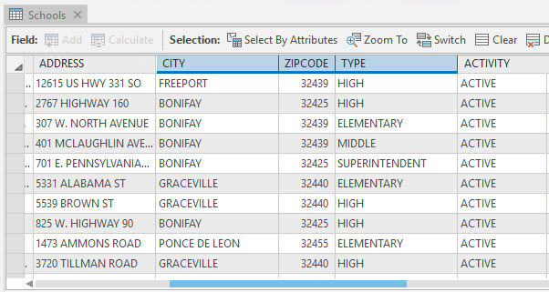
In ArcGIS Pro, multiline labels with concatenated text (string) can be created using the Arcade label expression. In this article's example, the Schools layer contains information on schools in Florida such as city, ZIP Code, and type of the school, as shown in the attribute table below.
This article describes the steps to create multiline labels displaying the CITY, ZIPCODE, and TYPE field values using the TextFormatting.NewLine constant and concatenate a text preceding each field value.
Note:
The TextFormatting.NewLine constant inserts a line break between the labels.
手順
- In an ArcGIS Pro project, add the layer, and create the label expression. For instructions, refer to Steps 1 through 4 in ArcGIS Pro: Writing a label expression, and select Arcade for Language.
- Build the expression in the Expression box.
- In the Expression box, highlight the content, and press Delete to clear the box.
- Type 'City:' + as the preceding text before the CITY field values.
- Under Fields, double-click the CITY field to add to the expression.
- Type + TextFormatting.NewLine to add a line break.
- Type + 'ZIP Code:' +.
- Under Fields, double-click the ZIPCODE field.
- Type + TextFormatting.NewLine to add another line break.
- Type + 'Type:' +.
- Under Fields, double-click the TYPE field.
- Click the Verify button to validate the expression. Click Apply to run the script.
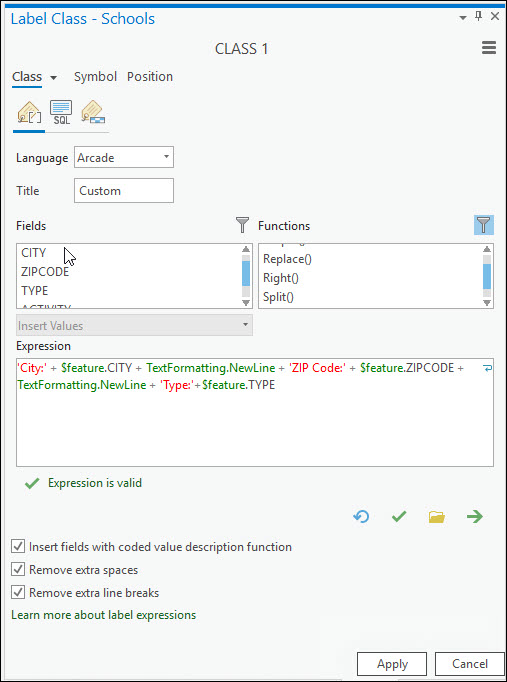
The following is the expression used in this article's example.
'City:' + $feature.CITY + TextFormatting.NewLine + 'ZIP Code:' + $feature.ZIPCODE + TextFormatting.NewLine + 'Type:'+$feature.TYPE
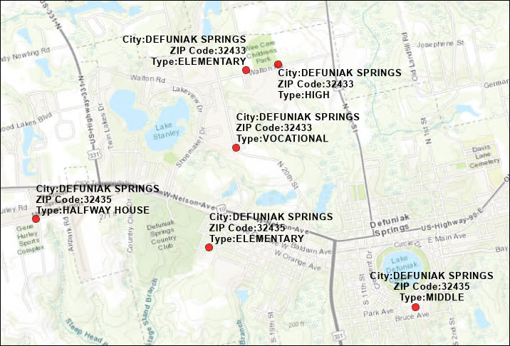
The map below displays the distribution of schools in Florida, labeled with their respective city name, ZIP Code, and school type on separate lines.
記事 ID:000026373
ArcGIS の専門家からヘルプを受ける
Esri Support アプリのダウンロード
関連情報
このトピックについてさらに調べる
Search for related information
Find training related to this topic
Explore ideas and give feedback