方法
Site Scan for ArcGIS Manager での DXF オーバーレイの使用
サマリー
Instructions provided describe how to use drawing exchange format (DXF) overlays in Site Scan Manager for ArcGIS.
Overlays are one of the most widely used and important tools within Site Scan. DXF files are now supported in beta mode in Site Scan, making this tool even more versatile.
手順
Upload DXF files in Site Scan for ArcGIS
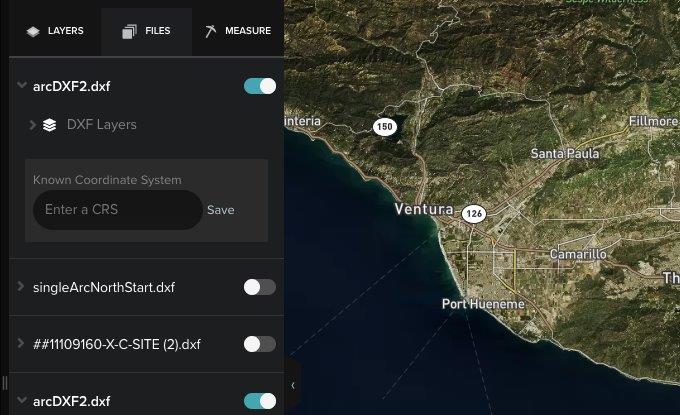
DXF files can be uploaded like any other Site Scan Manager supported file.
Note:
This is the same workflow currently implemented for PDF overlays.
- Navigate to the upload button (+ plus sign) on the bottom-left corner of the map view and select Overlays.
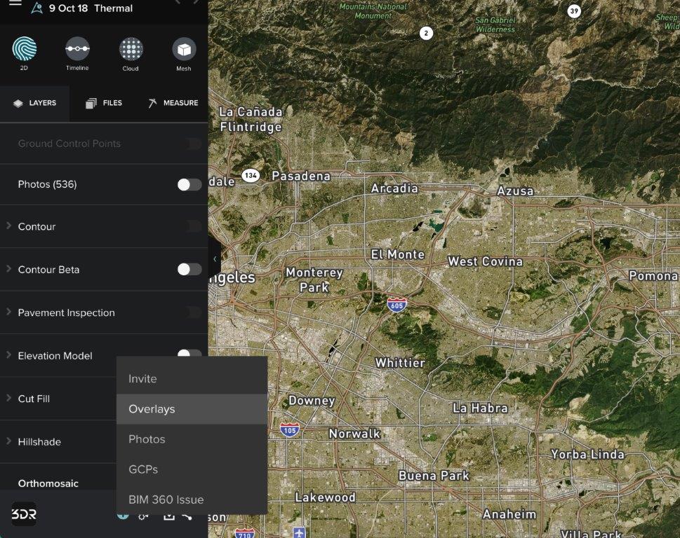
- In the Overlays dialog box, click Select Files to browse for DXF files on the computer.
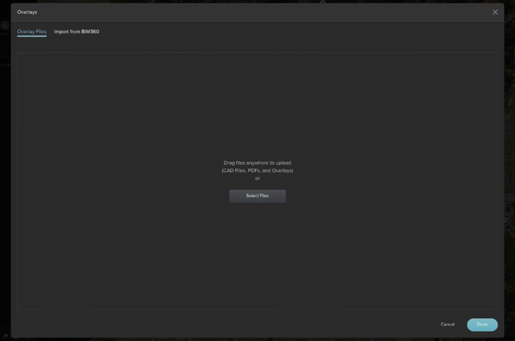
- After uploading the DXF file, enter the coordinate system (CRS) used by the DXF overlay and save it.
Georeferencing DXF files
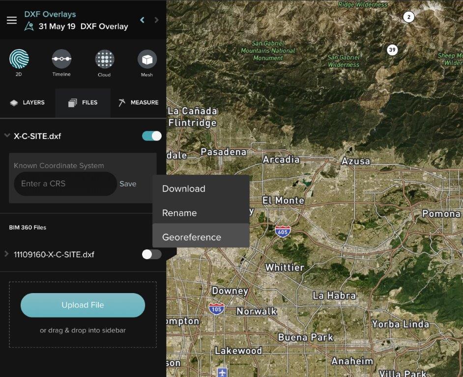
If the project uses a custom coordinate system, georeference the appropriate DXF.
- Right-click the DXF layer and select Georeference.
Note:
This is the same workflow currently implemented for PDF overlays.
- Select a point on the map and match it with a point on the DXF. Choose the correct horizontal units from the top-right drop-down; Meters, Standard Foot, or U.S. Survey Foot. Click Next.
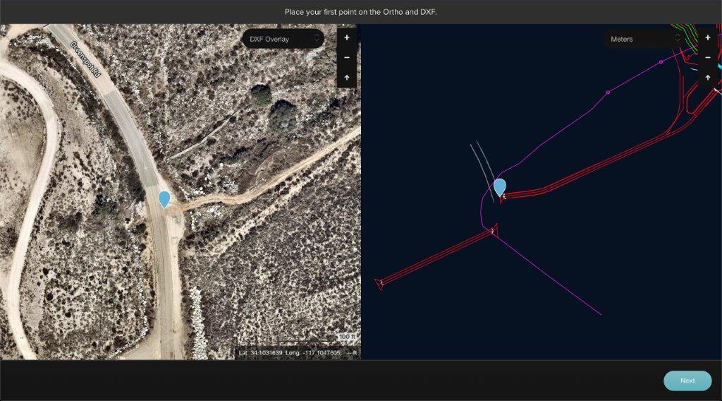
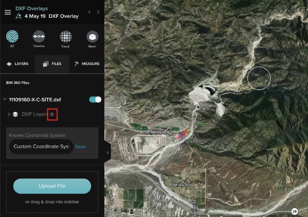
- Repeat the process for a second point, and click Finish. Once complete, the system redirects to the files section of the flight. Toggle on any of the uploaded DXF files. To re-position the DXF, click the location icon next to DXF Layers, as shown in the image below.
DXF Layers
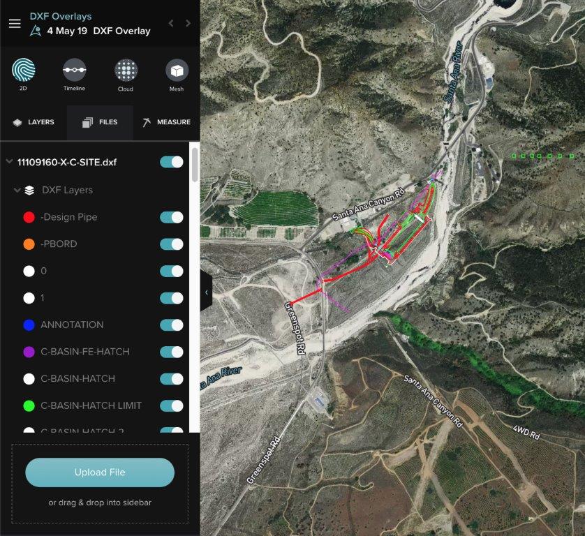
Site Scan Manager imports all of the layers, with the same colors and names, of the original DXF file.
- Visualize them by clicking on the drop-down arrow next to DXF Layers.
- Turn individual layers on or off to better visualize different sections by sliding the toggle next to each of the layers, as shown in the image below.
記事 ID: 000023064
AI によるサポートを受ける
Esri サポート AI チャットボットを使用して問題を迅速に解決します。


このトピックについてさらに調べる
Search for related information
Find training related to this topic
Explore ideas and give feedback
ArcGIS エキスパートのサポートを受ける
今すぐチャットを開始