よくあるご質問 (FAQ)
グリッド偏角とは何ですか?
答え
The Calculate Convergence Angle tool calculates the angle between the Central Meridian of the projected coordinate system applied to the data, and the line which intersects the point and runs from the point to the North (or South) Pole. A Convergence Angle between the Central Meridian of UTM Zone 15 North and the USGS Survey Control Point Meade's Ranch is shown in the following illustration.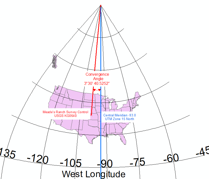
Note:
Convergence angles cannot exist in a Geographic Coordinate System, or in some projected coordinate systems like Web Mercator, because in these coordinate systems ALL lines of Longitude point directly at the North Pole.
記事 ID:000020700
ArcGIS の専門家からヘルプを受ける
Esri Support アプリのダウンロード
関連情報
このトピックについてさらに調べる
Search for related information
Find training related to this topic
Explore ideas and give feedback