PROCÉDURE
convertir des shapefiles en KML dans ArcGIS Pro
Résumé
Keyhole Markup Language (KML) is an XML-based format for storing geographic data, and is a common format for sharing data with non-GIS users. It can be composed of point, line, polygon features, and raster imagery with either a .kml or .kmz file extension. This article provides the steps to convert single or multiple shapefiles to a KML file in ArcGIS Pro.
Procédure
- Add the shapefiles to the map. Refer to ArcGIS Pro: Add a shapefile to the map for instructions.
Note:
KML and KMZ files must be in the coordinate system GCS_WGS_1984, WKID 4326. If the input data is on another datum than WGS 1984, run the Project tool in ArcToolbox > Data Management Tools > Projections and Transformations to apply the correct datum transformation.
If raster data will be included in the data being converted use the Project Raster tool.  This is critical if a datum transformation is required in the Project tool. Refer to the Knowledgebase article: Select the correct geographic (datum) transformation when projecting between datums to access the list of datum transformations.
- To convert multiple shapefiles to a KML file, group all the shapefiles in the Content pane. Skip this step if converting only one shapefile.
- Press Ctrl and click to select the desired shapefiles.
- Right-click a selected shapefile, and click Group. The selected shapefiles are grouped into New Group Layer.
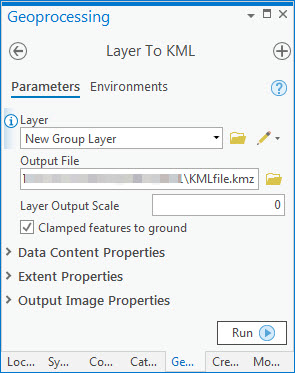
- In the Geoprocessing pane, click Toolboxes, and navigate to Conversion Tools > KML > Layer To KML.
- In the Layer drop-down list, select the shapefile or the layer group containing the shapefiles.
- Set a name and location for the Output File.
- Set other parameters as desired, and click Run.
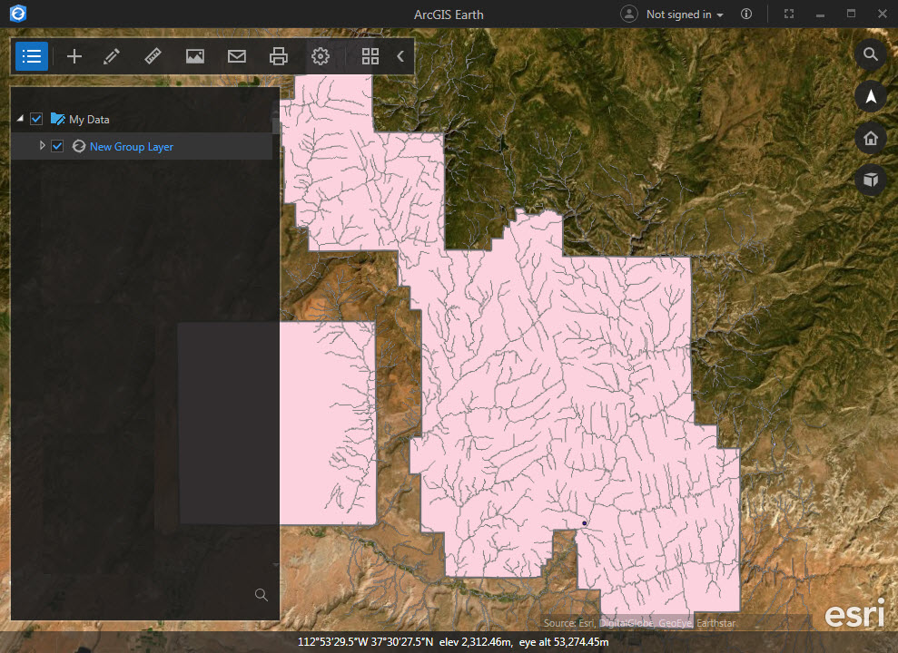
The converted KML file is located in the specified output location with a .kmz extension (compressed or zipped KML files). The image below shows the KMZ file opened in ArcGIS Earth.
Note:
To extract the KML files from the KMZ file, use a file extractor such as WinZip or WinRAR.
ID d’article:000023141
Obtenir de l’aide auprès des experts ArcGIS
Télécharger l’application Esri Support
Informations associées
En savoir plus sur ce sujet
Search for related information
Find training related to this topic
Explore ideas and give feedback