Forum aux questions
pourquoi les mesures de la barre d’échelle sont-elles incorrectes si le bloc de données ArcMap est dans un système de coordonnées géographiques ?
Réponse
A scale bar on a map set to a geographic coordinate system using units of decimal degrees only measures distances correctly at the Equator.
To apply a scale bar that measures distances correctly over all areas of the Earth's surface, the ArcMap data frame must be set to a projected coordinate system.
A scale bar measures linear units, such as feet, meters, kilometers, and miles.
When the ArcMap data frame is set to a geographic coordinate system, the units of measure are angular units. The number of degrees in the angle formed from the prime meridian at Greenwich, England to the center of the Earth, then back to the location of the data is the number of degrees, minutes and seconds of longitude (the X coordinate). The number of degrees formed in the angle from the Equator, to the center of the Earth then up or down to the location of the data is the number of degrees, minutes and seconds of latitude (the Y coordinate).
At the Equator, a degree of longitude measures about 69 miles, but at the North or South Pole, the length of a degree of longitude is 0.
As the lines of longitude converge toward the North or South Pole, the measured distance between these lines of longitudes across the surface of the Earth becomes shorter and shorter, while the angular measurement stays the same.
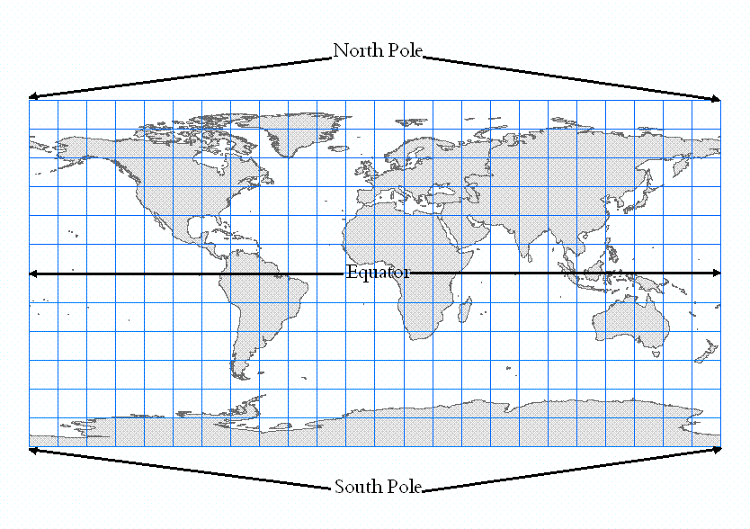
The following image shows a view of the surface of the Earth displayed in a geographic coordinate system. Notice that this distorts the North and South Poles, which are points, and displays them as lines that appear as long as the Equator.
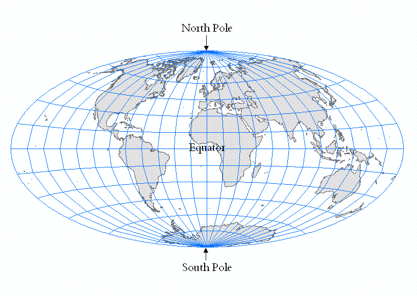
The following image shows a view of the surface of the Earth displayed in a projected coordinate system, in this case, Aitoff. Notice that the North and South Poles are correctly displayed as points.
For help selecting a suitable coordinate system, refer to the article, How To: Select a suitable map projection or coordinate system.
ID d’article:000007211
Obtenir de l’aide auprès des experts ArcGIS
Télécharger l’application Esri Support
Informations associées
En savoir plus sur ce sujet
Search for related information
Find training related to this topic
Explore ideas and give feedback