HOW TO
Add an image as a legend symbol (change style) in ArcGIS Online Map Viewer Classic
Summary
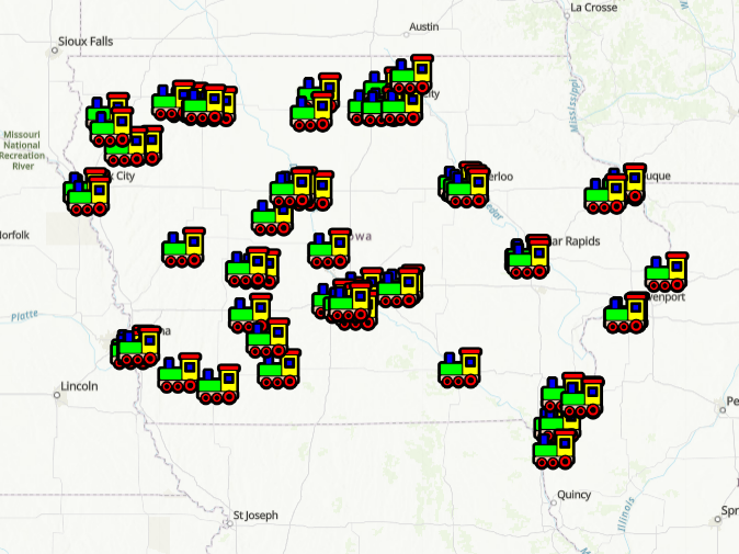
This workflow is for users trying to implement an external image as a symbol on their web map, ideally for point data. In this example, a point layer of intermodal freight facilities is symbolized with toy train images from an online search.
Procedure
- Log in to your ArcGIS.com account.
- Click the Map tab on the top and click Open in Map Viewer Classic.
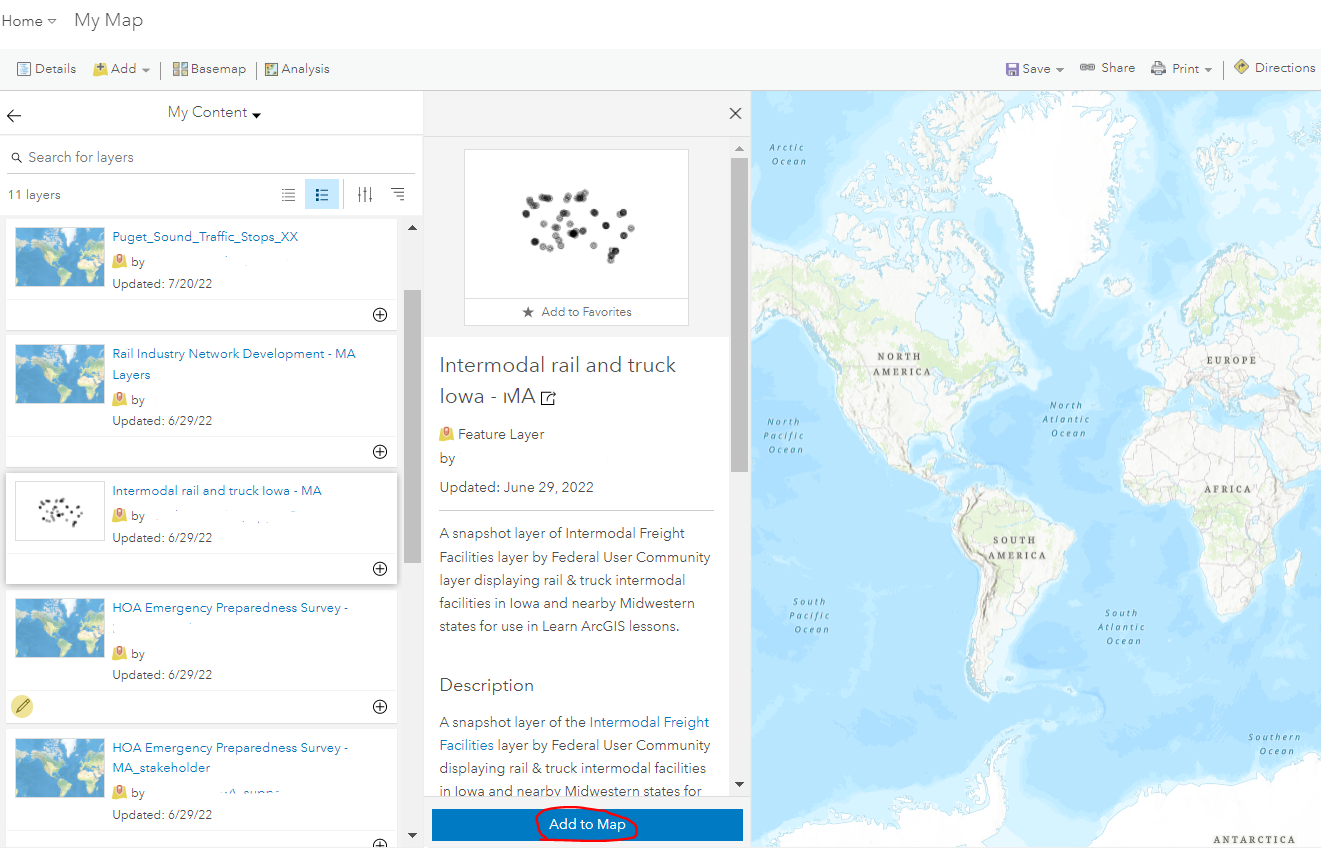
- Add data. In the image below, data is added from the My Content area in ArcGIS Online.

- From a list of layers in the Content area, click the one of interest, and click Add to Map, as shown in the next image.
- Click the back arrow and navigate to your Content area in Map Viewer Classic.
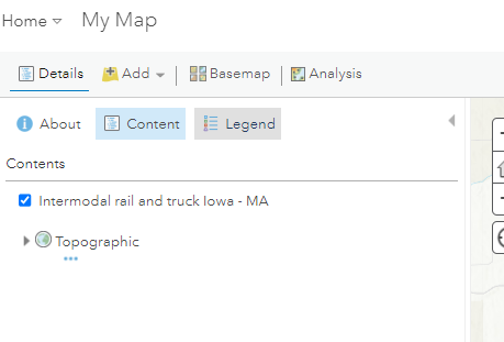
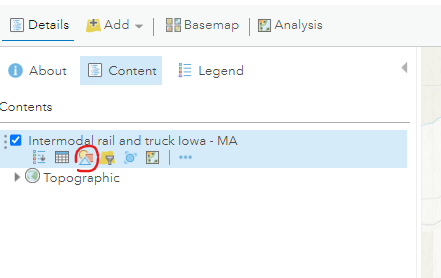
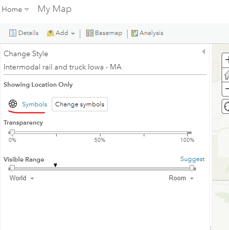
- Click the Change Style symbol as seen in the next image, and under Change Style, click Options for the point data.
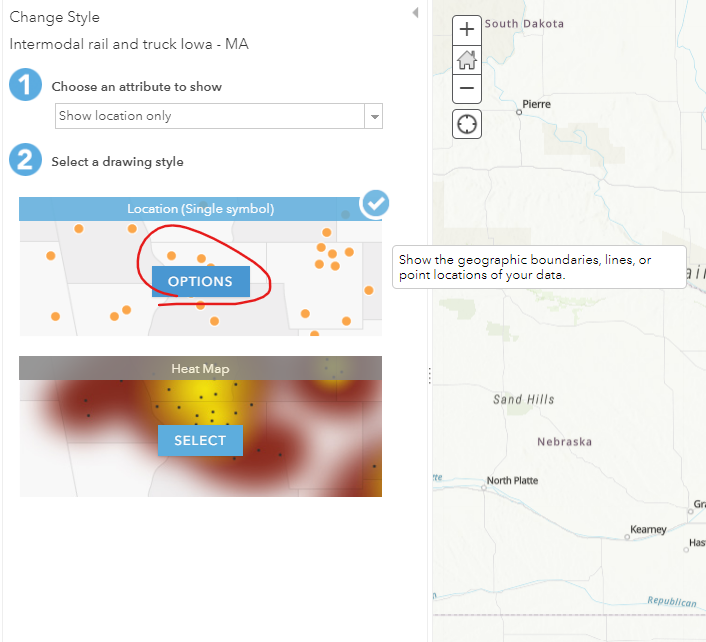
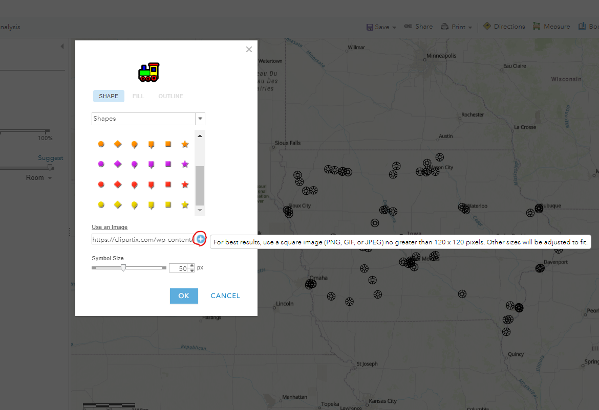
- In the next two images, under Change Style, click Symbols, and in the shape selector pop-up window, click Use an Image.
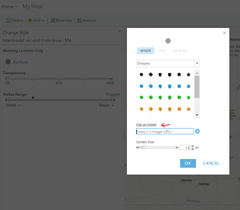
- Insert the image URL. Additionally, it is advisable to use 'clipart' type images for symbols.
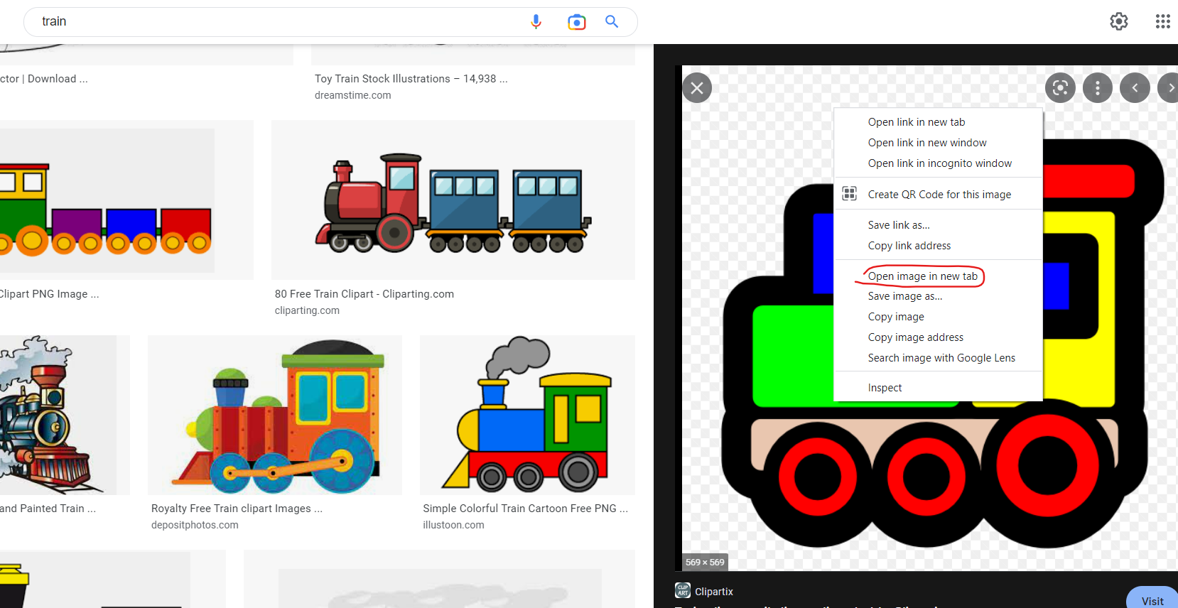
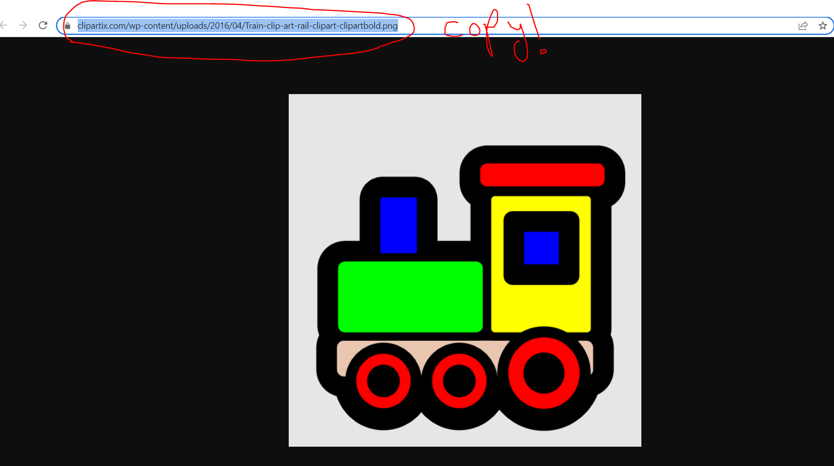
Note:
It is important to use the image URL only. For example, you search for an image of a train on Google images. After finding an ideal image, right-click it and click Open image in a new tab. Copy the URL of the image from the new tab.
- Paste the copied link in the image URL box that opened after clicking Use an Image in Step 7. Click the '+' sign to add the image as a symbol. The imported image can now be seen at the top of the opened window and can be adjusted by the Symbol Size slider at the bottom. Click OK once done. And OK again. The map is now updated with the new symbols.
- Save the map. At the top center of the window, click Save As, provide details as needed, and click Save Map.
Article ID: 000028125
Software:
- ArcGIS Online
Receive notifications and find solutions for new or common issues
Get summarized answers and video solutions from our new AI chatbot.


Related Information
Discover more on this topic
Search for related information
Find training related to this topic
Explore ideas and give feedback
Get help from ArcGIS experts
Download the Esri Support App