HOW TO
Access offline edits from ArcGIS Field Maps directly from an iOS or Android device
Summary
ArcGIS Field Maps stores offline replicas in an SQLite database or runtime geodatabase (as .geodatabase files) before they are synchronized with the feature service. If the offline edits cannot be synchronized, the locally stored edits are extracted from the mobile device and converted to a file geodatabase. This article provides the steps to do this in ArcGIS Field Maps on iOS and Android operating systems and explains how to work with or convert the recovered data in ArcGIS Pro.
Procedure
- Recover the runtime geodatabase from a mobile device.
- From an iOS device using the Apple Devices app.
Note:
Files can be extracted from an iOS device in multiple ways. For instance, files can be shared from the Files app to iCloud, Google Drive, or sent via email for computer download. This article describes the workflow of extracting files using Apple Devices.
- Ensure Apple Devices is installed on the computer.
- Connect the iOS device to the computer and launch Apple Devices. Ensure the device is successfully connected to the app.
- In Apple Devices, select Files in the left sidebar.
- Select Field Maps in the Apps column.
- Select the runtime geodatabase folder and click Save....
- Select a location to save the folder.
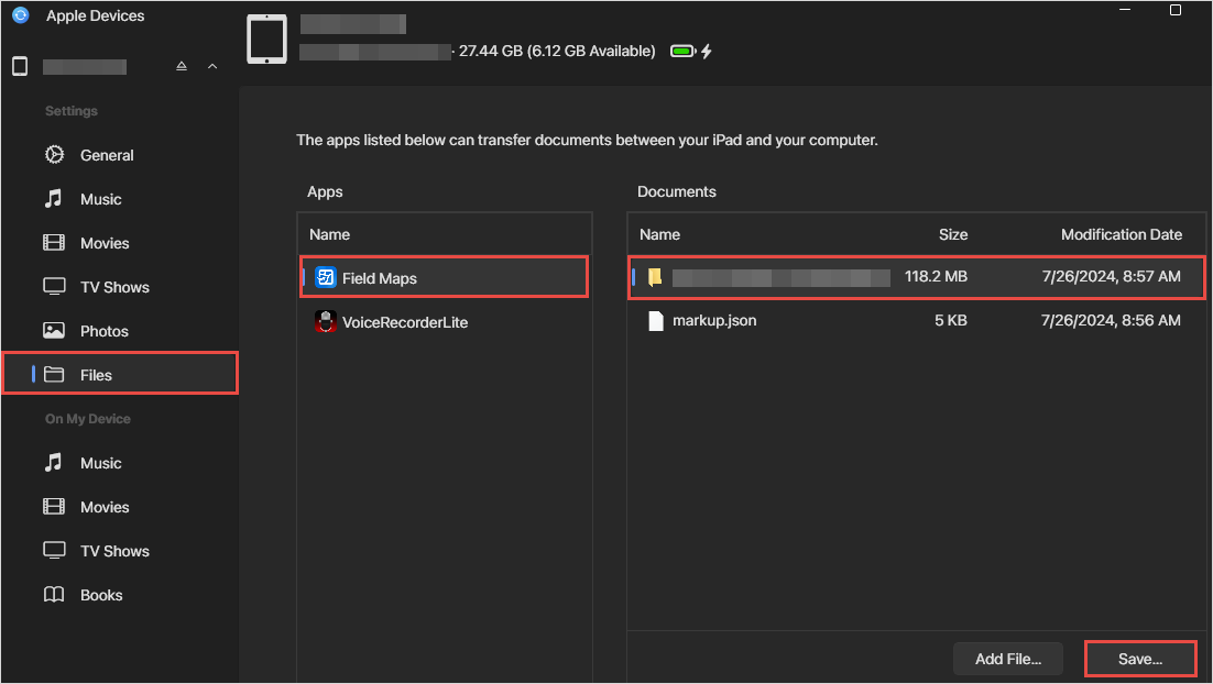
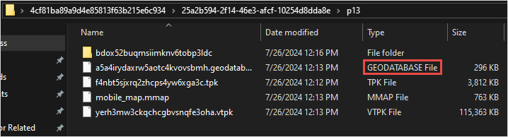
- Ensure the .geodatabase file is located inside the folder, as shown in the image below.
- From an Android device.
- Connect the Android device to the computer.
- Browse to the ArcGIS Field Maps folder. Below is an example of the folder path:
<Name of phone>\Internal shared storage\Android\data\com.esri.fieldmaps\files\<username>\mapareas
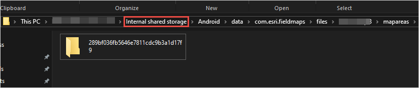
Note:
Due to differences in Samsung's file architecture compared to other Android devices, replace 'Internal shared storage' with 'Internal storage' for Samsung devices.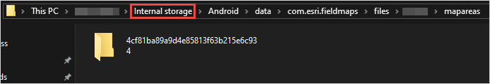
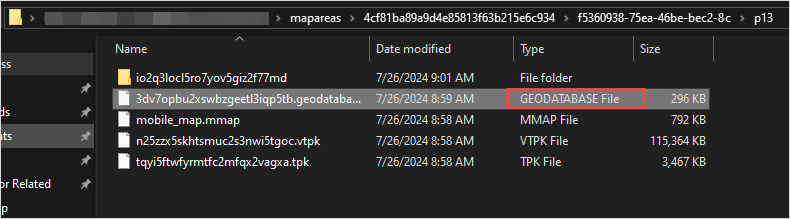
- Copy the entire folder containing the .geodatabase file from the device and paste it on the local machine. Ensure the .geodatabase file is inside the folder, as shown in the image below.
Note:
If unable to browse files using the Android device, install a file explorer application to access the data.
- Sync the offline edits of the runtime geodatabase in ArcGIS Pro.
- Launch ArcGIS Pro and log in to ArcGIS Online with the same credentials used in ArcGIS Field Maps.
- In the Catalog pane, on the Project tab, click Folders to add a folder connection to the runtime geodatabase folder. Refer to ArcGIS Pro: Connect to a folder for instructions.
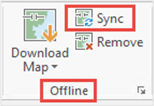
- Right-click the feature class and click Add To New > Map, as shown in the next image.

- On the ribbon, click the Map tab, and click Sync in the Offline group, shown in the next image. The Sync tool must be active when a valid offline dataset is added to the map contents.
Alternatively, use the following steps to convert the runtime geodatabase or mobile geodatabase to a file geodatabase using the Mobile Geodatabase To File Geodatabase tool in ArcGIS Pro.
- Launch ArcGIS Pro and open a project.
- In the Geoprocessing pane, search for the Mobile Geodatabase To File Geodatabase tool. Refer to ArcGIS Pro: Run a tool in the Geoprocessing pane for the steps to do this.
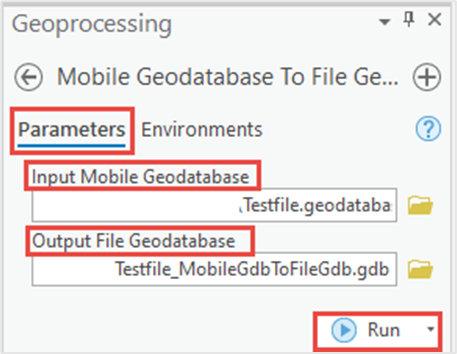
- In the Mobile Geodatabase To File Geodatabase pane, configure the Parameters tab as follows, and as shown in the next image:
- For Input Mobile Geodatabase, click Browse
 to browse and select the mobile geodatabase file.
 - For Output File Geodatabase, click Browse
 to specify the location of the output geodatabase file.
 - Click Run.
- For Input Mobile Geodatabase, click Browse
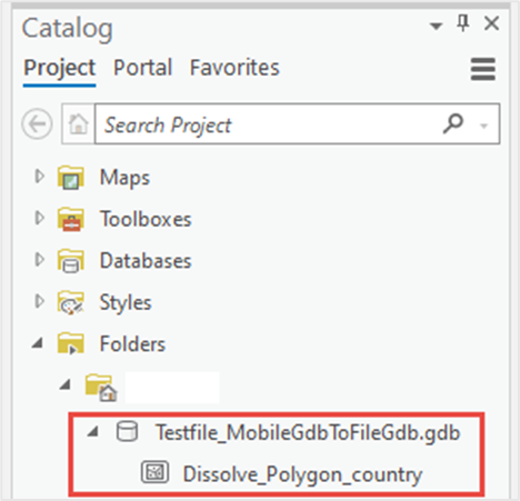
The image below shows the mobile geodatabase converted to the file geodatabase in ArcGIS Pro.
Article ID: 000026799
- ArcGIS Pro 3 3
- ArcGIS Field Maps Android
- ArcGIS Field Maps iOS
- ArcGIS Pro 3 2
- ArcGIS Pro 3 4
Get support with AI
Resolve your issue quickly with the Esri Support AI Chatbot.


Related Information
Discover more on this topic
Search for related information
Find training related to this topic
Explore ideas and give feedback
Get help from ArcGIS experts
Start chatting now