HOW TO
Use Cut/Fill measurements in Site Scan Manager for ArcGIS
Summary
Site Scan Manager for ArcGIS can perform Cut/Fill measurements for three-dimensional drone objects created by the program. This article reviews how to set the cut or fill capability in Site Scan for ArcGIS Manager, including inputs for the operation.
Cut/Fill measurements are a common analysis performed for three-dimensional raster products, both drone derived, and other types of three-dimensional products. In these analyses, an elevation raster is 'sliced' horizontally using a plane of consistent elevation or other elevation input. All elevated areas above the plane are considered 'cut' measurements, denoted by positive values, while depressions below the plane are considered 'fill' measurements, denoted by negative values. These measurements are useful for many applications, including construction and scientific analysis.
Procedure
For any flight processed in Site Scan for ArcGIS, open the Cut/Fill Layer to access this information. In the Cut/Fill Layer window, access the following options:
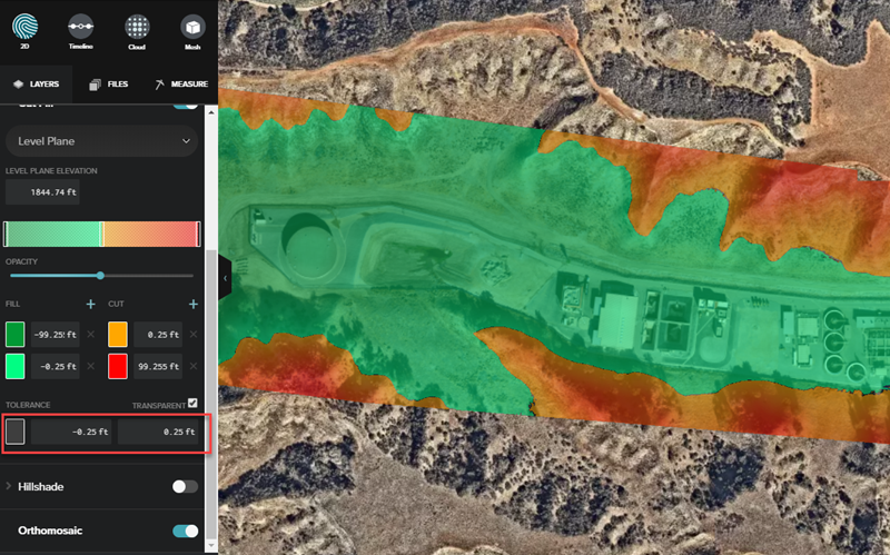
Cut/Fill ranges
- Set as many ranges as needed to see areas of CUT or FILL.
- Each range can have a different color assigned.
- Use the slider or enter the elevation ranges manually.
- Change the opacity by using the slider below the color ranges.
Tolerance range
- The first tolerance value corresponds to FILL, while the second one corresponds to CUT.
- The tolerance range can be set to transparent (default) or a solid color.
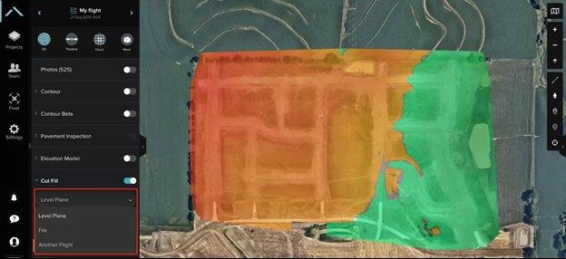
Comparison
Choose the desired layers to compare. The Cut/Fill tool can be used for comparison against a level plane, a previously uploaded XML file, or a previous flight. These different options are helpful to understand the progress of the site. Click the drop-down below the Cut/Fill toggle to see these options, as shown in the image below.
Level Plane Elevation
By default, the tool uses the median for the minimum and maximum elevations.
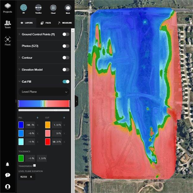
To improve the accuracy of measurements, Site Scan Manager allows importing a surface in LandXML format, which can be used for volume calculations and the Cut/Fill map.
File
Files previously uploaded into Site Scan can be used to compare real-world files to a design by selecting File from the comparison drop-down, and selecting the specific XML file to compare.

Flight
If there are other processed flights in the project (ideally processed with ground control points, so they line up properly), the Cut/Fill tool can be used to to compare the progress from one to the other.
Importing to Site Scan for ArcGIS
Use the Overlays interface to upload a LandXML file.
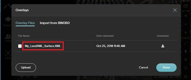
Upload as many LandXML files as needed. Uploaded files in Site Scan for ArcGIS can be selected from the Cut/Fill drop-down menu. If a coordinate system is not embedded in the file, manually enter its EPSG code (typically the same as the ground control points' coordinate system).
Note:
Surfaces georeferenced in a custom coordinate system are not supported.
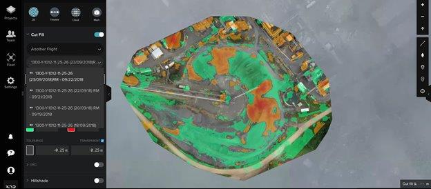
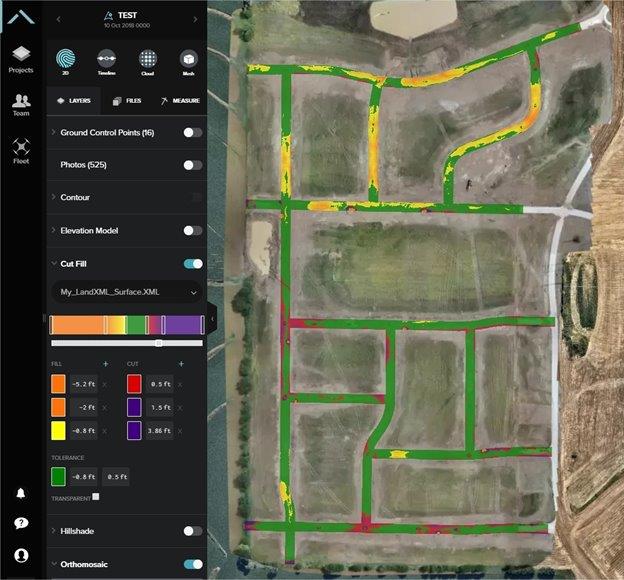
When using a LandXML overlay, the Cut/Fill calculations are shown only for the specific area the LandXML covers, as shown in the image below.
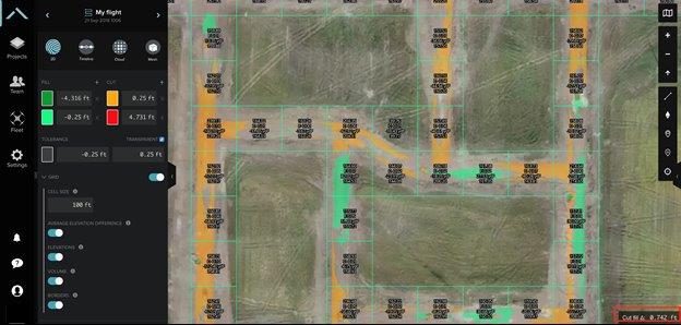
Grid view (beta)
The newest addition to the Cut/Fill tool is the grid view. Ensure beta mode is enabled to test it. Turning on the grid toggle allows visualization of elevation data difference within a grid layout. Actual elevation numbers can also be turned on, as well as the the volume of each grid (in cubic yards). The bottom-right section of the screen displays the elevation delta of the point at which the cursor is.
Article ID: 000023065
- Site Scan Manager for ArcGIS
Get support with AI
Resolve your issue quickly with the Esri Support AI Chatbot.


Discover more on this topic
Search for related information
Find training related to this topic
Explore ideas and give feedback
Get help from ArcGIS experts
Start chatting now