Frequently asked question
What are the measurement tools available in Site Scan Manager for ArcGIS?
Measuring tools
Site Scan Manager for ArcGIS has measuring tools to calculate Distances, Areas, and Volumes.
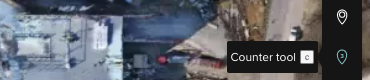
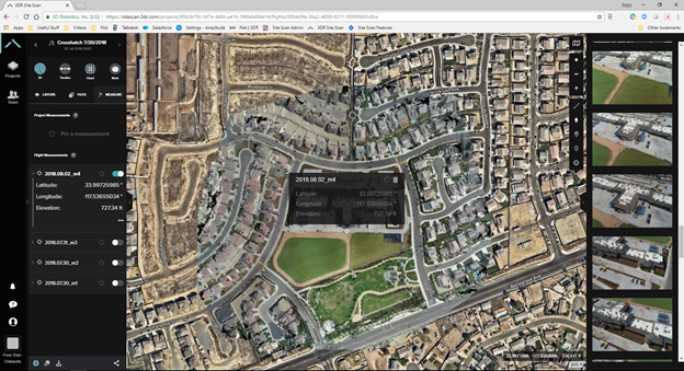
It is also possible to place Markers anywhere on the site that display the latitude and longitude. The Counter tool can be placed on any object in the map to get an accurate count.
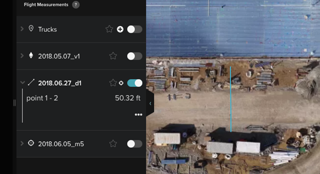
All of these measurements are turned into annotations and displayed under the Measurements menu on the left. Rename or delete the measurements by right-clicking them, and selecting the desired option. They can also be toggled on and off.
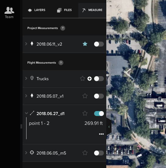
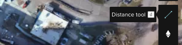
Measure distances by selecting the option from the Measure menu. Click once on the map to set the initial point from which to measure. Click once more anywhere on the map to add another point. Double-clicking sets the end point for the distance being measured. Click the line created to display the distance.
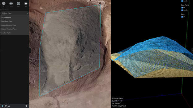
Measure both area and volume by selecting the Volume option from the Measurements menu. Click once to layout new vertices, and click twice to set the endpoint of the measurement box. Click the box to display Area and Volume.
For volume measurements, click the View Volume in 3D button in the annotation to access a wireframe view; click the drawn polygon, or right-click the annotation and select Inspect.

Determine a base point from which the volume is calculated through this method.
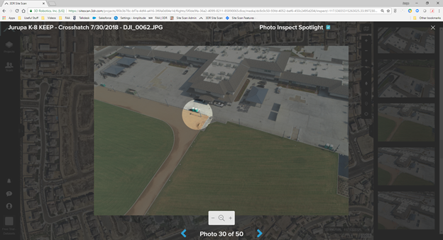
Use the Inspect Photo mode to visually inspect all the images of a specific point on the orthomosaic.
After selecting Inspect Photo, click anywhere on the orthomosaic to drop a marker. Site Scan Manager generates all the images that contain that point, and highlights the point clicked on each image with a red box.
Click a specific image on the photo reel located on the right of Site Scan Manager to further inspect at a higher zoom level. Site Scan highlights the area clicked on the orthomosaic with Photo Inspect Spotlight, as shown in the image below.
Article ID: 000023016
- Site Scan Manager for ArcGIS
Get support with AI
Resolve your issue quickly with the Esri Support AI Chatbot.


Discover more on this topic
Search for related information
Find training related to this topic
Explore ideas and give feedback
Get help from ArcGIS experts
Start chatting now