HOW TO
Clip a TIN layer with a polygon feature using the Edit TIN tool in ArcGIS Pro
Summary
A triangular irregular network (TIN) is a form of vector-based digital geographic data generated from features such as points, line, and polygons containing elevation information, or by converting other functional surfaces such as rasters or terrain datasets. To study a specific area of interest, it is possible to clip the TIN dataset layer with a polygon feature using the Edit TIN tool.
Procedure
Follow the instructions described below to clip a TIN layer with a polygon feature using the Edit TIN tool from the Data Management toolset.
Note:
The Data Management toolset is only available with a 3D Analyst license.
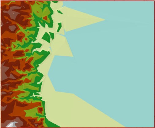
In this example, the TIN layer represents the surface morphology of the Front Range foothill, and Longmont plain in Colorado.
Note:
Before performing the steps below, Esri recommends retaining a copy of the unmodified version of the source TIN using the Copy TIN tool. Refer to ArcGIS Pro: Copy TIN for more information.
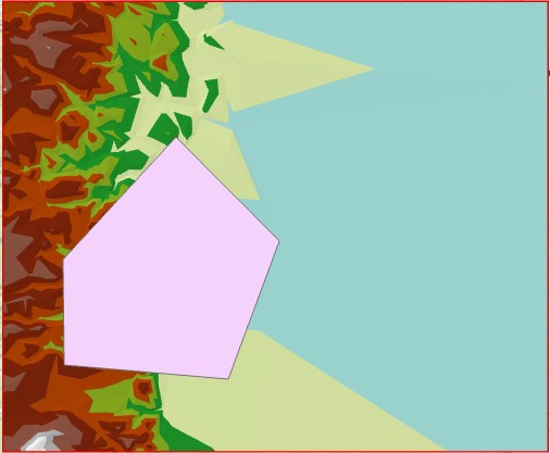
- Create a polygon feature specifying an area of interest in the TIN layer. Refer to ArcGIS Pro: Create a feature class and ArcGIS Pro: Create polygon features for steps to do this.
The image below shows an example of a specified study area using the polygon feature.
- Clip the TIN layer using the polygon feature created in the previous step.
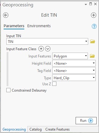
- In ArcGIS Pro, open the Edit TIN tool.
- In the Edit TIN window under Input TIN, click the folder icon, and navigate to the TIN dataset layer location. Select the desired TIN layer, and click OK. In this example, the TIN layer is TIN.
- Under Input Feature Class, specify Input Features. Click the folder icon, and navigate to the polygon data layer location. Select the polygon layer created from step 1, and click OK.
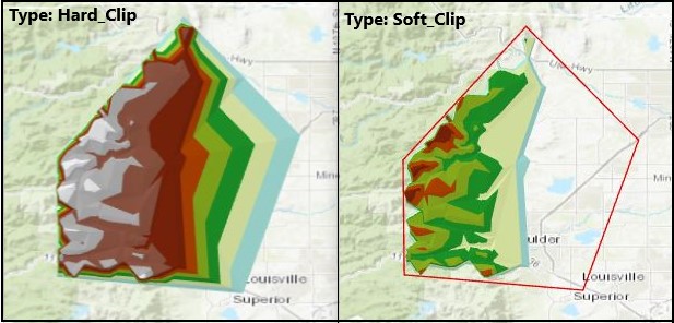
- Under Type, select Hard_Clip.
Note:
Hard lines and polygon boundaries define distinct breaks in slope. Linear interpolation is used across these lines in what is an otherwise continuously smooth surface. Examples of hard features include curbs, streams, and shorelines.
Note:
Soft lines and polygon boundaries do not interrupt surface smoothness. Soft features generally have no geomorphic significance, but are necessary in the triangulation nonetheless. An example of a soft feature is a soft clip polygon used to delineate the data area of the TIN. This type of polygon is often a study area or political boundary that has nothing to do with topography.
- Leave other parameters at default, and click Run.
Article ID: 000022207
- ArcGIS Pro
Get support with AI
Resolve your issue quickly with the Esri Support AI Chatbot.


Related Information
Discover more on this topic
Search for related information
Find training related to this topic
Explore ideas and give feedback
Get help from ArcGIS experts
Start chatting now