HOW TO
Split a line based on overlapping polyline features in ArcGIS Online
Summary
Performing network analysis sometimes requires splitting a single line based on overlapping polylines to get a segmented line for data extraction or to carry out further analysis. For example, to determine which streets (polylines) are traveled along a particular route (single line). This article provides the method to split a line based on the overlapping polyline features in ArcGIS Online. The line is returned as segmented lines, and includes only the line segments that overlap the polyline features.
Procedure
- Publish the line and polylines data to ArcGIS Online as hosted feature layers. Refer to Publish hosted feature layers for steps to do this.
- Create a web map, and add the hosted feature layers to the web map. Refer to Create a new map and Add layers to the map for steps to do this.
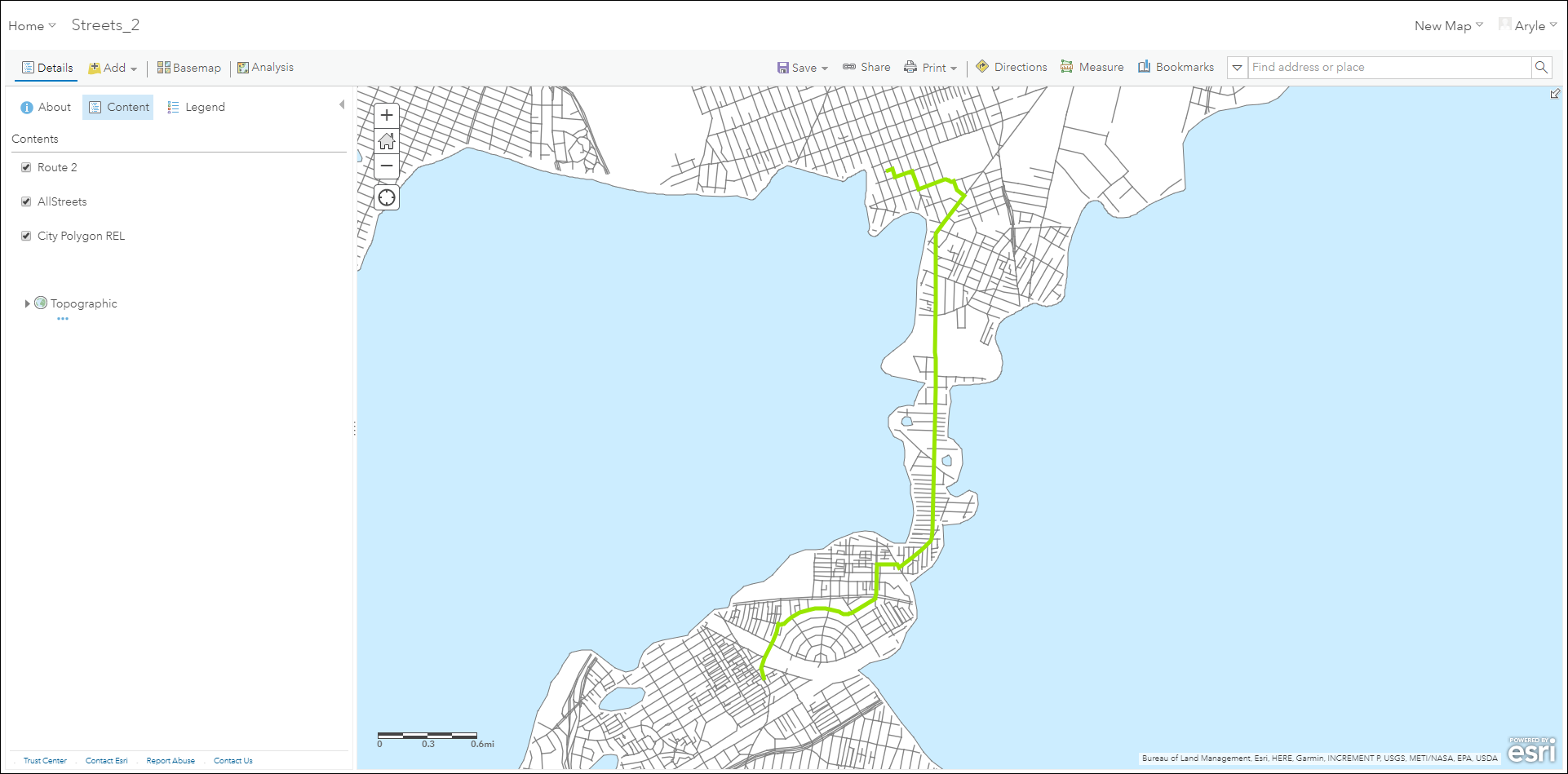
In this example, the green line represents the route layer, and the gray polylines represent the street layer.
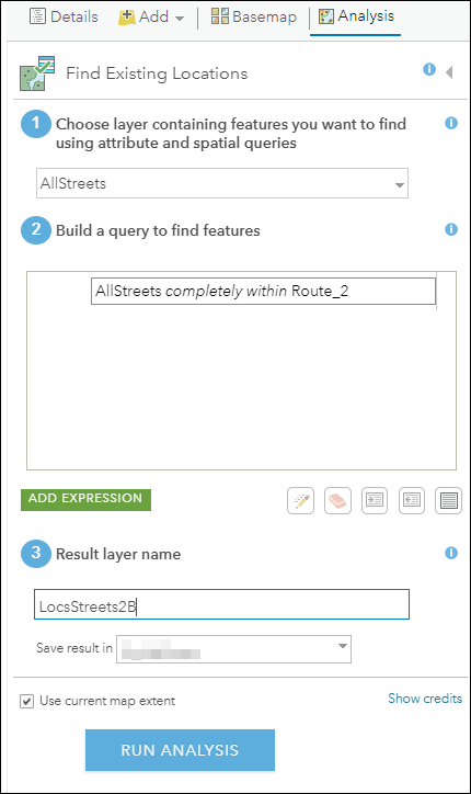
- Click the Analysis tab, and click Find Locations > Find Existing Locations.
Note:
Running the Find Existing Locations tool consumes credits. For more information, refer to Understand credits.
- In the Find Existing Locations pane, select the polyline layer for the Choose layer containing features you want to find using attribute and spatial queries parameter.
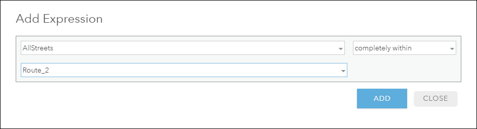
- Click Add Expression to add an expression to split the single line based on the overlapping polylines.
- In the Add Expression window, select the polyline layer from the top drop-down list. In this example, AllStreets is selected.
- Select completely within for the expression type.
- Select the line layer from the bottom drop-down list. In this example, Route_2 is selected. Click Add.
- Set a name for the Result layer name.
- Click Run Analysis.
The output layer is added to the map. In the output, the line can be selected in individual segments. The polyline layer attributes are appended to the output segmented lines according to the overlapping lines.

Article ID:000021953
- ArcGIS Online
Get help from ArcGIS experts
Download the Esri Support App
Related Information
Discover more on this topic
Search for related information
Find training related to this topic
Explore ideas and give feedback