PROBLEM
AutoCAD changes the units of the projection when an exported file from Esri is added to the application.
Description
When a DWG or DXF file exported from Esri software is added to AutoCAD, the units are different than the original units of the data.
Cause
In AutoCAD, the default reference units are inches when adding another DWG file to the existing file as a reference. When adding an xref to AutoCAD, the user must change the units of the reference in the AutoDesk program. There are two locations in which this must be done.
Solution or Workaround
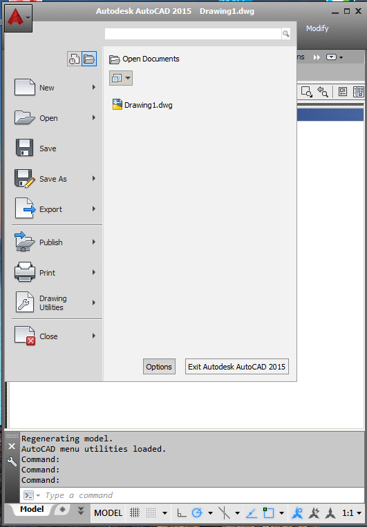
- In AutoCAD, click the large red letter "A" in the upper left corner of the application, and click the Options button.
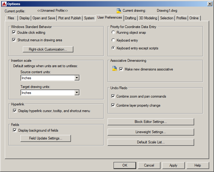
- On the User Preferences tab, under Insertion scale, set the Source content units and Target drawing units to match the input data units.
- Click Apply and OK to save these settings and exit the Options dialog box.
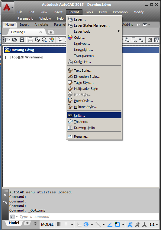
- Click the AutoCAD Format menu, and select Units.
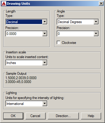
- In the Drawing units dialog, under Insertion scale, set the Units to scale inserted content to match the input data units, and click OK.
Note:
These settings are native to the AutoCAD application.  Esri has no control over these settings, and these must be set in the AutoCAD application so that the referenced data will be the proper size, and in the proper location, to align with the source DWG.
Article ID: 000021528
- ArcMap
- ArcGIS Pro
- Desktop Solutions
Get support with AI
Resolve your issue quickly with the Esri Support AI Chatbot.


Discover more on this topic
Search for related information
Find training related to this topic
Explore ideas and give feedback
Get help from ArcGIS experts
Start chatting now