PROBLEM
Error messages are returned when creating an ortho mapping workspace in ArcGIS Pro
Description
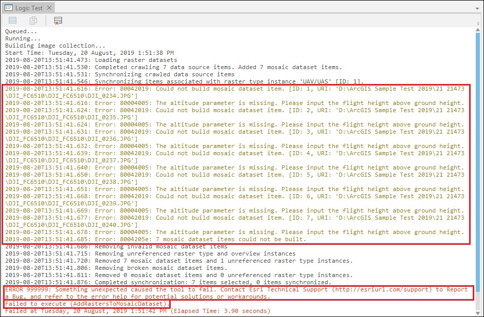
In some instances, when creating an ortho mapping workspace for drone imagery in ArcGIS Pro, the following error messages are returned:
Error:
80042019: Could not build mosaic dataset item. [ID: 5, URI: 'D:\ArcGIS Sample Test 2019\21 21473\DJI_FC6510\DJI_0238.JPG']
Error:
Error: 80004005: The altitude parameter is missing. Please input the flight height above ground height.
Error:
ERROR 999999: Something unexpected caused the tool to fail. Contact Esri Technical Support (https://esriurl.com/support) to Report a Bug, and refer to the error help for potential solutions or workarounds.
Error:
Failed to execute (AddRastersToMosaicDataset).
Cause
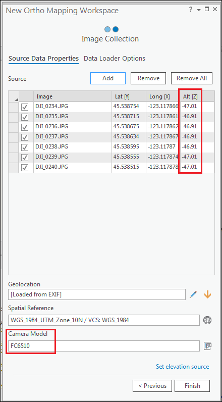
These errors occur if the altitude values of the imported drone imagery are negative when added to the Image Collection pane. This issue is specific to drone imagery from the DJI6000 series FC camera models. This is a known issue, logged by Esri as a defect. Refer to BUG-000119757.
Solution or Workaround
To resolve this issue, use one of the following workarounds:
Create and import the geolocation GPS text file
- In the Imagery tab, click New Workspace to open the New Ortho Mapping Workspace dialog box.
- In the Workspace Configuration pane, type the workspace name and click Next.
- In the Image Collection pane, click the Add button and browse to the folder containing the drone imagery. Click OK.
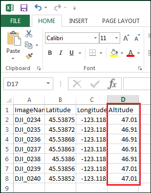
- Based on the table seen in the Image Collection pane, create a geolocation GPS text file in Microsoft Excel.
- Open a new Microsoft Excel workbook and add fields such as Image Name, Latitude, Longitude, and Altitude.
- Fill in the fields accordingly.
- For Altitude, change the negative values to positive.
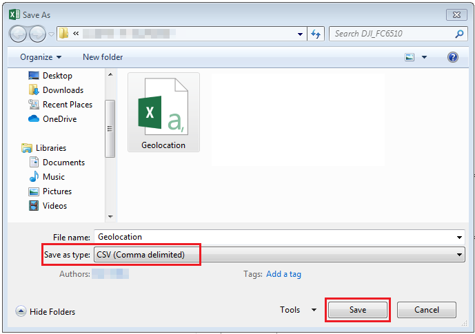
- Click File > Save As and save the workbook as a CSV (Comma delimited) file type. Click Save.
- In the Image Collection pane, click Import GPS File
 to import the created CSV file.
- Under GPS / Orientation file, navigate to the location of the created CSV file.
- Under Field Mappings, ensure Field and Field Index match correctly. Click OK.
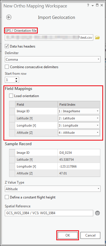
- In the Image Collection pane, ensure all the values in the Alt [Z] field are positive. Click Finish to execute the tool.
![All values in the Alt [Z] are positive values](https://webapps-cdn.esri.com/CDN/support-site/technical-articles-images/000021473/00N39000003LL2C-0EMf2000000rp5L.png)
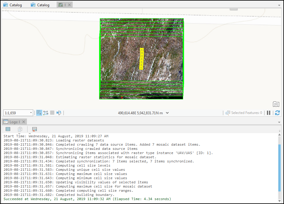
The image below shows the ortho mapping workspace successfully created without any errors.
Use Drone2Map for ArcGIS to create an orthomosaic
After creating a new project in the Drone2Map for ArcGIS application, generate an orthomosaic from the project images. Refer to Drone2Map for ArcGIS: Process single projects for more information.
Note:
The Drone2Map for ArcGIS application can be downloaded from ArcGIS Marketplace: Drone2Map for ArcGIS.
Note:
Assign the Drone2Map for ArcGIS license to the ArcGIS Online account. Refer to ArcGIS Online: Manage licenses for more information.
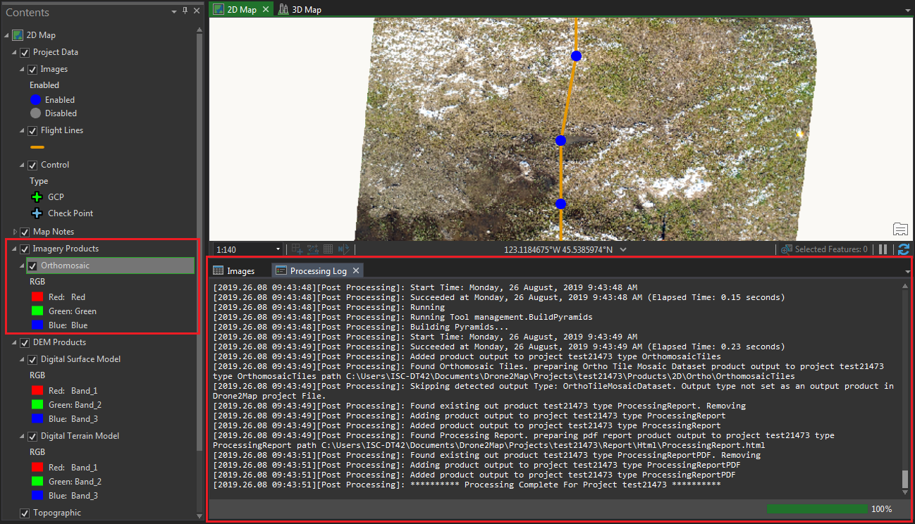
The image below shows the orthomosaic successfully created in the Drone2Map for ArcGIS application.
Article ID: 000021473
- ArcGIS Drone2Map 1 x
- ArcGIS Pro 2 x
- ArcGIS Drone2Map 2 x
Get support with AI
Resolve your issue quickly with the Esri Support AI Chatbot.


Related Information
Discover more on this topic
Search for related information
Find training related to this topic
Explore ideas and give feedback
Get help from ArcGIS experts
Start chatting now