HOW TO
Calculate points located in overlapping buffers in ArcGIS Online
Summary
Finding features in overlapping buffers gives an overview of features affected by two events or occurrences. For example, finding how many schools are located within a mile radius of chemical facilities and hospitals, finding the areal extent of farmland exposed to chemical spills triggered by nearby active Quaternary fault zones, or finding the number of houses possibly affected by floods and the proximity to flood relief camps.
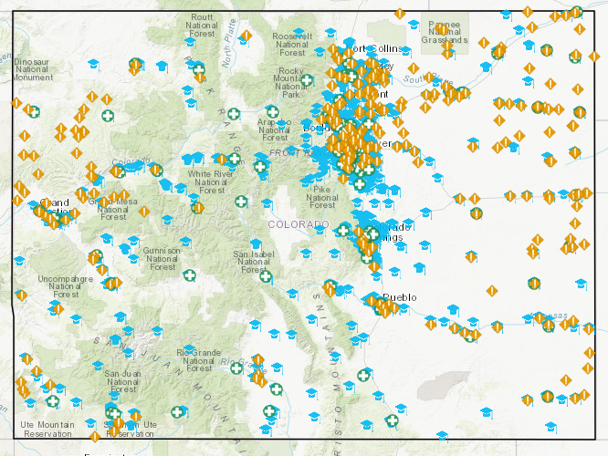
In April 2013, an explosion at the West Fertilizer Company plant in West, Texas, destroyed 150 buildings including four neighboring schools. Other incidents include the chlorine gas leak near Proctor, West Virginia, the chemical release in Atchison, Kansas, and the chemical release into the Elk River near Charleston, West Virginia. The image below shows 322 chemical facilities, 119 hospitals, and 1898 public schools located in Colorado. In this article, a study is conducted to determine the number of schools located in the overlapping zones within a mile radius of chemical facilities and hospitals.
Procedure
Use the following steps to calculate the points located in overlapping buffers in ArcGIS Online:
- In ArcGIS Online, create buffers around the two layers representing the two events or occurrences. Click Analysis > Use Proximity > Create Buffers.
Note:
This analysis consumes credit. One credit is consumed for every 1,000 features.
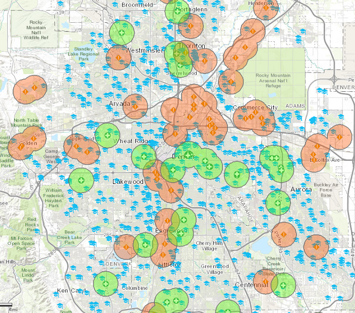
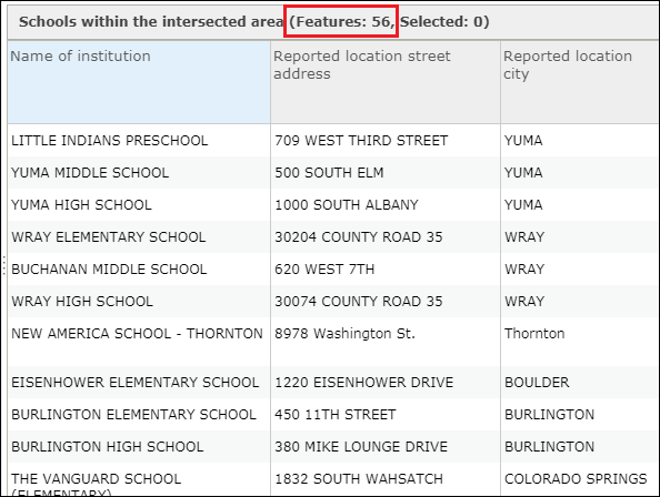
Note: To determine the number of features within buffers, click Analysis > Summarize Data > Summarize Within. The image below shows 279 schools are located within a mile radius of chemical facilities in Colorado.Alternatively, use the Find Existing Locations analysis by clicking Analysis > Find Locations > Find Existing Locations to find features within the study area. The same result is returned.
Both analyses consume credit. One credit is consumed for every 1,000 features.
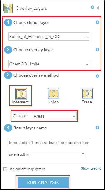
- To create an overlapping layer of buffer between two events or occurrences, click Analysis > Manage Data > Overlay Layers.
Note:
This analysis consumes credit. One credit is consumed for every 1,000 features.
- For Choose input layer and Choose overlay layer, select the buffers of the two layers created in Step 1. In this example, chemical facilities and hospital buffers are selected.
- For Choose overlay method, select Intersect. Accept the default Output as Areas.
- Uncheck the Use current map extent option, if necessary.
- Click RUN ANALYSIS.
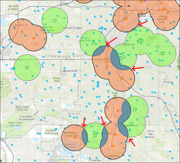
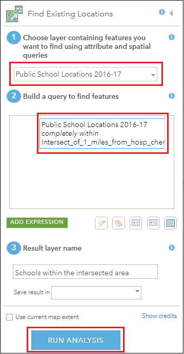
- To calculate the number of features located in the overlapping layer, click Analysis > Find Locations > Find Existing Locations.
Note:
This analysis consumes credit. One credit is consumed for every 1,000 features.
- For Choose layer containing features you want to find using attribute and spatial queries, specify the point layer containing the attributes to find. In this case, the school point layer.
- For Build a query to find features, create an expression that specifies the point layer located in the overlapping layer.
- Uncheck the Use current map extent option, if necessary.
- Click RUN ANALYSIS.
Note:
Alternatively, use Summarize Within to calculate the number of features within the overlapping layer. The same result as Find Existing Locations is returned.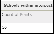
Article ID: 000020726
- ArcGIS Online
Get support with AI
Resolve your issue quickly with the Esri Support AI Chatbot.


Related Information
Discover more on this topic
Search for related information
Find training related to this topic
Explore ideas and give feedback
Get help from ArcGIS experts
Start chatting now