HOW TO
Construct 3D lines for underground holes in ArcGIS Pro
Summary
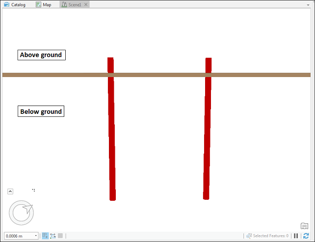
ArcGIS Pro allows converting 2D points to 3D lines and viewing the lines in a 3D scene. In this article, a CSV file of underground holes (wells) containing 'from', 'to', 'X', 'Y' and 'Z' fields are used to construct 3D lines. Viewing the wells in a 3D scene highlights the surface elevation and depth of the wells so a more realistic representation is displayed.
Procedure
The following steps describe how to construct 3D lines for wells from a CSV file.
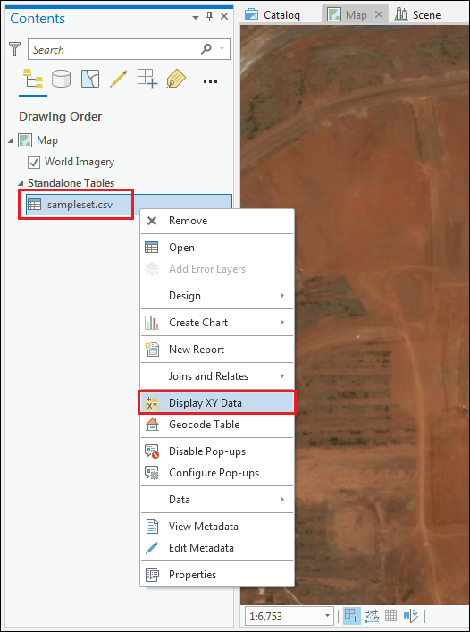
- In ArcGIS Pro, add the CSV file to the project using the Add Data button.
- Right-click the CSV file and select Display XY Data to create a point feature class.
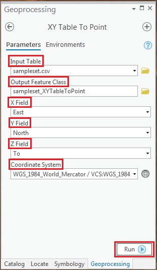
- Use the XY Table To Point tool to create a new point feature class based on X, Y, and Z-values from the table:
- In the XY Table To Point geoprocessing pane, browse the CSV file added in step 1 for Input Table.
- Set a name and location for Output Feature Class.
- Specify the input for X Field and Y Field. For Z Field, select 'to' from the drop-down list.
- For Coordinate System, make sure the projection is selected from the Projected coordinate system list.
- Click Run.
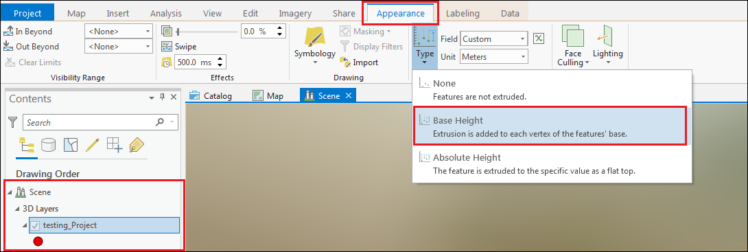
- Add a map and scene to the project. To do this, refer to ArcGIS Pro: Add maps and scenes to a project.
- In the Contents pane, drag the point feature class to the 3D Layers group and make sure the feature class is selected.
- In the Appearance tab, click Type in the Extrusion group, and select Base Height.
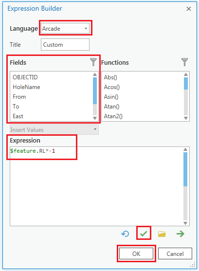
- Set attribute value to extrude features by multiplying the height field to -1 to generate lines beneath the surface of the ground.
$feature.(height field)*-1
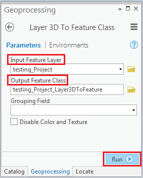
- Use the Layer 3D To Feature Class tool to convert the extruded point feature class to a 3D line feature class.
Note:
To navigate below ground, refer to ArcGIS Pro: Navigate below ground.
- In the Layer 3D To Feature Class geoprocessing pane, browse to the input feature layer for Input Feature Layer.
- Set a name and location for Output Feature Class.
- Click Run.
The image below shows the constructed 3D lines for wells in ArcGIS Pro.
Article ID:000020433
- ArcGIS Pro
Get help from ArcGIS experts
Download the Esri Support App
Related Information
Discover more on this topic
Search for related information
Find training related to this topic
Explore ideas and give feedback