HOW TO
Determine the intersecting attributes of a raster layer and a polygon layer
Summary
In studies involving multiple attributes and covering massive acres of land, the intersecting attributes of a raster and a polygon can provide helpful information. For instance, finding the areas of land cover types (polygon) of a national park (raster), or identifying land use types (polygon) of a state (raster), or determining the areas of different soil types (polygon) in a study site (raster).
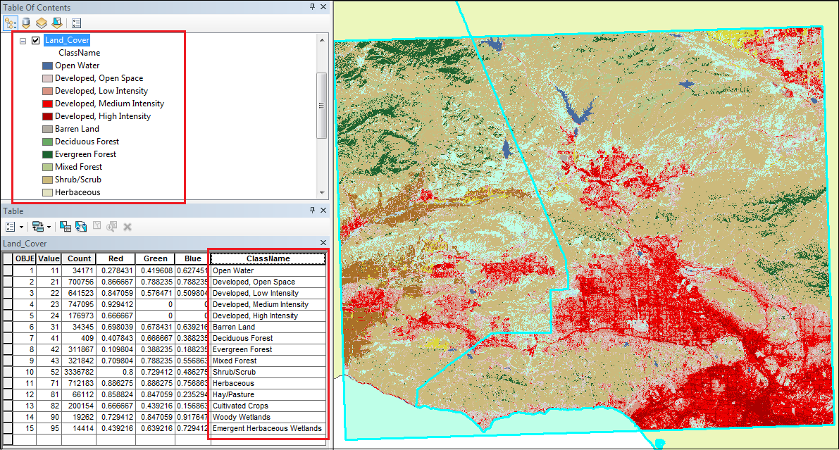
In this article, the areas of each land cover type (raster) intersecting mountain lion habitats (polygon) in Southern California are determined. The map below shows the integer raster layer of land cover types in the study area. The ClassName attribute of the Land_Cover raster layer is used in this example.
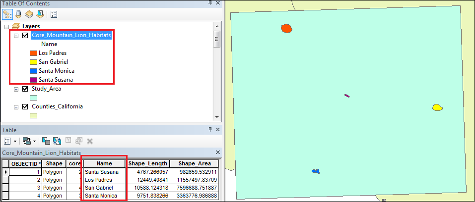
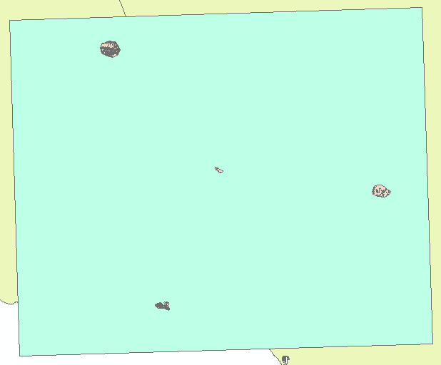
The map below shows the polygon layer of mountain lion habitats in the study area. The Name attribute of the Core_Mountain_Lion_Habitats polygon layer is used in this example.
Procedure
- In ArcMap, use the Raster to Polygon tool to convert the raster layer to a polygon layer.
Note:
The Raster to Polygon tool only works with an integer grid type. Use the Int tool to convert a floating raster to an integer raster. To determine the raster grid type, right-click the raster layer, and click Properties > Source. The Pixel Type field of the Raster Information section shows the grid type. For more information on Esri Grid formats, refer to ArcMap: Esri Grid format.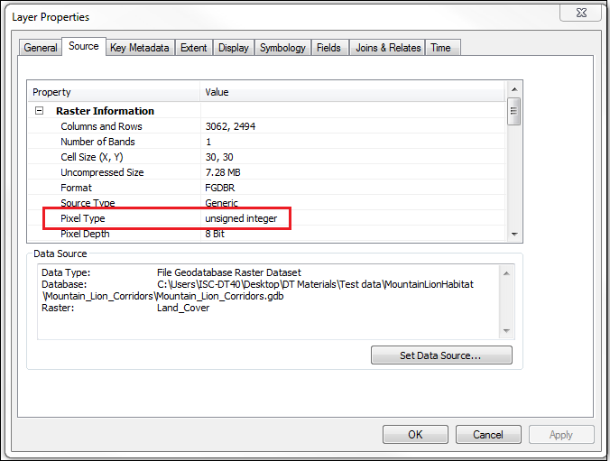
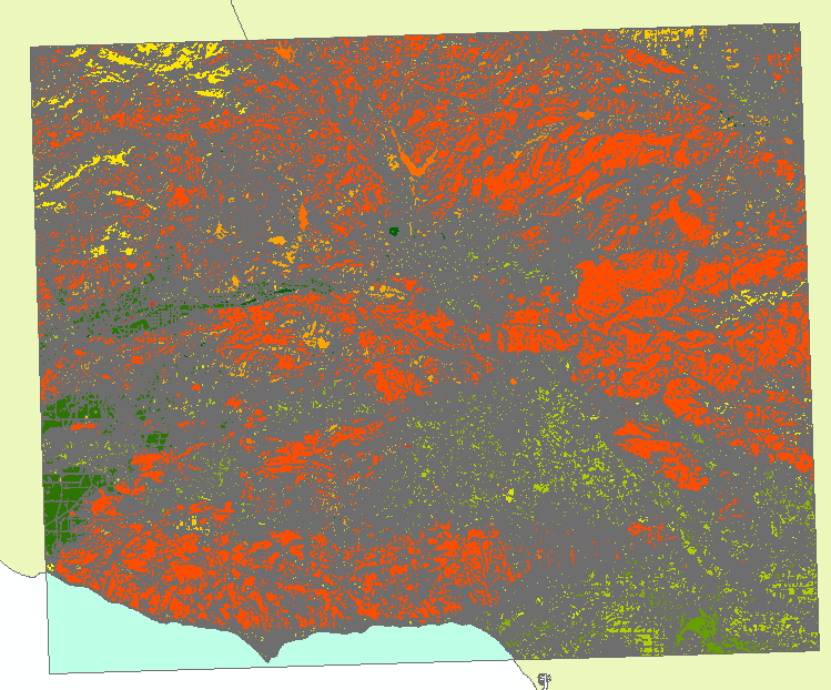
The map below shows the RasterToPoly_LandCover polygon layer created from the Land_Cover raster layer.
- Use the Intersect tool to determine the areas where both polygon layers intersect. The map below shows the areas where the RasterToPoly_LandCover and Core_Mountain_Lion_Habitats polygon layers intersect, named Habitat_LandCover_Intersect.
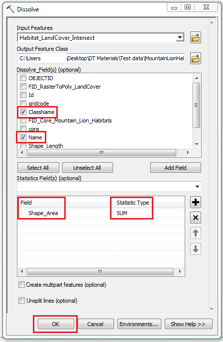
- Use the Dissolve tool to find the total area where the attributes of both polygon layers intersect.
- For Input Features, select the intersect output layer created in Step 2. In this example, it is Habitat_LandCover_Intersect.
- For Dissolve_Field(s), specify the attributes involved. In this example, they are ClassName and Name.
- For Field, specify the area property. In this example, it is Shape_Area.
- For Statistic Type, select SUM from the drop-down menu.
- Click OK.
Demonstrated below is the attribute table of the dissolved layer. The total area where the raster layer intersects the polygon layer is shown in the SUM_Shape_Area column.
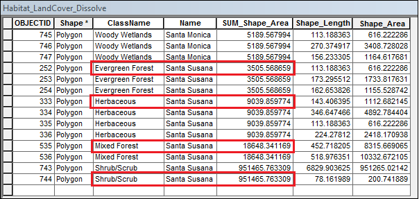
In this article, the types of land cover intersecting the Santa Susana mountain lion habitats are the evergreen forest with 3505.568659 square meters, the herbaceous cover with 9039.859774 square meters, the mixed forest with 18,648.341169 square meters, and the shrub or scrub with 951,465.763309 square meters.
Article ID:000020355
- ArcMap
Get help from ArcGIS experts
Download the Esri Support App
Related Information
Discover more on this topic
Search for related information
Find training related to this topic
Explore ideas and give feedback