HOW TO
Symbolize a feature layer using two types of symbology in ArcGIS Pro
Summary
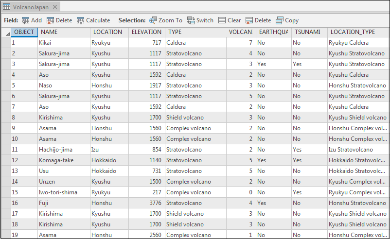
In some instances, a single layer has many attributes, which can be symbolized differently for better visual presentation. The image below shows a single layer of volcanoes in Japan (VolcanoJapan) that has multiple attributes, such as Location, Elevation, Type, and Volcanic Explosivity Index (VEI). In this article, two different attributes are symbolized using two types of symbology in ArcGIS Pro.
Procedure
Use the following steps to symbolize a feature layer using two types of symbology in ArcGIS Pro.
- In the ArcGIS Pro Contents pane, right-click the desired feature layer, and click Symbology.
- In the Symbology pane, click the Primary symbology tab
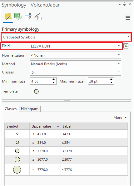
 . Specify the symbology type and the first field to symbolize. For more information on symbology types in ArcGIS Pro, refer to ArcGIS Pro: Symbolize feature layers. The image below shows the ELEVATION field is symbolized using Graduated Symbols.
- Click the Vary symbology by attribute tab
 . For more information, refer to ArcGIS Pro: Attribute-driven symbology.
- Specify the symbology type.
Note:
In this workflow, the visual variable is limited to Transparency, Rotation, and Color variations.
- Specify the second field to symbolize.
- Check the Show legend check box to display the visual variable applied to the second field in the Contents and Legend panes.
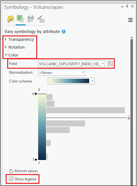
The image below shows the VOLCANIC EXPLOSIVITY INDEX field is symbolized to unclassified color symbology.
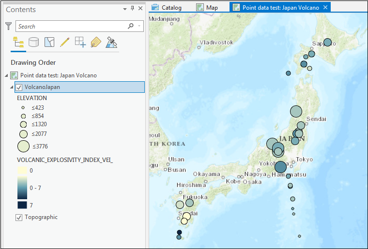
The image below shows the same layer (VolcanoJapan) is symbolized using two types of symbology (graduated symbols and unclassed colors) to represent two different attributes (Elevation and VOLCANIC EXPLOSIVITY INDEX).
Note:
Although it is possible to symbolize a single layer using different symbology, it is best to minimize the types of symbology used. This is to avoid producing a cluttered map and to prevent confusion during data interpretation.

An alternative method is to create a copy (or copies) of the original feature layer in the Contents pane, and to symbolize each feature layer differently. Users can then choose to display the layers, as needed, from the Contents pane. The workflow described above limits the options for a second symbology, but having another copy of the feature layer provides more options.
Article ID: 000020118
- ArcGIS Pro
Get support with AI
Resolve your issue quickly with the Esri Support AI Chatbot.


Related Information
Discover more on this topic
Search for related information
Find training related to this topic
Explore ideas and give feedback
Get help from ArcGIS experts
Start chatting now