PROBLEM
XY data are not displayed automatically in ArcGIS Online
Description
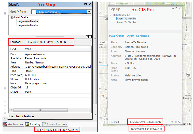
In ArcGIS Online, clicking a feature does not display the XY data in the pop-up window. The XY data of the pointer location is also absent in Map Viewer. Both functionalities exist in ArcMap and ArcGIS Pro, where XY data are displayed at the bottom of the map view and in the feature pop-up window, as shown in the images below:
Cause
This is a known limitation in ArcGIS Online. ArcGIS Online Map Viewer or the feature pop-up window does not display XY data automatically, unless configured.
Solution or Workaround
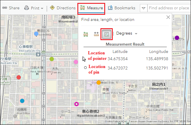
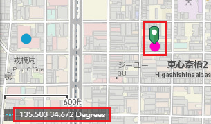
To display the XY data in ArcGIS Online Map ViewerNote: This method only displays the XY data of a single dropped pin. Users cannot save the result, make a list of the XY data of multiple dropped pins, or extract the XY data of pinned locations. To make a list of the desired XY data, copy and paste the values manually into a text editor.
- In ArcGIS Online, click Measure.
- Select the Location button.
Note:
Click the Degrees drop-down button to select the XY data format.

- Click anywhere on Map Viewer to find the XY data of the dropped pin.
The Measurement Result field shows the Latitude and Longitude of the pointer at any instance, and the location of the dropped pin.
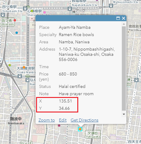
To extract the XY data of all the features, refer to How To: Append spatial coordinates into a CSV file containing addresses using ArcGIS Online.
Note:
Upload the extracted data as a CSV or TXT file into Map Viewer for the XY data to appear in the pop-up window of each feature.
To view the XY data in web applications created or shared from ArcGIS Online
For Web AppBuilder for ArcGIS
- In the Widget tab of Web AppBuilder for ArcGIS, enable the Coordinate widget.

- In the map view, navigate to the bottom left section, and click the Click to enable clicking map to get coordinates icon as shown in the image below.
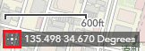
Note:
Clicking this icon displays the XY data of the dropped pin. Otherwise, the XY data change according to the movement of the pointer.
- Drop the pin anywhere on the map. The XY data show the longitude and latitude of the dropped pin.
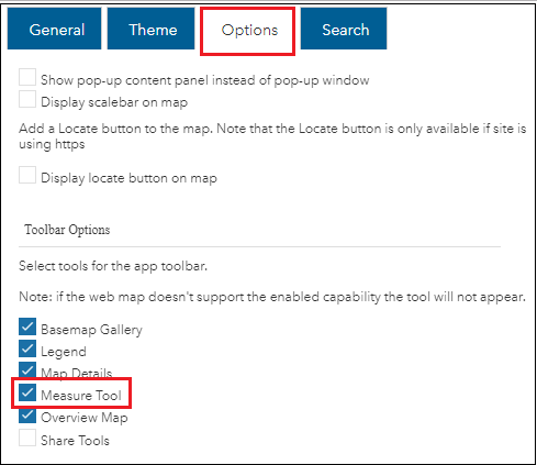
- In the Basic Viewer template, click the Options tab.
- Under the Toolbar Options section, enable Measure Tool. Click Save.
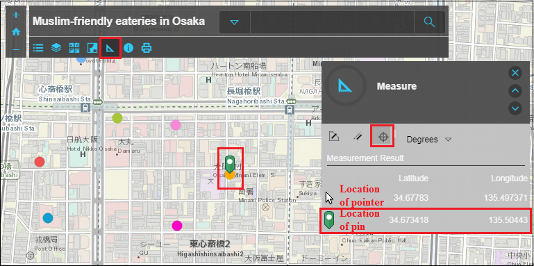
- In the map view, click the Measure tool.
- Click the Location icon.
- Click anywhere on the map view to find the XY data of the dropped pin.
The Measurement Result field shows the Latitude and Longitude of the pointer at any instance, and the location of the dropped pin.
Article ID:000019995
- ArcGIS Web AppBuilder
- ArcGIS Online
Get help from ArcGIS experts
Download the Esri Support App
Related Information
Discover more on this topic
Search for related information
Find training related to this topic
Explore ideas and give feedback