HOW TO
Display the sum of attribute values in the ArcMap legend
Summary
The sum of attribute values in the ArcMap legend helps users visualize the scope of attributes displayed on the map. The summary of attributes such as the total area of each forest type in Malaysia (for example, lowland dipterocarp, mangrove, peat swamp, and montane ericaceous forests), the total length of each major road class in a city (for example, interstate highways, turnpikes, expressways, and railways), and the total volume of rainfall in different Pennsylvania cities (for example, the volume of rainfall in Philadelphia, Pittsburgh, and Allentown) can be displayed in the map legend.
The map below shows the major roads in Alachua County, Florida.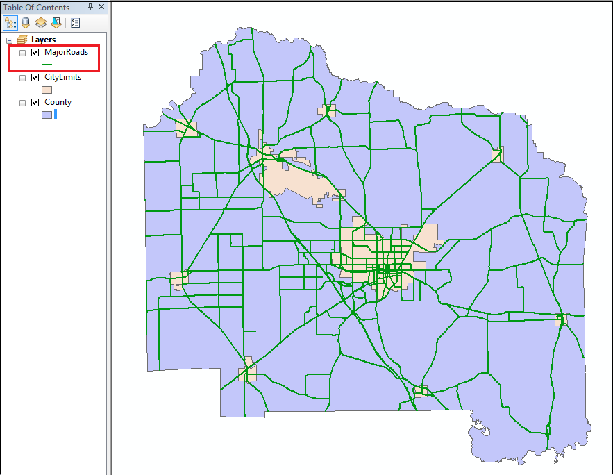
The attribute table below shows the major roads in Alachua County classified differently, and the road lengths specified. In this article, the total road length of each road class is determined.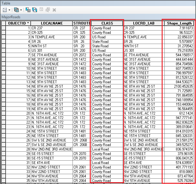
Procedure
Follow the steps below to display the sum of attribute values, which in this case is the total road length of each major road class in Alachua County, in the ArcMap legend:
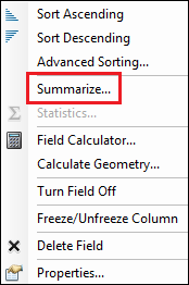
- In ArcMap, open the attribute table of the desired feature class to summarize. Right-click the field header of the desired field. In this case, the feature class is MajorRoads and the field is CLASS.
- Click Summarize.
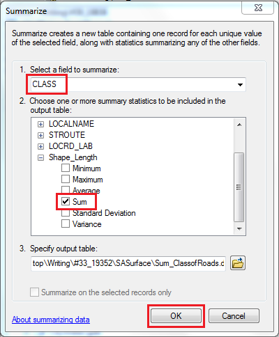
- In the Summarize dialog box, specify the field and attribute(s) to summarize.
In this case, the Sum attribute of the CLASS field is summarized.
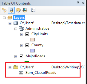
- Click OK. In the Summarize Completed dialog box, click Yes to add the result table to the map. A DBF table is displayed in Table Of Contents.
- Click Search
 and search for Join Field.
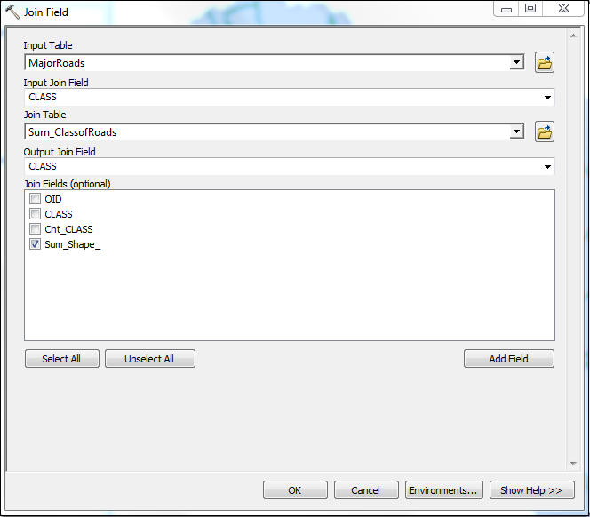
 - In the Join Field dialog box, configure the required fields and click OK.
In this article, the Sum_ClassofRoads DBF file (Join Table) created in step 4 is added to the MajorRoads feature class (Input Table). The CLASS field is the field in which the join is based on (Input Join Field and Output Join Field). The Sum_Shape_Length attribute is the summarized attribute value (Join Fields).
- In Table Of Contents, double-click the feature class to summarize.
- In the Layer Properties dialog box, select Symbology.
- In the Show field, click Categories > Unique values, many fields.
- In Value Fields, specify the field to summarize as the first field and the summarized attribute as the second field.
- Click Add All Fields.
- Click OK.
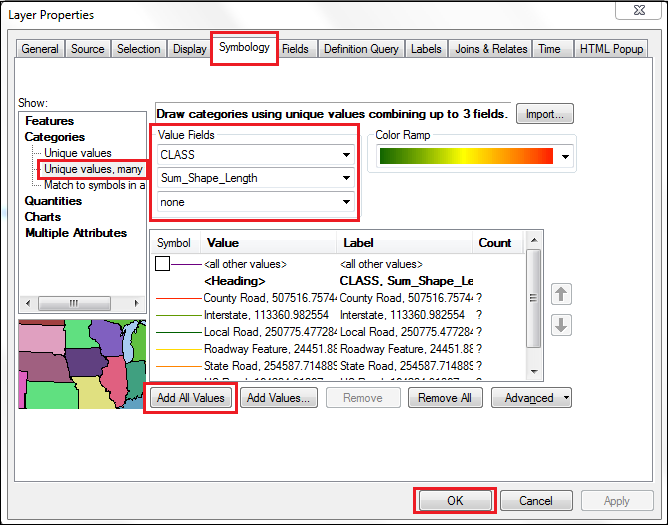
The desired feature class is now symbolized according to the Unique values, many fields symbology.
- In the Layout view of the map, insert a map legend. The sum of attribute values appears in the map legend.
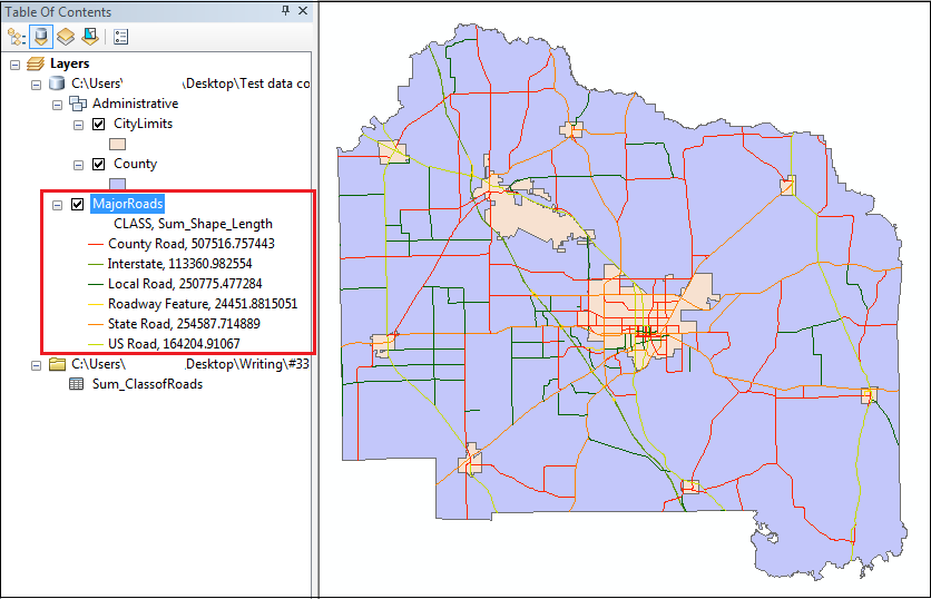
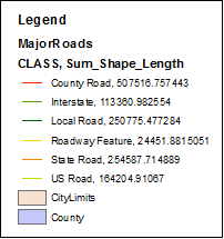
In the image below, the map legend displays the different classes of major roads in Alachua County, Florida, with their respective total road lengths.
Article ID: 000019836
- ArcMap
Get support with AI
Resolve your issue quickly with the Esri Support AI Chatbot.


Related Information
Discover more on this topic
Search for related information
Find training related to this topic
Explore ideas and give feedback
Get help from ArcGIS experts
Start chatting now