PROBLEM
Unable to geocode a table of addresses to a personal geodatabase feature class or shapefile
Description
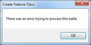
When attempting to geocode a table of addresses using the ArcGIS Online World Geocoding Service and saving the output as a personal geodatabase feature class or a shapefile (.shp), the following error message is returned:
Error:
There was an error trying to process this table.
Cause
The issue occurs due to the number of records and character limitations of attribute fields in the output shapefile or feature class in the personal geodatabase (.mdb). For example, the number of characters for a long integer field in a shapefile is limited to nine. For more information on shapefile limitations, refer to Geoprocessing considerations for shapefile output.
Solution or Workaround
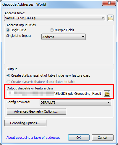
To solve this issue, change the geocode output location to a file geodatabase (.gdb) or enterprise geodatabase. For more information and steps to create a file geodatabase, refer to Create a file geodatabase. To create an enterprise geodatabase, refer to Create an enterprise geodatabase in SQL server.
For more information on the types of geodatabases available in ArcGIS, refer to Types of geodatabases.
Article ID:000019698
- ArcMap
Get help from ArcGIS experts
Download the Esri Support App
Related Information
Discover more on this topic
Search for related information
Find training related to this topic
Explore ideas and give feedback