PROBLEM
The raster image shifts from the original location when adding control points
Description
In some instances, when attempting to add control points to a raster image in ArcGIS Pro using the Add Control Points option, the image shifts from the original location.
Cause
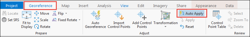
This issue occurs because the Auto Apply option is enabled. By default, when clicking the Georeference icon in the Imagery tab, the Auto Apply option in the Adjust group is enabled. If this option is enabled, the image automatically shifts as the control points are added, removed, or modified. For more information about this option, refer to the following web help page, ArcGIS Pro Help: Adjust.
Solution or Workaround
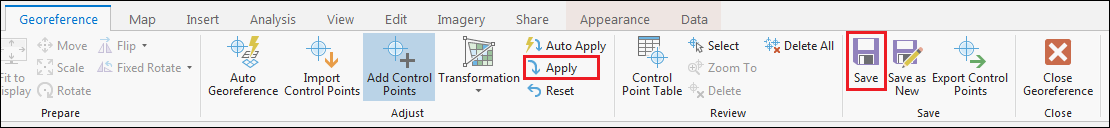
To resolve this issue, in ArcGIS Pro, disable the Auto Apply option and add all the required control points. After adding the control points, update the display by clicking the Apply option, and click Save.
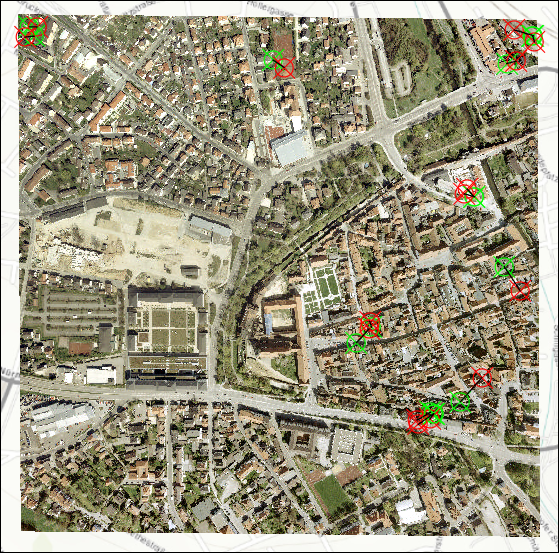
The following image shows the raster image and the control points are displayed on the original location on the map.
Article ID:000019497
- ArcGIS Pro
Get help from ArcGIS experts
Download the Esri Support App
Related Information
Discover more on this topic
Search for related information
Find training related to this topic
Explore ideas and give feedback