HOW TO
Clip a grid to a specific polygon shape
Summary
A grid is a raster data storage format native to Esri representing either discrete data (integer grids) or continuous data (floating-point grids). In some cases, a grid with a large extent must be clipped to a specific polygon shape, keeping only the areas within the polygon.
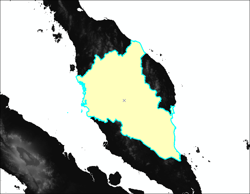
This article describes three methods to clip a grid to a polygon; using the Extract by Mask tool, using the Clip tool, or using the Clip button on the Image Analysis window. The figure below shows the grid layer overlain with a polygon feature as the extent to clip a portion of the grid.
Procedure
Use the Extract by Mask tool
The Extract by Mask tool extracts the cells of a grid that correspond to the areas defined by a mask. The mask can be a raster or feature dataset. In this example, a polygon feature class is used as the mask to clip a grid.
Note:
The Extract by Mask tool requires a Spatial Analyst license.
- In ArcMap, open the ArcToolbox window and navigate to Spatial Analyst Tools > Extraction > Extract by Mask.
- In the Extract by Mask dialog box, select or browse the grid to clip as the Input raster.
- Select or browse the polygon feature class containing the polygons to clip the grid as the Input raster or feature mask data.
- Specify a name and location for the Output raster.
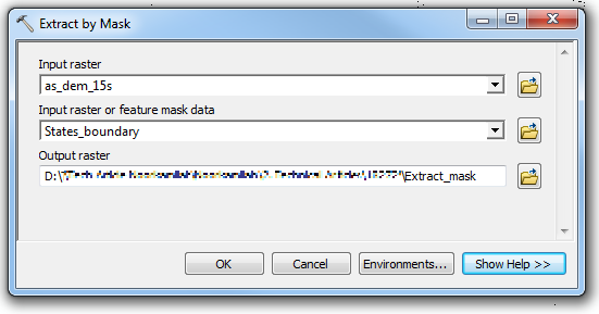
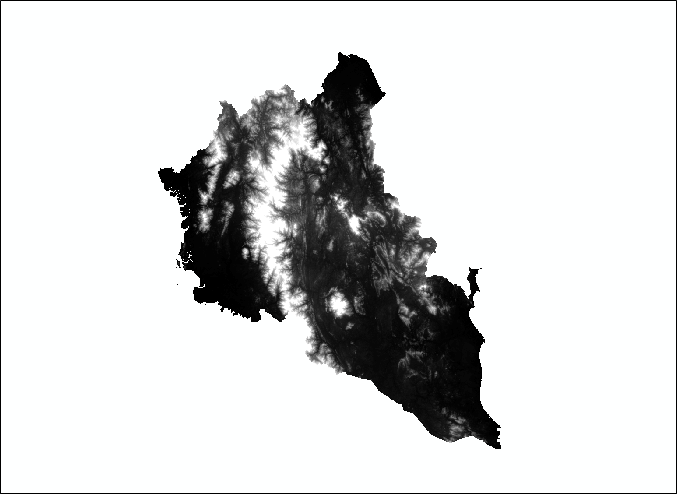
- Click OK. The clipped grid is displayed in the map as a new layer.
Use the Clip tool
The Clip tool is used to clip a portion of the grid by the minimum bounding rectangle of a feature class or by the polygon geometry of the features. To clip a grid by the polygon geometry of features in a feature class, select the feature class as the output extent, and check the 'Use Input Features for Clipping Geometry' option.
Note:
To clip a grid to a specific polygon geometry in a polygon feature class containing multiple polygons, select the polygon feature on the map using the Select Features tool before opening the Clip dialog box.
- In ArcToolbox, navigate to Data Management Tools > Raster > Raster Processing > Clip.
- In the Clip dialog box, select or browse to the grid as the Input Raster.
- Select or browse to the polygon feature class containing the polygons to clip the grid as the Output Extent.
- Check the Use Input Features for Clipping Geometry option. This enables clipping a grid using the polygons in the selected feature class as the clipping extent.
- Specify a name and location for the Output Raster Dataset.
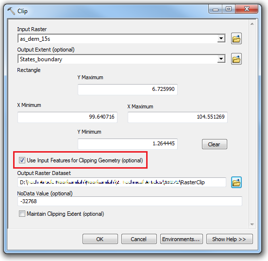
- Click OK. The clipped grid is added to the map as a new layer.
Use the Clip button on the Image Analysis window
The Clip button on the Image Analysis window provides the functionality to clip any raster including a grid using a selected polygon feature within a feature class layer. Refer to ArcMap: Using the Clip button on the Image Analysis window for instructions. However, the Clip function creates a temporary output layer. To save the layer file, export the layer to a new raster dataset. Refer to ArcMap: Exporting a raster in ArcMap for instructions.
Article ID: 000018272
- ArcMap
Get support with AI
Resolve your issue quickly with the Esri Support AI Chatbot.


Related Information
Discover more on this topic
Search for related information
Find training related to this topic
Explore ideas and give feedback
Get help from ArcGIS experts
Start chatting now