Frequently asked question
Is it possible to generate statistics calculated by the zones of a reclassified raster?
Answer
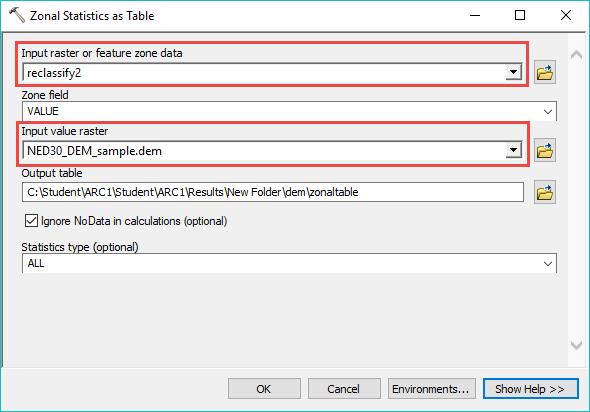
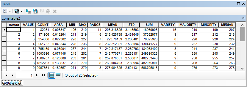
Yes, it is possible to generate statistics calculated by the zones of a reclassified raster. After classifying the raster, use the Zonal Statistics as Table tool to create a table containing the summary of raster values within the zones. Select the reclassified raster as the Input raster or feature zone data and the elevation raster as Input value raster. The tool provides more information compared to the Zonal Statistics tool and requires a Spatial Analyst extension.
For more information on the Zonal Statistics and Zonal Statistics as Table tools, refer to: How Zonal Statistics works.
Article ID:000018047
- ArcMap
Get help from ArcGIS experts
Download the Esri Support App
Related Information
Discover more on this topic
Search for related information
Find training related to this topic
Explore ideas and give feedback