PROBLEM
NetCDF files are projected incorrectly in ArcGIS Pro
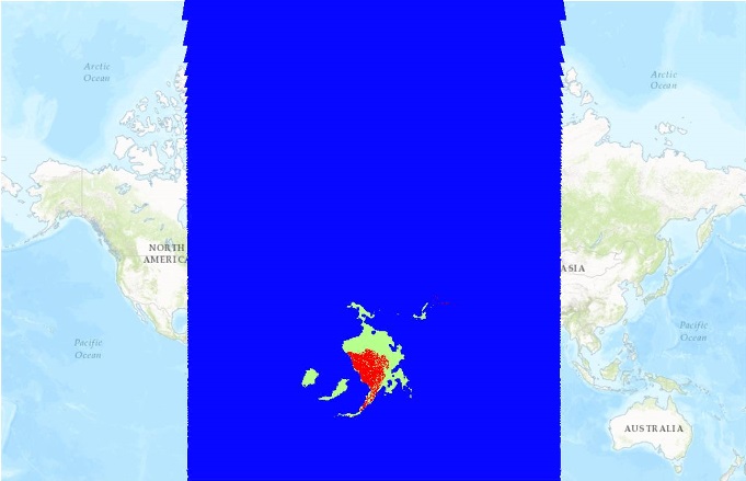
Description
When projecting a Network Common Data Form (NetCDF) file in ArcGIS Pro as a raster layer, the layer is projected incorrectly. For example:
Note:
Network Common Data Form (NetCDF) is a file format for storing multidimensional scientific data (variables) such as temperature, humidity, pressure, wind speed, and direction.
Cause
This issue occurs because by design, netCDF files are required to be converted to raster layers before they can be used in ArcGIS Pro. For more information, refer to ArcGIS Help: Reading netCDF data as a raster layer.
Solution or Workaround
To convert netCDF files to raster layers, use the Make NetCDF Raster Layer tool located in the Multidimension toolbox in ArcGIS Pro.- In ArcGIS Pro, run the Make NetCDF Raster Layer tool and convert the NetCDF file to a raster layer.
- Right-click the layer generated from Step 1 > Data > Export Raster.
- Select and define the options and configurations and click OK to run the tool.
- Once the NetCDF file is converted, define the Projection. The existing projection defined is inaccurate and must be re-defined. For more information on Projection, refer to ArcGIS Help: Define Projection.
- Open the converted file in a new Project and add the basemap. The netCDF data are aligned accurately.
Article ID: 000017990
Software:
- ArcGIS Pro
Get support with AI
Resolve your issue quickly with the Esri Support AI Chatbot.


Related Information
Discover more on this topic
Search for related information
Find training related to this topic
Explore ideas and give feedback
Get help from ArcGIS experts
Start chatting now