HOW TO
Calculate and export the latitude and longitude of an area of a DEM in ArcMap
Summary
A digital elevation model (DEM) is used to study the elevation of an area. Sometimes it is useful to export the latitude and longitude of a certain area in the DEM to a map to identify the location of a slope.
Procedure
Follow the instructions below to calculate and export the latitude and longitude of points in a certain area of a DEM in ArcMap.
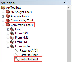
- In ArcToolbox, double-click Conversion Tools. Click the From Raster drop-down arrow, and select the Raster to Point tool.
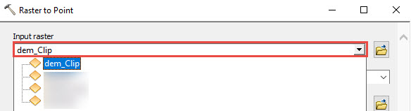
- In the Raster to Point dialog box, click the Input raster drop-down arrow. Select the DEM layer. For more information on the Raster to Point tool, refer to Raster to Point.
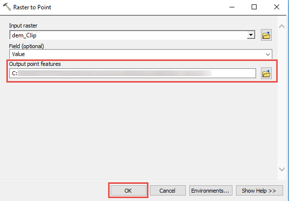
- Set the Field Parameter to Value. In the Output point feature text box, set the output point feature class location. Click OK.
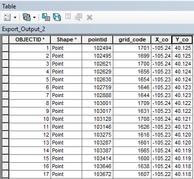
- Create two new fields in the attribute table of the point feature class to add the latitude and longitude field. Use the Calculate Geometry tool to calculate the latitude and longitude of the new point features. For more detailed steps, refer to How To: Calculate latitude and longitude for point features.
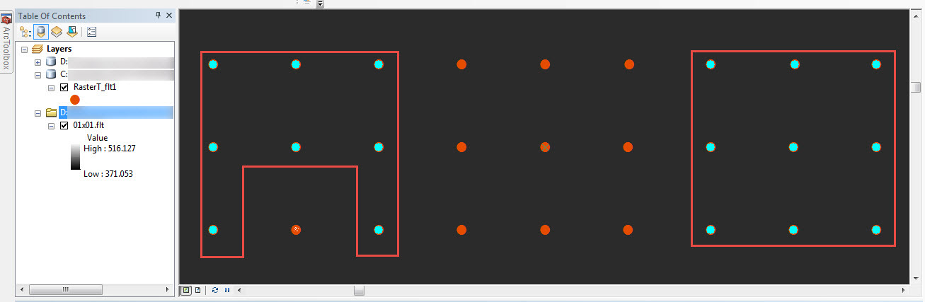
- Select the specific points of the DEM layer to export. For more information on selecting features, refer to Selecting features interactively. The image below shows the selected feature points of the DEM layer.
- To export the specific points, right-click the layer. Click Data > Export Data.
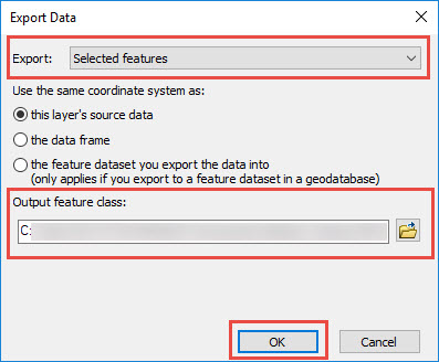
- In the Export Data dialog box:
- Click the Export drop-down arrow, and select Selected features.
- In the Export Data dialog box, set the Output feature class and click OK. A new feature class with the specific latitude and longitude is created in the Table Of Contents.
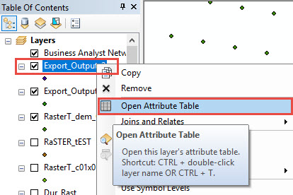
- Right-click the new point feature class. Click Open Attribute Table to view the coordinates of the selected points.
Article ID: 000017878
Software:
- ArcMap
Get support with AI
Resolve your issue quickly with the Esri Support AI Chatbot.


Related Information
Discover more on this topic
Search for related information
Find training related to this topic
Explore ideas and give feedback
Get help from ArcGIS experts
Start chatting now