HOW TO
Create a raster surface showing the distance from each pixel to the center of the raster image in ArcMap
Summary
In some cases, when doing a radiometric calibration on a sequence of air photos, the distance of each pixel to the center of a raster image must be calculated. Converting the raster to point features can be time-consuming. As an alternative, this can be done by using some of the tools in the Spatial Analyst toolbox in ArcMap.
Procedure
The instructions provided describe how to create a raster surface showing the distance from pixels to the center of the raster image.
Note:
Georeference the raster, if necessary. This geographic location does not change the result, but enable the following steps. Some of the tools used in this workflow require an ArcGIS Desktop Advanced license and Spatial Analyst extension.
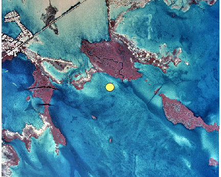
- Create a point feature in the center of the raster image.
- Open the Raster Calculator tool and multiply the raster image by 0 to generate a new raster with constant value of 0.

- Open the Raster To Polygon tool and convert the raster layer generated in the previous step to a polygon feature.
- Open the Feature To Point tool and generate a point feature from the polygon feature created in the previous step.
- Open the Raster Calculator tool and multiply the raster image by 0 to generate a new raster with constant value of 0.
- Create a raster layer that shows the distance from each cell in the raster to the point feature.
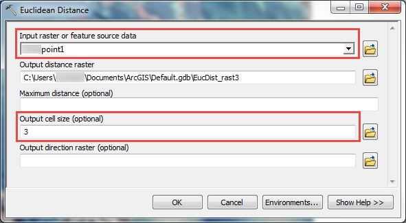
- In the Catalog window, navigate to System Toolboxes > Spatial Analyst Tools > Distance > Euclidean Distance.
- Select the point feature generated in Step 1 as Input raster or feature source data.
- Browse to the raster generated in Step 1 as Output cell size.
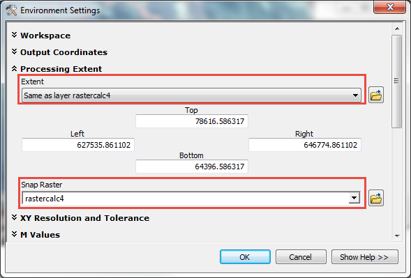
- Click the Environments button.
- Expand Processing Extent and set both Extent and Snap Raster to the raster generated in Step 1(a). Click OK > OK.
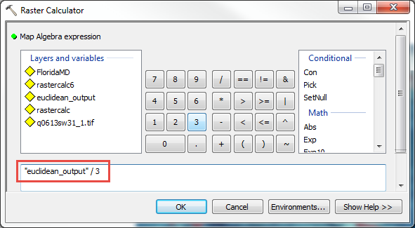
- Normalize the distance to the unit of pixels by performing a calculation on the raster layer created in Step 2.
- In the Catalog window, navigate to System Toolboxes > Spatial Analyst Tools > Map Algebra > Raster Calculator.
- Divide the raster created in Step 2 by its pixel size. Click OK.
Note:
The pixel size can be identified in the Layer Properties of the raster layer > Source > Cell Size (X, Y).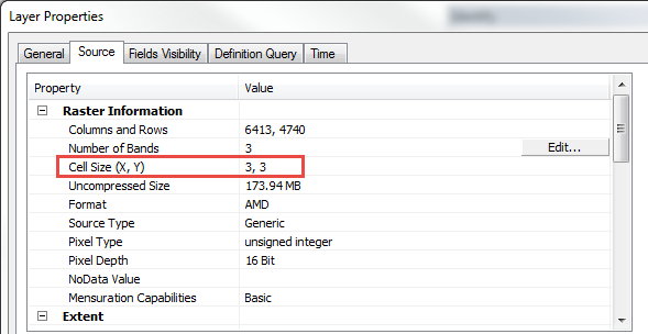
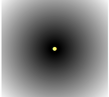
Note:
In the example image below, transparency is applied to the distance raster layer on top of the original raster image. Use the Identify tool and click any area of the output raster to examine the distance (pixel value) to the center of the raster image.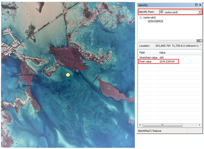
Article ID: 000017814
- ArcMap
Get support with AI
Resolve your issue quickly with the Esri Support AI Chatbot.


Related Information
Discover more on this topic
Search for related information
Find training related to this topic
Explore ideas and give feedback
Get help from ArcGIS experts
Start chatting now