HOW TO
Configure a stream service to connect observations in a web map
Summary
One of the output options for GeoEvent services on a GeoEvent Server is "Send Features to a Stream Service". If a stream service is published, it can be added as a stream layer to a web map in ArcGIS Online or Portal for ArcGIS, where the style of the layer can be changed, similar to how a feature layer's style is changed. Unique, however, to the style settings of a stream layer is a check box for "Connect Observations".
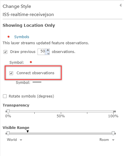
The Connection Observations check box enables a line on the layer which connects events in the order in which they appear in the data.
Procedure
The instructions provided describe how to create a connecting line between observations in a stream layer.
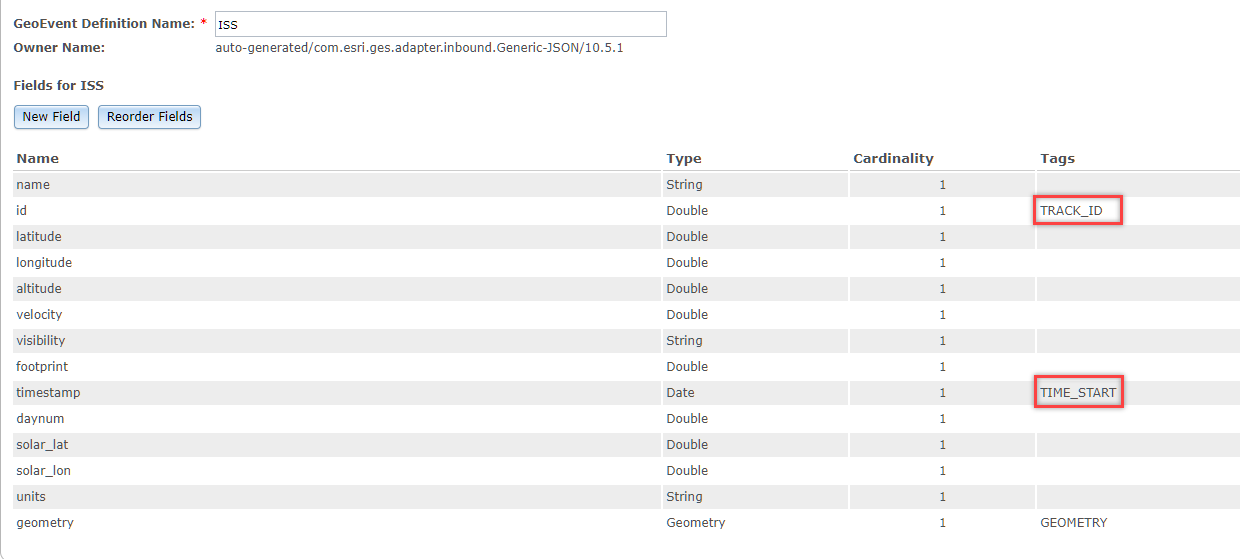
- To enable this setting for the stream layer in the web map, ensure that the GeoEvent definition includes a TRACK_ID tag in one of the fields. This allows the "Connect Observations" option to to appear in the Change Style menu in the web map.
- In addition, ensure the definition also includes a TIME_START or TIME_END tag for one of the fields. This allows the lines to be drawn between the points in the stream.
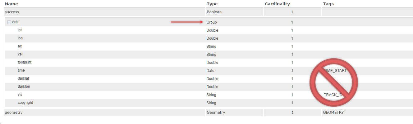
Note:
Tags must not be added to fields listed under a grouped field in a hierarchical definition, as seen below. These tags are not recognized if publishing a Stream Service based on hierarchical definitions.
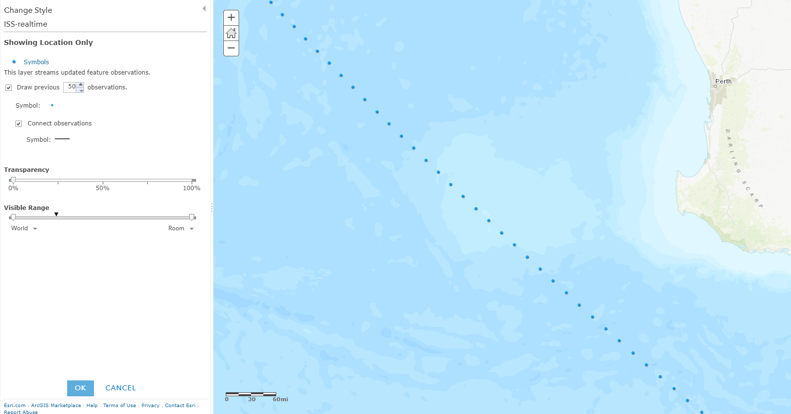
- Enable the check box to draw previous observations, and set the desired value.
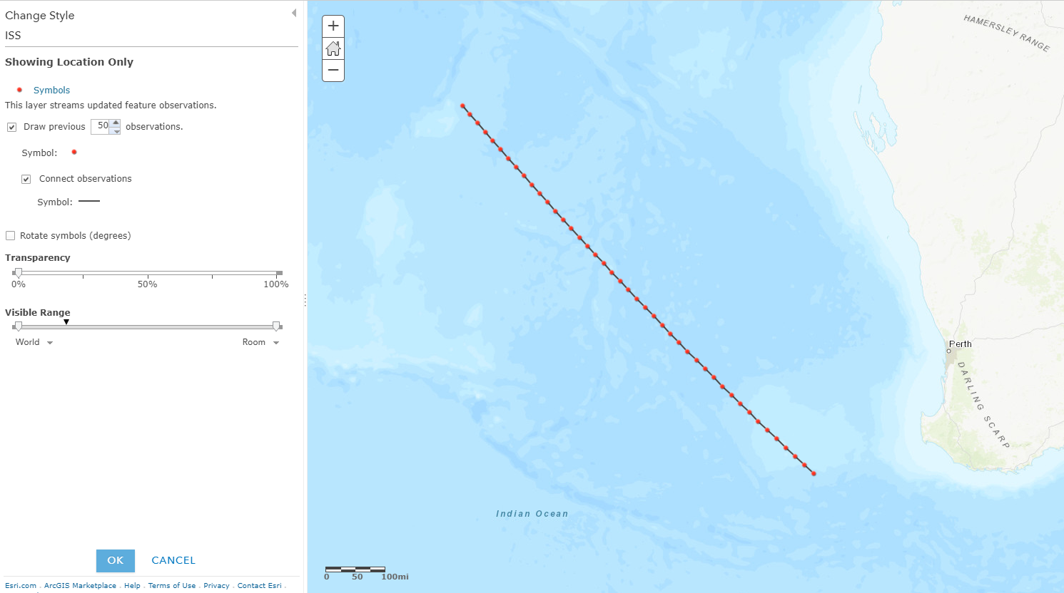
- The resulting stream layer connects the observations successfully, based on the symbol style selected for the layer.
Note:
Without the TIME_START or TIME-END tag, the Connect Observations setting is visible but does not allow the lines to be drawn.
Article ID:000016966
- ArcGIS Online
- Portal for ArcGIS
- ArcGIS Server
Get help from ArcGIS experts
Download the Esri Support App
Related Information
Discover more on this topic
Search for related information
Find training related to this topic
Explore ideas and give feedback