HOW TO
Draw a 3D conical frustum in ArcGIS Pro
Summary
A conical frustum is a cone with a flat surface top, or without a pointed end. It can depict the shape of a mountain and can be used for general measurements, such as the surface area of a mountain top. A conical frustum can be created in ArcGIS Pro by creating two multipatch features; a cone and a cuboid. The two features intersect in a way such that the cone is cut off from the top and the final result returns a conical frustum.
Procedure
The following procedure describes how to create a 3D conical frustum in ArcGIS Pro.
Note:
Ensure this procedure is performed in a Scene layer. Both the Local and Global view can be selected from the View pane in ArcGIS Pro.
- In ArcGIS Pro, open the Catalog pane (View > Catalog Pane) and create two multipatch features: a cone and a cuboid. If needing assistance on how to create multipatch features, refer to the following web help document: ArcGIS Pro: Create multipatch features.
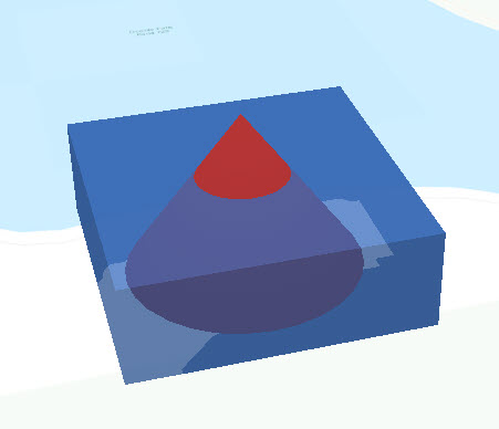
Note:
The cuboid feature must be wider but shorter than the cone feature so that the entirety of the bottom part of the cone is preserved when the two features are processed. The image below demonstrates the multipatch features prior to creating the frustum.
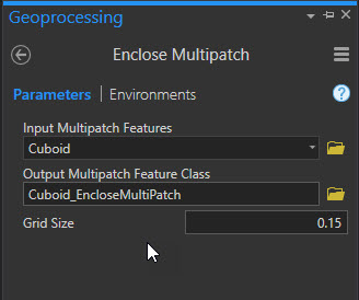
- Open the Enclose Multipatch geoprocessing tool and run the tool twice, once for each input multipatch feature. The tool generates two new features on the scene, which are used for Step 3.
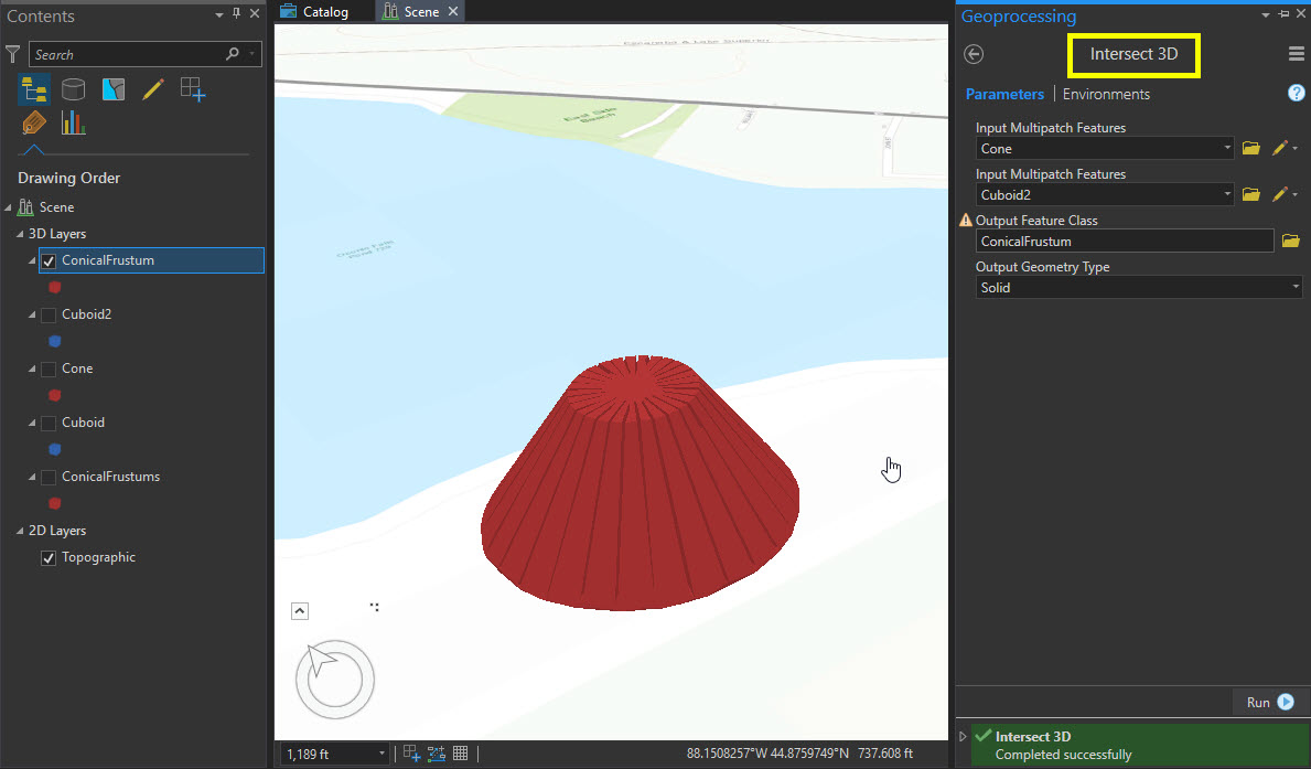
- Open the Intersect 3D tool and input the features created in Step 2. Specify the output feature name and set the Output Geometry Type section to Solid. The tool returns a new feature class of a cone with the top cut off.
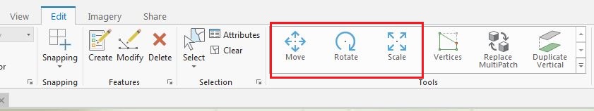
Move, rotate, or scale the feature using the tools in the Edit pane.
Article ID:000016928
- ArcGIS Pro
Get help from ArcGIS experts
Download the Esri Support App
Related Information
Discover more on this topic
Search for related information
Find training related to this topic
Explore ideas and give feedback